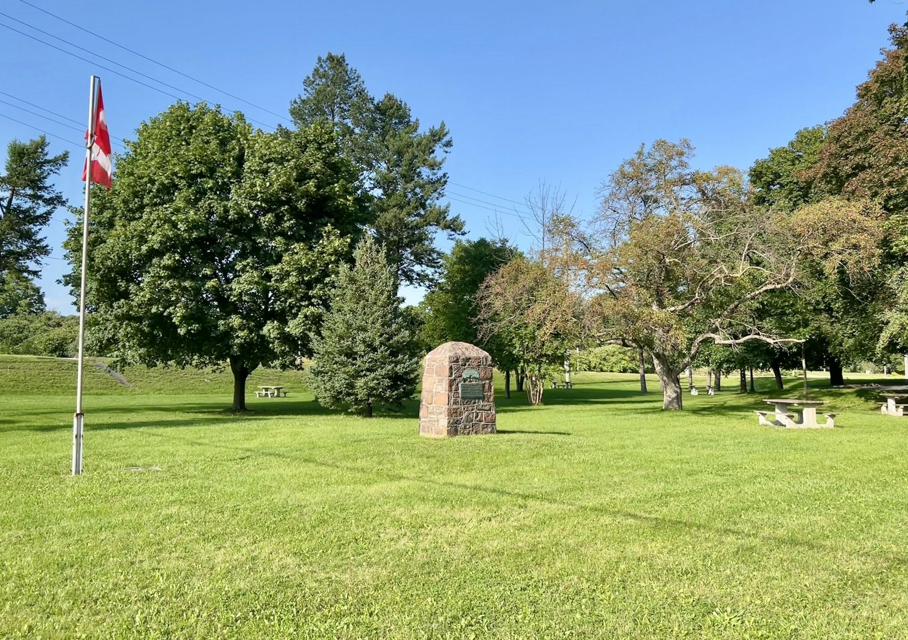
On Brant Road 24 at Brant Highway 5, on the right when traveling north on Brant Road 24.
Unveiled by Her Excellency
The Lady Tweedsmuir
October 2, 1937
“For Home and Country"
To commemorate the birth place of
Adelaide Hunter-Hoodless
1858-1910
Who founded the Women's Institute
Feb. 19th 1897
Erected by . . . — — Map (db m232132) HM
On Elm Street at William Street, on the right when traveling south on Elm Street.
Born in Paris, Ontario in 1915, Charles Joseph Sylvanus "Syl" Apps was a professional hockey player, businessman and politician. Throughout his life, Apps displayed remarkable breadth in his abilities and accomplishments. He was a varsity . . . — — Map (db m223241) HM
On King Street 0.1 kilometers west of Potter Drive, on the left when traveling west.
In 1793 Lieutenant-governor Simcoe granted to Abraham Dayton the entire township of Burford. Dayton was a Native of New Milford, Connecticut, U.S.A. The township was to become the "New Jerusalem" for a religious sect with which he was affiliated. . . . — — Map (db m301949) HM
On Brant Highway 5 0.5 kilometers west of Sager Road, on the right when traveling west.
Ontario's thirteenth prime minister was born on this farm
and in 1913 graduated from Ontario Agricultural College.
A supporter of the United Farmers of Ontario, he was
elected to the provincial legislature in 1919 as member
for Brant North . . . — — Map (db m223085) HM
On Mount Pleasant Road 0.2 kilometers south of Ellis Avenue, on the right when traveling south.
Canadas first woman graduate in medicine was born in Mount Pleasant. She attended the Toronto School of Medicine, received her degree from Victoria University in 1883, and was licensed to practise. Her mother, Dr. Emily Howard Stowe, had graduated . . . — — Map (db m299631) HM
On Homestead Road at Hiram Road, on the right when traveling east on Homestead Road.
This house was built in 1831 by Hiram Capron, a
native of Vermont who, in 1822, had emigrated to Norfolk
County where he helped to establish one of Upper Canada's
earliest iron foundries. He settled here at the Forks of the Grand in 1829, . . . — — Map (db m223280) HM
On Paris Plains Church Road 1.1 kilometers east of Pinehurst Road, on the left when traveling east.
Built by the free labour of its own congregation with
stones gathered from nearby fields, the West Dumfries
Chapel was completed and dedicated in 1845. It is a fine
example of a type of cobblestone construction seldom
found elsewhere in . . . — — Map (db m221681) HM
On Grand River Street South at Burwell Street, on the right when traveling north on Grand River Street South.
This house and the adjoining structure were built by Asa
Wolverton, a native of Cayuga County, New York, who had
immigrated to Upper Canada in 1826. About 1832 he settled
in Paris, where he erected sawmills and became a prosperous lumber . . . — — Map (db m223265) HM
On Elm Street 0.1 kilometers south of Willow Street, on the right when traveling south.
The Grand River is aptly named. Flowing 290 kilometres from the Dundalk Highlands to Lake Erie, its watershed is the largest in Southern Ontario. Winding its way through marshes, woods and Carolinian forests, the river provides the common thread . . . — — Map (db m261532) HM
On Grand River Street North at William Street, on the right when traveling north on Grand River Street North.
On this site, Alexander Graham Bell, inventor of the telephone,
received from Brantford, Ontario, on August 10, 1876, the world's first successful long distance telephone call.
Erected by the Charles Fleetford Sise Chapter Telephone Pioneers . . . — — Map (db m223183) HM
On West Street just north of Wellington Street, on the right when traveling north.
This Monument the work of Walter S. Allward, R.C.A. Sculptor, was placed here through International subscription by the Bell Telephone Memorial Association to mark the invention of the Telephone at Brantford by Alexander Graham Bell in 1874 — . . . — — Map (db m215700) HM
On Wellington Street just west of George Street, on the right when traveling west.
Architect John Turner and contractor William Sinon built this court house for the Provisional County of Brant in 1852-53. Turner was Brantford's most influential nineteenth-century architect, designing several important public buildings in Brant . . . — — Map (db m198273) HM
On Wellington Street just east of Market Street, on the left when traveling east. Reported missing.
In July, 1852, the Six Nations Indians sold to Brant County the land upon which this court-house now stands. Designed by John Turner and William Sinon and erected by the Provisional County of Brant, the stone and brick building was largely . . . — — Map (db m198271) HM
On Tutela Heights Road 0.8 kilometers east of Mount Pleasant Road, on the left when traveling east.
In 1877 this house, then located in downtown Brantford,
became Canada's first telephone business office. It was
the residence of the Reverend Thomas Philip Henderson
(1816-1887), a former Baptist minister and school
inspector in Paris, . . . — — Map (db m230401) HM
On Dalhousie Street just west of Market Street, on the left when traveling west.
Lingering Snow, oil on canvas, n.d. Collection of Glenhyrst Art Gallery of Brant George Thomson was born in Claremont, Ontario in 1868 and, at the age of nine, moved to Rose Hill Farm outside Leith, near Owen Sound. He is the oldest . . . — — Map (db m222039) HM
Near Mohawk Street close to Morrison Road, on the left when traveling west.
English: Originally called St. Paul's, this chapel was the first Protestant church in Upper Canada and is now the oldest surviving church in Ontario. Built by the Crown in 1785, it was given to those Mohawk Indians led by Joseph Brant who . . . — — Map (db m83743) HM
A Grand Legacy
In 1994, the Grand River was formally designated a Canadian Heritage River.
This honour recognizes rivers of outstanding significance and their important role in Canadian history. The Grand is unique, as it is the only . . . — — Map (db m240760) HM
On Colborne Street East just east of Johnson Road, on the right when traveling east.
Across the Grand River at this point lies "Bow Park", once the farm of George Brown, a leading architect of Confederation, who built up an estate of some 800 acres beginning in 1866. A Scottish immigrant, Brown founded the Toronto "Globe" in 1844, . . . — — Map (db m284027) HM
On Market Street just north of Darling Street, on the right when traveling north.
Log Cabin, oil on canvas, n.d. Collection of the City of Brantford John Claude Whale is the second son of painter Robert R. Whale and was born during his parents' voyage from England to Canada. A self-taught artist like his father, he . . . — — Map (db m243605) HM
On Lynnwood Drive just south of Glenwood Drive, on the right when traveling south.
Marsh Birds, oil on canvas, 1878 Collection of Glenhyrst Art Gallery of Brant John Hicks Whale was born in Liskeard, England in 1829 and is the nephew of artist Robert R. Whale. He emigrated to Canada in the early 1850s and married . . . — — Map (db m243674) HM
Born into a prominent Brantford family, Lawren Harris began to paint as a child. At the University of Toronto, a professor noticed he sketched during lectures and advised he be sent to Europe to study art. While in Germany (1904-1907), . . . — — Map (db m239617) HM
On Darling Street west of Market Street, on the left when traveling west.
Three Chords, lithograph print, 1973 Collection of Glenhyrst Art Gallery of Brant Michael Snow is among the world's most celebrated artists and filmmakers. Born in Toronto in 1928, Snow's artwork and films have been exhibited at art . . . — — Map (db m221940) HM
On Mohawk Street close to Morrison Road, on the left when traveling west.
English: Allies of the British during the American War of Independence, the Six Nations Iroquois received extensive lands along the Grand River in 1784. Mohawks, led by Joseph Brant, established a village of some 400 individuals here by . . . — — Map (db m83697) HM
On Mohawk Street, on the right when traveling east.
This observation site constructed on the flood control dyke
overlooks the original canoe landing area for the Mohawk
village which was located here at the ox bow in the River Ouse (Grand River). At that time the river flowed past this area. The . . . — — Map (db m262395) HM
On George Street just north of Darling Street, on the right when traveling north.
Designed by John Turner and built in 1883, Park Baptist Church served as a place of worship for over a century until a dwindling membership led to closure in 1992. The fate of the building remained uncertain until 2000 at which time restoration . . . — — Map (db m215890) HM
On West Street just east of Brant Avenue, on the left when traveling east.
[English]To commemorate our heroic Polish and Canadian soldiers under British Command in World War II To honor war veterans who fought for world freedom and all the people that endured suffering and hardship[Polski]Pamieci bohaterów . . . — — Map (db m243591) WM
On Colborne Street East 0.3 kilometers east of Wayne Gretzky Boulevard, on the right when traveling east.
This house, "Echo Villa", was built by the Reverend Peter
Jones (Kahkewaquonaby) who lived here from 1851 until
his death. Son of the noted surveyor, Augustus Jones, and
Tuhbenahneequay, a Missisauga chief's daughter, Peter was
born at . . . — — Map (db m237708) HM
On Dalhousie Street just west of George Street, on the right when traveling west.
Royal Victoria Place, originally known as the Commercial Buildings, was designed by John Turner and built in 1881 by Bernhard Heyd. One of the first occupants was the Royal Loan and Savings Company. Following a devastating fire in 1988, . . . — — Map (db m215851) HM
On West Street just north of Chatham Street, on the left when traveling north.
[English] Pioneering journalist in the late 19th century, Sara Jeannette Duncan challenged social and political norms by examining women’s changing roles, the need for a national culture, and the way Canadian politics . . . — — Map (db m215697) HM
On West Street just north of Chatham Street, on the left when traveling north.
[English] An internationally renowned author, Duncan was raised in the adjacent house and educated locally. She taught school briefly, but then determinedly turned to journalism, gaining notice for her distinctive and witty writing . . . — — Map (db m215698) HM
Near Mohawk Street close to Morrison Road, on the left when traveling west.
This chapel, the first Protestant church in Ontario, was built by the Crown for the Mohawks of the Six Nations Iroquois who settled here in 1794. It replaced the Queen Anne Chapel (1712) at Fort Hunter, New York, which the Mohawk lost, . . . — — Map (db m284104) HM
Near Darling Street just west of George Street, on the right when traveling west.
This National Monument erected by the Brant Memorial Association, Incorporated 41 Vic. Cap. 62 S.O. to Thayendanegea. Capt. Joseph Brant born 1742 died 1807 interred at Mohawk Church and to The Six Nations Indians for their . . . — — Map (db m215797) HM
On Tutela Heights Road 0.8 kilometers east of Mount Pleasant Road, on the left when traveling east.
The Bell Homestead
Here at his parents' home in July 1874, Alexander Graham
Bell conceived the fundamental idea of the telephone and, in August 1876, carried out the first successful long-distance trials. The Homestead evokes the . . . — — Map (db m230331) HM
On Brant Avenue at Scarfe Avenue, on the right when traveling north on Brant Avenue.
Originally dedicated November 11, 1923, and moved from Gore Park to this site on June 2, 1992. The members of the Imperial Order Daughters of the Empire were the sole contributors to this Cenotaph, the only one in Brantford at that time. The . . . — — Map (db m243640) HM WM
On Wellington Street just east of George Street, on the left when traveling east.
In the 1820's significant improvements to the Hamilton and London road attracted settlers to the Indian lands at Brant's Ford where this thoroughfare crossed the Grand River. A thriving village soon developed and in 1830 the Six Nations surrendered . . . — — Map (db m199047) HM
On Salt Springs Church Road 0.9 kilometers south of Brant County Road 18, on the right when traveling south.
In the early 1820's, the Rev. Alvin Torry was appointed by the American Methodist Society to minister the people of the Grand River Valley. Beginning at Port Maitland he travelled upstream establishing missions on the way and by 1822 arrived in the . . . — — Map (db m299626) HM
On Tutela Heights Road 0.8 kilometers east of Mount Pleasant Road, on the left when traveling east.
Invention of the Telephone
Even here at his father's home where he came for rest
and peace, Alexander Graham Bell continued to ponder
the elusive secret of voice transmission, and it was here,
on 26 July 1874, that insight finally . . . — — Map (db m230396) HM
On Mohawk Street, on the right when traveling west.
The Mohawk Institute
The Mohawk Institute was established in 1831 for children of the Six Nations Iroquois living on the Grand River. Pupils from other native communities in Ontario attended the school as well. Like all Canadian . . . — — Map (db m230264) HM
A Brief History…
• 11,000 Years Ago - Nomadic hunter/ gatherer culture in tundra-like environment of the Grand River Valley.
• 9000 Years Ago - Hunter/gatherer culture begins to implement seasonal migratory camps.
The environment has . . . — — Map (db m240764) HM
Near Mohawk Street close to Morrison Road, on the left.
Tomb Inscription
This tomb is erected to the memory of THAYENDANEGEA , or Captain Joseph Brant, Principal Chief and Warrior of the Six Nations Indians, by his Fellow-Subjects, admirers of his fidelity and attachment to the British . . . — — Map (db m83696) HM
Near Darling Street just west of George Street, on the right when traveling west.
Victoria Park was set aside as a square when Lewis Burwell surveyed the original town plan for Brantford in 1830. The square was first landscaped as a formal park in 1861. The plans were prepared by John Turner, a local architect who designed many . . . — — Map (db m284009) HM
On West Street just north of Wellington Street, on the right when traveling north.
[English] An outstanding sculptor of some of Canada's finest public monuments, Walter Allward is best known for his masterpiece, the Vimy war memorial in France. He emerged as a dominant figure in the transition from . . . — — Map (db m215699) HM
Near Myrtleville Drive 0.3 kilometers west of Balmoral Drive, on the right when traveling west.
[English] A leading spokesman for Canadian agrarian and co-operative movements, Good was born and raised on Myrtleville farm. He early developed a strong sense of social responsibility and, returning here after attending the . . . — — Map (db m217700) HM
Near George Street just north of Wellington Street, on the right when traveling north.
Landscape with Tree, oil on board, n.d. Collection of Glenhyrst Art Gallery of Brant William Henry Clapp was born in Montreal to American parents in 1879. In 1904 he left Canada to study art at l'Academie Julian in Paris, France. By . . . — — Map (db m221779) HM
On Saint Paul Avenue at Palmerston Avenue, on the right when traveling south on Saint Paul Avenue.
In 1869, on the recommendation of the Rev. Egerton Ryerson, Superintendent of Education, funds were allocated to establish the first provincial school for blind children. The Ontario Institution for the Education of the Blind, which included the . . . — — Map (db m230229) HM
On Oakland Road (County Route 4) at King Street South (County Route 24), on the right when traveling west on Oakland Road.
In October, 1814, an invading American force of about 700 men under Brigadier-General Duncan McArthur advanced rapidly up the Thames Valley. He intended to devastate the Grand River settlements and the region around the head of Lake Ontario which . . . — — Map (db m78341) HM
Near County Highway 54 just east of Chiefswood Road, on the right when traveling east.
[English] Completed in 1856, Chiefswood owes its importance to its architecture and the prominence of the people who lived here. Derived from the popular Italianate style of the Picturesque movement, the grandeur of the house . . . — — Map (db m209067) HM
On 4th Line close to Chiefswood Road, on the left when traveling west.
English: An Onondaga from the Six Nations of the Grand River, Tom Longboat was one of the world's great long-distance runners. He ran his first race in Caledonia in 1905 and two years later shot to international attention with a . . . — — Map (db m83700) HM
Near County Highway 54 just east of Chiefswood Road, on the right when traveling east.
In this house "Chiefswood", erected about 1853, was born the Mohawk poetess Emily Pauline Johnson (Tekahionwake). Her father, Chief G.H.M. Johnson a greatly respected leader of the Six Nations, built "Chiefswood" as a wedding gift for her English . . . — — Map (db m208900) HM
Near County Highway 54 just east of Chiefswood Road, on the right when traveling east.
[English] Born here at Chiefswood, the daughter of a Mohawk chief, E. Pauline Johnson gained international fame for her romantic writings on Indian themes, but she also wrote about nature, religion and Canadian nationalism. . . . — — Map (db m209066) HM
Near 4th Line close to Chiefswood Road, on the left when traveling west.
English:
This celebrated Mohawk chief of Canajoharie Castle and Johnson Hall grew up in the Mohawk Valley. He received his baptism of fire at the battle of Lake George in 1755. He served with Sir William Johnson in the Niagara . . . — — Map (db m83714) HM
Near 4th Line close to Chiefswood Road, on the left when traveling west.
English:
Commemorating the loyal services and unswerving fidelity of the Six Nations of Iroquois Indians to the British Empire in the Seven Years War, 1755 - 1763, the War of the American Revolution, 1775 - 1783, and in the defence of . . . — — Map (db m83712) HM
On 4th Line close to Chiefswood Road, on the left when traveling west.
Lest We Forget
1914 - 1918
Lt. Brant, Cameron D. • Lt. Moses, James D. • Arron, William • Claus, Issac • Curley, Lloyd • Fish, Reuben • Garlow, James • Goosey, David • Groat, Samuel B. • Hill, Hiram • Hill, Roy • Homer, Harrison • . . . — — Map (db m83744) WM
Near Fourth Line Road at Chiefswood Road, on the left when traveling east.
English
John Brant was born in the Mohawk Village (Brantford), the youngest son of the renowned Joseph Brant. He was educated at Ancaster and Niagara, and fought with distinction during the War of 1812. Brant devoted his life to improving . . . — — Map (db m78340) HM
On Simcoe Street at Talbot Street, in the median on Simcoe Street.
Dr. Charles Duncombe (1791-1867), prominent physician and politician, was leader of the militant reform movement in the London District at the time of the Rebellion of 1837. He rallied the local "Patriots" at the settlement of Scotland, planning to . . . — — Map (db m189196) HM
On Oakland Road (County Road 4) just east of Simcoe Street (County Road 16), on the right when traveling east.
In 1914, the Scotland Women’s Institute donated this historic bell to be mounted atop the original Scotland Library, located beside the “Garden Wall” house. The bell was rung three times daily, at 6 a.m., 12 Noon, and 6 p.m. In 1932, the Scotland . . . — — Map (db m221713) HM
On Blue Lake Road (County Road 35) 0.6 kilometers west of Brant Road (Provincial Highway 24), on the right when traveling west.
Adelaide Hunter was born in this farm house and lived here until she married John Hoodless in 1881. On February 19, 1897, she organized at Stoney Creek the world’s first Women’s Institute. It was her belief that in this organization rural women . . . — — Map (db m208855) HM
On Blue Lake Road (County Road 35) 0.6 kilometers west of Brant Road (Provincial Highway 24), on the right when traveling west.
[English] Born in Ontario, Adelaide Hoodless sought to release the full potential of women for social action. An outspoken educator and social reformer, she successfully pressed for acceptance of Domestic Economy as a subject for . . . — — Map (db m208860) HM
On Beverly Street East (Nixon Way) (County Highway 5) 0.2 kilometers east of Tolhurst Avenue (Reid Street), on the right when traveling east.
In recognition of three generations of the Nixon family, who represented the residents of the County of Brant between 1919 and 2004 both Provincially and Federally, this portion of Highway #5 is being designated as the “Nixon Way.” — — Map (db m243520) HM
On Main Street South (County Road 13) at High Street, on the right when traveling north on Main Street South.
To our Men & Women who served in World War II & Korea Allen, Edsel ☆22/5/1944 • Allen, Edward • Allen, W. • Alysworth, A. • Anderson, Douglas • Anderson, C. • Andrews, Leslie • Attridge, Donald • Bailey, J. • Barker, Leslie • . . . — — Map (db m243538) WM
On Main Street South (County Road 13) at High Street, on the right when traveling north on Main Street South.
This building was presented in memory of Salem Griswold Kitchen by his wife was remodeled by the citizens of the community and is a memorial to the soldiers who fought in the Great War These made the supreme sacrifice Armstrong Walter N . . . — — Map (db m243442) HM WM
On Queen Street North (Bruce County Road 3) at Cambridge Street, on the right when traveling south on Queen Street North (Bruce County Road 3).
One of Canada's outstanding artists, Milne was born on a farm near Burgoyne, Saugeen Township, and raised in Paisley. Though largely self-taught, he studied briefly in New York at the Art Student's League, and in 1913 exhibited some of his paintings . . . — — Map (db m307595) HM
On Queen Street North (Bruce County Road 3) at Cambridge Street, on the right when traveling south on Queen Street North (Bruce County Road 3).
David Milne was one of the first Canadian artists to explore modernist styles and subject matter. His paintings, watercolours, and prints are subtle arrangements of colour, space, and line.
In 1903, he left Paisley for New York City, . . . — — Map (db m307589) HM
On Mill Street at Queen Street South, on the right when traveling west on Mill Street.
The mill property was developed by D. Hanna, in the 1850'S. He built a dam, mill race one saw mill on the south side of the river. In 1869, D. Fisher bought the property and operated a flour and saw mill. The central rectangle of the present mill . . . — — Map (db m307652) HM
On Queen Street North 0.1 kilometers south of Church Street, on the right when traveling south.
This shop was built by Wm. Flood who purchased the lot from David Hanna in 1869
and was the owner until 1894. In October of 1889, a fire destroyed much of the business section on the west side of Queen St. N. but did not affect this building. . . . — — Map (db m307637) HM
On Queen Street North (Bruce County Road 3) 1 kilometer south of Church Street, on the right when traveling south.
Born in Truro, England, March 9, 1819.
Came to New York (1838), then to Toronto (1840) and to Grey County (1844).
In 1851 he came from Walkerton by raft down the Saugeen River arriving in Paisley a few weeks after his friend Simon Orchard. He . . . — — Map (db m307650) HM
On Queen Street North (Bruce County Road 3) 0.1 kilometers Church Street, on the right when traveling south.
In April 1851, Simon Orchard and
family beached their raft near
this point. Motivated by a dream
he experienced during a brief residence in Walkerton, he and his family descended the Saugeen
River. Captivated by the sight of two rivers joining, . . . — — Map (db m307649) HM
On Queen Street South at Mill Drive, on the right when traveling south on Queen Street South.
In 1852 Samuel T. Rowe, 2nd settler to Paisley, built a log tavern on this site. It became the first store and provided food and drink for weary travelers. It was also the site of the first church service and meeting place for several denominations, . . . — — Map (db m307636) HM
In July 1890, John Elliot, a mill builder from Chesley, purchased this lot in a section of Queen Street North Burned out by the fire of 1889 and constructed this handsome building. In 1902,
Elliot sold it to James Steele and the metal plaque near . . . — — Map (db m307651) HM
On Queen Street North (County Road 3) at Cambridge Street, on the right when traveling south on Queen Street North.
The brick chimney is all that remains of a foundry, which once employed as many as sixty men. Built in the early 1860's, it
operated for several years as Laidlaws
Foundry. John Stewart purchased the
business in the late 1860's and changed its . . . — — Map (db m307517) HM
On Lighthouse Road at Cedar Trail, on the left when traveling west on Lighthouse Road.
[English] Built in 1859 by the Department of Public Works, this handsome 26 m structure is one of six “Imperial towers” on these shores. The circular limestone tower has walls 150 cm thick at the base, tapering to 61 cm at the top. The . . . — — Map (db m198318) HM
On Harbour Street at Huron Terrace, on the left when traveling west on Harbour Street.
Bruce County's extensive coastal waters with their hidden rocks, shoals, deadly storms, shifting sand bars and cliff-bound shore, are among the most treacherous areas of the Great Lakes. Since the first light was lit in 1858, The many lighthouses . . . — — Map (db m307436) HM
On Harbour Street at Huron Terrace, on the right when traveling west on Harbour Street.
The origins of this huge rock, known locally as "Paddy's Stone," has many variations. One colourful version relates how Paddy Walker was sitting on the front step of his hotel one evening when the sky was lit by the trail of a falling meteor. Paddy . . . — — Map (db m307439) HM
On Harbour Street 0.3 kilometers west of Huron Terrace.
In memory of a Canadian hero
Sergeant Charles William Mann
Veteran of the Second World War and champion of the Kincardine community
June 29, 1922 - January 28, 2017
This is a tribute to Charles William Mann, one of Canada's true . . . — — Map (db m307446) HM WM
On Harbour Street at Huron Terrace, on the left when traveling west on Harbour Street.
In the spring of 1848 Captain Alexander M. MacGregor guided
the small schooner Fly into the mouth of the Penetangore River,
landing the first settlers at what would become Kincardine. Although it was exposed to storms, the harbour at . . . — — Map (db m307438) HM
On Huron Terrace at Huron Street, on the right when traveling south on Huron Terrace.
The Legend of Donald Sinclair
Back in 1856, on a cold, October day, a small vessel left the Port of Goderich carrying a family from the Isle of Skye, Scotland. It was the final leg of a journey for the immigrant family which intended to farm . . . — — Map (db m307365) HM
On Harbour Street 0.2 kilometers west of Huron Terrace, on the right when traveling west.
Levi Rightmeyer, an American entrepreneur, and his wife, Isabella, once owned and operated their saltworks where MacPherson Park (locally known as Tiny Tots Park) stands today. This was one of three saltworks in Kincardine, which exported much of . . . — — Map (db m307445) HM
Douglas Point Nuclear Power Plant
The Douglas Point Nuclear Power Plant began generating electricity in 1967 and continued until 1984. This joint project between Atomic Energy of Canada Ltd. and Ontario Hydro was the first . . . — — Map (db m307515) HM
On Water Street at Goldie Street (Provincial Highway 11), on the right when traveling north on Water Street.
Pump House A brick building was constructed in 1887 for the purpose of providing fire protection to a portion of the village. A well was dug in the basement of the pump house with a pipe extending to the Saugeen River. A steam engine of 4 . . . — — Map (db m198320) HM
On Goldie Street (Provincial Highway 11) at Queen Street South, on the right when traveling west on Goldie Street.
In 1852, shortly after this region was opened for settlement, the government reserved land for a town here on the Elora and Saugeen Road, at the confluence of the Teeswater and Saugeen Rivers. Already settled on the site were Simon Orchard and . . . — — Map (db m198319) HM
On Clinton Street South at James Street East, on the right on Clinton Street South.
Jennie Fletcher was born March 19, 1890, one of nine children.
Her father, John, was a fishmonger and a fish and chip shop owner who truly believed that his daughter should learn to swim. I won my first medal at 11," she said "I was a natural-born . . . — — Map (db m278200) HM
On Clinton Street South 0.1 kilometers Union Street East, on the left when traveling south.
[west side]
1914 - 1918
"Who so giveth his life for my sake
shall find it”
World War 1914-1918
Culross and Teeswater
Nursing Sister Maude C. Mcglynn ·
Alexander Bannerman ·
Alexander Alphonse Brick ·
George David Colvin · . . . — — Map (db m279007) WM
On Clinton Street South at Union Street East, on the right when traveling north on Clinton Street South.
By 1855 the first permanent settlers on the site of Teeswater, the families of Matthew Hadwen and Peter Brown, had located here on the Teeswater River. In that year Brown erected a sawmill and later added a grist-mill. In 1856 a post otfice was . . . — — Map (db m278208) HM
On Ontario Highway 9 0.4 kilometers east of Sideroad 5 Greenock, on the right when traveling west.
The early settlers, primarily of Scottish and Irish descent, came to Greenock circa 1850. Shortly after their arrival they received Land Grants from Queen Victoria. Located halfway between Durham and Kincardine, two regionally important centres at . . . — — Map (db m278213) HM
On McNab Street 0.1 kilometers south of Durham Street East, on the right when traveling south.
In 1850 Joseph Walker came here to the Durham Road where it crosses the Saugeen River. He built an inn and contracted to build two bridges and a part of the road. He and his son William were in 1851 granted tree lots and later allowed to buy . . . — — Map (db m278239) HM
Near William Street north of Brown St, on the left when traveling east.
"Willie Emerging"
Sculptor: Dave Robinson
Medium: Adair dolomitic limestone
Donated by
Arriscraft Corporation
To honour the 40th annual groundhog weekend celebrations 1956-1996
Commissioned by
The Wiarton and District . . . — — Map (db m289210) HM
In Flanders fields the poppies blow
between the crosses row on row
1914 - 1918
Their name endureth for evermore
Our Honoured Dead
Bert Lawrence ·
Wm Little ·
Hugh Mccall ·
Cliff Miller ·
Kenneth Parker ·
Fred Newman ·
Ernest . . . — — Map (db m273197) WM
On Main Street North (Chatham-Kent County Road 22) at Elm Street East on Main Street North (Chatham-Kent County Road 22).
In 1851 George Brown, founder of the Toronto Globe and one of Canada's Fathers of Confederation, purchased about 4000 acres in this vicinity. The Great Western Railway ran through his property in 1855 and that year a station and a post office were . . . — — Map (db m272395) HM
On Riverview Line just west of Bloomfield Road, on the left when traveling east.
Upon sighting American war ships at the mouth of the Thames River on October 1, 1813, the British Army boarded scows and bateaux near this site. One by one, the boats and their cargo were pulled across the river to their next encampment site at . . . — — Map (db m184677) HM
Near William Street North at Murray Street, on the left when traveling north. Reported missing.
While British Army was encamped at Dolsen's, Procter travelled to Fairfield to investigate the site as a defensive position. At Tecumseh's urging, and learning that the Americans were closing rapidly, Colonel Warburton, Procter's . . . — — Map (db m309267) HM
On River Line (County Route 39) just east of Communication Road (Ontario Highway 40), on the left when traveling east.
East of the Forks, the Thames River becomes shallower and not navigable for larger ships. With the American forces close behind, the British vessels were threatened with capture. One cargo ship, probably the Miamis, had already been set on fire . . . — — Map (db m71398) HM
On Queen Street south of Cross Street, on the right when traveling south.
The Carnegie library, which stood on this site from 1903 to 1967, was made possible by a $15,000 grant from the foundation of American philanthropist, Andrew Carnegie. This attractive building, constructed by J.C. Wilson and Sons and designed in the . . . — — Map (db m306255) HM
Near William Street North at Murray Street, on the left when traveling north.
There were many casualties at the skirmish at the Forks. Although we do not presently know the identities of the warriors who were killed, we do know that two Kentucky men in Colonel Johnson's Mounted Infantry lost their lives at this . . . — — Map (db m309268) HM
Near William Street North just north of Colborne Street (County Route 39), on the left when traveling north.
The Chatham Armoury was constructed in 1905 as a result of reform and expansion of the volunteer militia. The first unit to occupy the Armoury was the 24th Kent Regiment that was formed in 1901. It was the centre for local recruitment and training . . . — — Map (db m71382) HM
Near William Street North at Murray Street, on the left when traveling north.
On this site a blockhouse was constructed in 1794 by order of Lieutenant-Governor John Graves Simcoe. He planned to establish here a small naval arsenal which would form a link in the defences of Upper Canada's western frontier and also draw the . . . — — Map (db m71313) HM
1052 entries matched your criteria. The first 100 are listed above. Next 100 ⊳