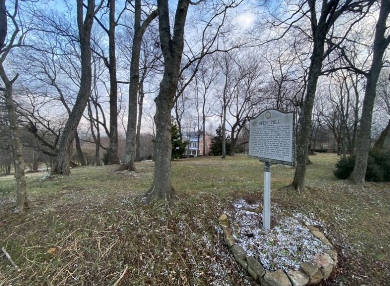
By Darren Jefferson Clay, January 16, 2021
Owen Hill Marker
GEOGRAPHIC SORT Title Sort Marker Number Sort Marker Number Sort for Trails Publication Order Sort Publication Order Sort A Erected Year Sort Most Viewed Sort Most Recent-Interest Sort Most Recently Changed Sort SEE FAQ #33 FOR DESCRIPTIONS
On Owen Hill Road east of Do Drop In Lane, on the left when traveling east.
On Murfreesboro Road (Tennessee Route 96) at Meadowbrook Boulevard, on the right when traveling west on Murfreesboro Road.
On Osburn Road at Osburn Hollow Road, on the right when traveling west on Osburn Road.
On Nolensville Road (U.S. 41) at Old Murphreesboro Road, on the right when traveling north on Nolensville Road.
On Nolensville Road (U.S. 41), on the right when traveling north.
On Nolensville Road (U.S. 41), on the right when traveling north on Nolensville Road.
On Nolensville Rd near TN Hwy 96, on the right when traveling north.
On Hillsboro Road (U.S. 431) 0.1 miles north of Hillsboro Valley Road, on the right when traveling north.
On Old Smyrna Road 0.9 miles west of Edmondson Pike, on the right when traveling west.
On Wilson Pike (Tennessee Route 252) at Crocket Road, on the right when traveling north on Wilson Pike.
On Green Hill Boulevard at Concord Road ( Route 253), on the right when traveling south on Green Hill Boulevard.
On High Lea Road at Maryland Way, on the right when traveling south on High Lea Road.
On Wikle Road East at Devens Drive, on the right when traveling west on Wikle Road East.
Paid Advertisement
On Concord Road (State Road 253) 0.1 miles east of Lipscomb Drive, on the right when traveling east.
On Wyndchase Circle just west of Aspen Grove Drive, on the right when traveling west.
On Franklin Road (U.S. 31) at Country Club Drive, on the right when traveling south on Franklin Road.
On Executive Center Drive 0.1 miles east of Franklin Road (U.S. 31), on the right when traveling west.
On Franklin Road (U.S. 31) at Jackson Lane, on the right when traveling south on Franklin Road.
On Old Smyrna Road 0.3 miles east of Jones Parkway, on the right when traveling east.
On Franklin Road (U.S. 31) north of Elijahs Way, on the right when traveling north.
On Concord Road (State Highway 253) 0.1 miles east of Lipscomb Drive, on the left when traveling east.
On Carters Creek Pike (Tennessee Route 246) at Popes Chapel Road, on the left when traveling south on Carters Creek Pike. Reported damaged.
On Arno Road, on the right when traveling north.
On Horton Highway (Alternate U.S. 31) 0.1 miles north of Bellenfant Road, on the left when traveling south.
On Horton Highway (Alternate U.S. 31) at Arno-College Grove Road, on the right when traveling south on Horton Highway.
On Pulltight Hill Road at Cross Keys Road, on the right when traveling west on Pulltight Hill Road.
On Flat Creek Road, on the left when traveling west.
On Horton Highway (Alternate U.S. 31) 0.3 miles south of 3rd Street, on the right when traveling south.
On Flat Creek Road, on the right when traveling west.
Paid Advertisement
On Horton Highway (Alternate U.S. 31) at Flat Creek Road, on the right when traveling south on Horton Highway.
On Owen Hill Road, on the right when traveling east.
On Arno-Allisona Road at Pulltight Hill Road, on the left when traveling north on Arno-Allisona Road.
On Caney Fork Road, on the right when traveling west.
On Bowie Lake Road, on the right when traveling west.
On City Center Boulevard at City Center Way, on the right when traveling south on City Center Boulevard.
On Founders Pointe Boulevard at New Highway 96 (State Route 96), on the right when traveling north on Founders Pointe Boulevard.
On Franklin Road north of Liberty Pike.
On Lewisburg Avenue (U.S. 431) at Thompson Alley, on the left when traveling south on Lewisburg Avenue.
On Columbia Avenue (Business U.S. 31) at Everbright Avenue, on the left when traveling north on Columbia Avenue.
On Ernest Rice Lane, on the left when traveling east.
On Granbury Street at Columbia Avenue (Business U.S. 31), on the left when traveling west on Granbury Street.
On Bending Chestnut Road at Greenbriar Road, on the right when traveling north on Bending Chestnut Road.
Near South Berrys Chapel Road at Hillsboro Road (U.S. 431), on the left when traveling west.
On South Berrys Chapel Road at Hillsboro Road (U.S. 431), on the left when traveling south on South Berrys Chapel Road.
On Boyd Mill Pike at Old Hillsboro Road ( Route 46), on the right when traveling east on Boyd Mill Pike.
Paid Advertisement
On Leipers Creek Road, on the right when traveling west.
On Boyd Mill Pike just south of Route 96, on the left when traveling south.
On Boxley Valley Road 0.2 miles south of Boyd Mill Pike, on the right when traveling south.
On Carnton Lane south of Brandon Drive (Route 0.3), on the left when traveling south.
On Carothers Parkway at Corporate Centre Drive, on the right when traveling north on Carothers Parkway.
On Cleburne Street, on the right when traveling west. Reported missing.
On Glass Lane 0.2 miles west of Magnolia Drive.
On 4th Avenue North just north of North Margin Street, on the right when traveling north.
On Herbert Drive at Breezeway Lane, on the left when traveling east on Herbert Drive.
On Main Street (U.S. 31) at 3rd Avenue South, on the right when traveling east on Main Street.
On Cummins Street, on the left when traveling south.
On Glass Lane 0.1 miles Highway 96, on the right when traveling north.
On Kittrell Rd at Columbia Pike (Highway 31), on the right when traveling west on Kittrell Rd.
On Arno Road 0.3 miles west of Old Arno Road, on the left when traveling west.
On 2nd Avenue South south of East Main Street (U.S. 31), on the right when traveling south.
On Murfreesboro Road (Tennessee Route 96) 0.5 miles west of Eddy Lane, on the right when traveling east.
Paid Advertisement
On Legends Club Lane 0.1 miles east of Franklin Road (U.S. 31), on the right when traveling east.
On Pinewood Road (Tennessee Route 46) at Green Chapel Road, on the right when traveling east on Pinewood Road.
On Carters Creek Pike (State Highway 246) 0.7 miles south of Bear Creek Road, on the right when traveling south.
On Old Hillsboro Road (Tennessee Route 46) at Old Natchez Trace, on the right when traveling north on Old Hillsboro Road.
On Captain Freeman Parkway east of Lewisburg Pike ( Route 106), on the left when traveling east.
On Jamison Station Lane at Old Liberty Pike, on the right when traveling north on Jamison Station Lane.
On 4th Avenue North north of Main Street, on the left when traveling north.
On 1st Avenue South 0.1 miles south of East Main Street (U.S. 31), on the left when traveling south.
On Public Square near Main Street.
Near Hughes Crossing just east of Levisa Lane, on the right when traveling west.
On Granbury Street 0.1 miles west of Columbia Avenue (Business U.S. 31), on the right when traveling west.
On Franklin Road (U.S. 31) at Legends Club Lane, on the right when traveling north on Franklin Road.
On Long Lane 0.1 miles north of Peytonsville Road, on the right when traveling north.
On South Margin Street just east of 2nd Avenue South, on the right when traveling north.
On West Main Street west of 6th Avenue North, on the left when traveling west.
Paid Advertisement
On Southall Road just east of McMillan Road, on the right when traveling east.
On Natchez Street just north of West Fowlkes Street, on the right when traveling north.
On Garrison Road, on the left when traveling west.
On Hillsboro Road (U.S. 431) at Boxwood Drive, on the right when traveling south on Hillsboro Road.
On Greenbriar Hill Road, on the right when traveling south.
On Old Charlotte Pike East 0.3 miles south of Hamilton Branch Lane, on the left when traveling south.
On 11th Avenue North at Glass Street, on the right when traveling north on 11th Avenue North.
On 2nd Avenue North north of East Main Street ( Route 6), on the right when traveling north.
On Hargrove Road 0.2 miles north of Hargrove Ridge Road, on the right when traveling south.
On Hillsboro Road (U.S. 431) 0.1 miles south of J B Hood Drive, on the right when traveling south.
On Old Hillsboro Road (Tennessee Route 46) east of Joseph Street, on the right when traveling east.
On South Margin Street (Business U.S. 431) at Lewisburg Avenue (Business U.S. 431), on the left when traveling west on South Margin Street.
On Church Street at 2nd Avenue South, on the right when traveling west on Church Street.
On 2nd Avenue South south of East Main Street, on the left when traveling south.
On Blazer Road 0.4 miles east of McMillan Road, on the left when traveling east.
Paid Advertisement
On West Main Street (Business U.S. 31) at 3rd Avenue North, on the left when traveling north on West Main Street.
On Bear Creek Road 0.3 miles west of Carters Creek Pike ( Route 246), on the right when traveling west.
Near Eastern Flank Circle 0.4 miles south of Lewisburg Pike ( Route 106), on the left when traveling west.
Near Eastern Flank Circle 0.4 miles south of Lewisburg Pike ( Route 106), on the left when traveling west.
On Del Rio Pike east of Two Rivers Lane, on the left when traveling east.
︽
147 entries matched your criteria. The first 100 are listed above.
The final 47 ⊳