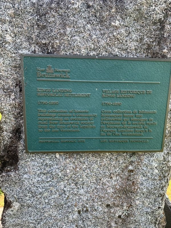
This collection of historic buildings creates a community representing an evolution of rural New Brunswick society from the Loyalists to the late Victorians.
Cette collection de bâtiments
historiques forme une . . . — — Map (db m230388) HM
On rue Notre Dame (New Brunswick Route 17) just west of rue Saint Jean, on the right when traveling west.
Ce canon a été en service dans les jungles de Burma, tout près de l'Australie et l'Afrique du Nord. Il termina son service en 1996 pour retourner au Canada, par la suite fut donné à la localité de Kedgwick en l'honneur de tout les . . . — — Map (db m125694) HM WM
Near Rue Centrale Street 0.5 kilometers north of Saint Thomas Street ( Route 925), on the left when traveling north.
[Français] Depuis sa construction, ce bâtiment a occupé une place toute spéciale dans le cœur des Acadiens, à titre de monument commémoratif, de maison d’enseignement et de foyer de rassemblement pour des activités . . . — — Map (db m269199) HM
Near Rue Centrale Street 0.5 kilometers north of Saint Thomas Street ( Route 925), on the left when traveling north.
[Français] Malgré les déportations des années 1750 et 1760, de nombreux Acadiens revinrent d'exil et d'autres quittèrent leur refuge pour se réinstaller sur leur terre natale. S'armant de courage et de détermination, . . . — — Map (db m269197) HM
Near Rue Centrale Street 0.5 kilometers north of Saint Thomas Street ( Route 925), on the left when traveling north.
[English]
The Monument-Lefebvre holds a special place in the hearts and minds of the Acadian people. Overlooking the scenic Memramcook Valley, the Monument-Lefebvre was built in 1896-97. This memorial is an . . . — — Map (db m269299) HM
Near Loggie Drive just north of Cunard Street, on the left when traveling north.
English:
From Newcastle paperboy to London press baron, Max Aitken was, in his time, one of the most powerful Canadians on the world's stage. A self-made millionaire, he worked his way into the limelight through a 50-year role in . . . — — Map (db m142230) HM
Near Main Street (New Brunswick Route 8) 0.3 kilometers north of Campbell Road ( Route 118), on the right when traveling north.
In the early 19th century, a young cook named Ryan worked in a lumber camp near the Dungarvon River. One day the cook died, probably murdered by the camp boss, while the men were working in the woods. The men returned during a severe snow storm and . . . — — Map (db m139798) HM
Near Main Street (New Brunswick Route 8) 0.3 kilometers north of Campbell Road ( Route 118), on the right when traveling north.
Henry Reid leased stone quarry sites in the area in the 1870s and 1880s. These unused millstones came from the quarry in Indiantown (now Quarryville). Another Reid stone quarry operated at Blackville during the same period. In addition to . . . — — Map (db m139703) HM
English: From the bygone days of New Brunswick's "Golden Age of Sail", its once-prosperous commercial fishery, and its growing tourism and ecotourism industry, the Petitcodiac River continues to play an important role in the . . . — — Map (db m150992) HM
Near Assomption Boulevard 0.2 kilometers east of Westmorland Street, on the right when traveling east.
English: Historically, the Petitcodiac River was home to a large number of fish species. Both the rainbow smelt and Atlantic tomcod numbered in the hundreds of thousands. There were healthy populations of gaspereau, American eel, . . . — — Map (db m150985) HM
On Bendview Court just south of Main Street ( Route 106), on the left when traveling south.
In memory of the 1.5 million martyrs
of the Armenian Genocide
and
all victims of genocide
A la mémoire de 1,5 millions de martyrs
du génocide arménien
et
de toutes les victimes de génocide — — Map (db m106601) HM WM
Near Main Street (New Brunswick Route 106) 0.1 kilometers west of Wheeler Boulevard, on the right when traveling east.
English: The Settlers of the Township of Monckton reached their destination after 44 days at sea, on June 3, 1766. Captain Jonathan Hall guided the sloop along Pennsylvania's Schuylkill River to the New England coast, then entered . . . — — Map (db m151002) HM
On Downing Street north of Assomption Boulevard, on the right when traveling north.
English: The Provincial Bank Building (opposite) is located at the corner of Main and Downing. Commissioned in 1909 by the Provincial Bank of Canada to be its Maritime Provinces headquarters, this building was occupied by the bank . . . — — Map (db m150996) HM
On Main Street (New Brunswick Route 106) just east of Ruelle Oak Lane, on the right when traveling east.
English: Built in 1926, the Capitol Theatre was designed by Moncton architect René-Arthur Fréchet and features frescoes by Emmanuel Briffa. With its deep, opera-style stage, the theatre has accommodated both motion pictures and live . . . — — Map (db m150964) HM
On Downing Street at Assomption Boulevard, on the right when traveling north on Downing Street.
English: Downing Street is the namesake of Johanna Downing, a Moncton resident from 1840 until 1876. She and her husband, Peter McSweeney, moved from Ireland to Hillsborough, New Brunswick, in 1832. Peter later became a farmer, real . . . — — Map (db m150995) HM
On Queen Street just west of Church Street, on the right when traveling west.
On this site a house of worship was erected in 1857 destroyed by fire 1913 present building dedicated to the glory of God May 16, 1915 160th Anniversary June 8, 1988 Heritage Moncton Inc. — — Map (db m151005) HM
On Main Street (New Brunswick Route 106) at Bendview Court, on the right when traveling east on Main Street.
This part of "Le Coude" (The Bend) was in earlier times called Terre-Rouge. Three families from the Grand-Prée region first settled here:
Jean Babineau & Isabelle Breau, circa 1733,
followed by Joseph Breau & Isabelle Thibodeau
and Charles . . . — — Map (db m106603) HM
On Downing Street north of Assomption Boulevard, on the right when traveling north.
English: Downing Street was an important hub for many industries relying on various modes of transportation for the arrival and shipment of cargo and merchandise. Français: La rue Downing était une plaque tournante . . . — — Map (db m150998) HM
On Bendview Court just south of Main Street ( Route 106), on the left when traveling south.
The Moncton 100 Monument honours Joseph Salter, shipbuilder, entrepreneur and first mayor of the Township of Moncton in 1855.
Local entrepreneurs, whose names are inscribed on this monument, undertook funding of the project as their gift to . . . — — Map (db m106613) HM
Near Main Street (New Brunswick Route 106) 0.1 kilometers west of Wheeler Boulevard, on the right when traveling east.
English: 1 • This journey began in Europe where eight families, seven of German origin, and one of Welsh origin, set out to seek a new homeland. It ended here, on these muddy Banks of the Petitcodiac River, when the families of . . . — — Map (db m151001) HM
On Queen Street just west of Church Street, on the left when traveling west.
This plaque commemorates Methodism in Moncton 1781 Ministry of Methodist Preachers 1822 Circuit established 1828 Methodist Society formed 1847 First denominational church in Moncton, corner of Main and Wesley Streets 1877 . . . — — Map (db m151214) HM
On Downing Street just north of Assomption Boulevard, on the right when traveling north.
English: These maps and street directories of Moncton show businesses and homes once located on Downing Street. Français: Ces cartes et répertoires de Moncton montrent les entreprises et résidences autrefois situées . . . — — Map (db m150999) HM
Near Main Street (New Brunswick Route 106) 0.1 kilometers west of Wheeler Boulevard, on the right when traveling east.
English:
In honour of the permanent settlers of the Monckton township, the Stief, Lutz, Treitz, Jones, Sommers, Copple, Ricker and Wortman families who came up the Petitcodiac River from Pennsylvania and landed on the bank of this . . . — — Map (db m151000) HM
On Botsford Street (New Brunswick Route 134) north of Queen Street, on the right when traveling north.
First wooden church erected in 1872 Cornerstone present church laid 1888 100th anniversary of first celebrated mass November 1, 1991 November 1, 1891 — November 1, 1991 Heritage Moncton Incorporated — — Map (db m150993) HM
On Downing Street north of Assomption Boulevard, on the right when traveling north.
English: The Peter McSweeney Company Limited (700 Main) offered a special sale called the Red and Green Tag Campaign twice a year, when the tides allowed customers to arrive by ship in the morning to go shopping and return home in . . . — — Map (db m150997) HM
Near Main Street (New Brunswick Route 106) 0.1 kilometers west of Wheeler Boulevard, on the right when traveling east.
English: When they first arrived, the settlers lived together in small, rough cabins. But soon, each family built its own home, as stipulated in the Articles of Agreement. Initially, all livestock was housed in a communal shed. The . . . — — Map (db m151003) HM
Near Assomption Boulevard 0.2 kilometers east of Westmorland Street, on the right when traveling east.
English: Because of access to the Atlantic Ocean and an abundance of timber, communities along the Petitcodiac, like others in New Brunswick, flourished during the "Golden Age of Sail". It began as early as 1827, when Moncton was . . . — — Map (db m150981) HM
Near Main Street (New Brunswick Route 106) just west of Wheeler Boulevard, on the right when traveling east.
English: Powered by the high tides of the Bay of Fundy, the tidal bore has fascinated visitors and residents for generations. It was considered one of the top tidal phenomena in the world until the construction of a causeway in the . . . — — Map (db m150960) HM
On Westmorland Street just south of Main Street ( Route 106), on the right when traveling south.
Built in 1900 by John T. Hawke, Publisher and Editor of The Transcript Revitalized in 1990 by the Law Firm of Ellsworth Johnson & Partners Registered as a Historic Place on September 9, 1996 This commemorative plaque was erected by Ellsworth . . . — — Map (db m150994) HM
Near New Brunswick Highway 127 (New Brunswick Route 127) 9 kilometers south of Route 1, on the right when traveling south.
English:
In 1984, the United States Congress designated Saint Croix Island an international historic site in recognition of the historical significance of the Island to the United States and Canada.
The majestic Saint Croix . . . — — Map (db m144503) HM
Near New Brunswick Highway 127 (New Brunswick Route 127) 9 kilometers south of Route 1, on the right when traveling south.
English:”Having found no place more suitable than this island... Sieur de Monts… allowed me to draw up the plan of our settlement."
Seventy-nine men, including noblemen, artisans, labourers, Catholic and . . . — — Map (db m144499) HM
Near New Brunswick Highway 127 (New Brunswick Route 127) 9 kilometers south of Route 1, on the right when traveling south.
English:
Sieur de Monts named the island Saint Croix Island, and Champlain recorded that: "The island is covered with fir, birch, maple, and oak. It is naturally well located... and is easy to fortify... We considered this the . . . — — Map (db m144498) HM
Near New Brunswick Highway 127 (New Brunswick Route 127) 9 kilometers south of Route 1, on the right when traveling south.
English:”It was difficult to know the country without having wintered there... Winter came upon us sooner than we had expected..."
Could you survive a winter on Saint Croix Island if...
• dangerous ice cut you . . . — — Map (db m144501) HM
Near New Brunswick Highway 127 (New Brunswick Route 127) 9 kilometers south of Route 1, on the right when traveling south.
English:
The precise mapping of Acadie in the 17th century was the work of one individual — Samuel de Champlain.
Between May 1604 and August 1605, travelling by barque, pinnace, canoe or on foot, Champlain surveyed and . . . — — Map (db m144500) HM
Near New Brunswick Highway 127 (New Brunswick Route 127) 9 kilometers south of Route 1, on the right when traveling south.
English:"In order to escape the cold and dreadful winter we experienced on Saint Croix Island, Sieur de Monts decided to move the settlement to another location. Having… found no port that was acceptable to us... we outfitted . . . — — Map (db m144502) HM
Near New Brunswick Highway 127 (New Brunswick Route 127) 9 kilometers south of Route 1, on the right when traveling south.
English:
Welcome On Saint Croix Island in 1604, French nobleman-courtier Pierre Dugua Sieur de Monts established a settlement. This outpost was the first attempt by the French at year-round colonization in the territory they . . . — — Map (db m144495) HM
Near New Brunswick Highway 127 (New Brunswick Route 127) 9 kilometers south of Route 1, on the right when traveling south.
English: Samuel de Champlain, explorer and geographer on Sieur de Monts' expedition, recorded in late June 1604 that:
”...we entered a river... wherein...we found two islands — one very small and near the western . . . — — Map (db m144496) HM
Near New Brunswick Highway 127 (New Brunswick Route 127) 9 kilometers south of Route 1, on the right when traveling south.
English:
The Micmac, Maliseet, and Passamaquoddy hunters and traders provided a commercial lifeline for Sieur de Monts' colony. Their first-hand knowledge of the territory allowed these entrepreneurs to control the supply of furs. . . . — — Map (db m144497) HM
On Joes Point Road close to Harriet Street, on the right when traveling east.
English on left
What kind of house?
A blockhouse is a modest fortified building with a distinctive overhanging upper level. In 18th- and 19th-century North America, both Britain and the United States built many blockhouses for . . . — — Map (db m77366) HM
On Frederick Street at Parr Street, on the left when traveling south on Frederick Street.
Charlotte County Court House
The Charlotte County Court House is the best preserved
example in New Brunswick of the typical mid-19th century
Maritime court house. Like the Queens County Court House
in Gagetown, N.B. and others . . . — — Map (db m294972) HM
On Montague Street at Edward Street, on the right when traveling west on Montague Street.
English: This elegant church marks the growth of Presbyterianism and the Kirk of Scotland in New Brunswick. Built in 1821-1824, the structure successfully combines the American meeting house form with the British Palladian style. The . . . — — Map (db m137515) HM
Near Water Street close to King Street, on the right when traveling east.
W.W.I
Anning, William • Bartlett, George Leonard • Boone, George • Cork, Alfred • Crichton, Clarence M. • Greenlaw, Ernest • Grimmer, Harold Mackie • Jack, Edward • Key, William James • Markee, Percy • McMullin, Herbert • MacQuoid, Charles Loren . . . — — Map (db m77394) WM
On Joes Point Road close to Harriet Street, on the right when traveling east.
This marker consists of two side-by-side plaques, one in English and the other in French. English:
The West Point Blockhouse and a battery were erected by the townspeople of St. Andrews at the outbreak of the War of 1812-14 in anticipation . . . — — Map (db m77240) HM
On Water Street close to King Street, on the right when traveling east.
English
Founded by Loyalists in 1783, St. Andrews is a fine and rare surviving example of a Canadian town whose plan and character clearly reflect its 18th-century origins. The town retains the four key elements of a British colonial . . . — — Map (db m77398) HM
Near Water Street close to King Street, on the right when traveling east.
From the Chiputneticook Lakes, the waters of the St. Croix River tumble through rolling Appalachian scenery to one of the most historic estuaries in Canada, at Passamaquoddy Bay. Here, French colonization in North America began in 1604 . . . — — Map (db m292618) HM
To commemorate the men and women serving in the Canadian Arms Forces and to honour those who made the ultimate sacrifice while serving Canada and the people of Afghanistan. — — Map (db m77433) WM
Kingsbrae Garden welcomes on of the world’s oldest and rarest trees, Wollemia nobilis; the only one in Canada. An epic journey for a historic little tree, across 90 million years and 10,000 miles. from Wollemi National Park’s Blue Mountains . . . — — Map (db m77397) HM
On Joes Point Road close to Harriet Street, on the right when traveling east.
English on left
Against the odds
Many blockhouses were built in North America, but few have survived. Why is this one still here? Throughout the 19th century the St. Andrews Blockhouse was used for storage and occasionally as a . . . — — Map (db m77241) HM
On Joes Point Road close to Harriet Street, on the right when traveling east.
English on left
No hard feelings
Have a look across the St. Croix River to the land on the other side of Navy Island; that’s the United States you can see! When the War of 1812 broke out, the citizen of St. Andrews had little to . . . — — Map (db m77363) HM
On Joes Point Road close to Harriet Street, on the right when traveling east.
English on left
St. Andrews’ citizens step up
In 1812, St. Andrews was a young town, founded not long before by Loyalists from New England fleeing the American Revolution. A modest fortification - Fort Tipperary - had been built in . . . — — Map (db m77362) HM
On Joes Point Road close to Harriet Street, on the right when traveling east.
English on left
Welcome to St. Andrews Blockhouse National Historic Site, part of Parks Canada’s diverse and ever-growing system of national park, national historic sites and national marine conservation area.
Wartime building . . . — — Map (db m77361) HM
On Chipman Hill just south of Union Street, on the left when traveling north.
English:
Remarkable for the range of trompe l'œil effects and skillful execution, the wall and ceiling paintings inside this residence, part of a row of similar town houses, reflect the taste of the High Victorian era, . . . — — Map (db m140107) HM
On Market Square just east of Water Street, on the right when traveling east.
English:
In 1867, brothers George and William Barbour started a wholesale operation on South Market Wharf supplying fish, eggs, poultry and other local goods to vessels and area retailers. Although the building burned in the . . . — — Map (db m145582) HM
On Water Street just west of Prince William Street, on the left when traveling south.
English:
Look out to the head of the harbour, and you'll see Partridge Island, a major point of entry for European immigrants during the 19th and 20th centuries, almost 100 years before Ellis Island.
Many of our ancestors . . . — — Map (db m145397) HM
On Prince William Street at Saint James Street, on the left when traveling north on Prince William Street.
English:
Partridge Island has been home to natural and human communities for a long time.
It began about 300 million years ago when ash from an ancient volcano created the island. Sand and soil slowly built up, seeds took . . . — — Map (db m145599) HM
Near Chesley Drive (New Brunswick Route 100) at Bentley Street, on the right when traveling north.
English:
Some of the world's oldest fossils from a time long before dinosaurs have been found near here. Billion-year-old cyanobacteria lived underwater in Precambrian times and left circular shapes in the rock called . . . — — Map (db m147794) HM
Near Lancaster Avenue 0.2 kilometers east of Bridge Road ( Route 100), on the left when traveling east.
English:
In 1741 Benedict Arnold was born in Connecticut to a prosperous family. Twice before he was 18 young Arnold ran away to join British forces fighting the French and Indian wars.
When the American revolution began . . . — — Map (db m141993) HM
English What do you do for a 225th anniversary The answer in Canada’s first incorporated city was celebrate! Saint John 225: The Original City/La ville originale was a year-long celebration of the city’s heritage, creativity and . . . — — Map (db m77568) HM
Construction of this tower was begun by the British Army during the War of 1812 as one of the projected series of fortifications intended to block the western land approach to Saint John. Subsequent to its completion in 1815 the tower . . . — — Map (db m120628) HM
On Prince William Street at King Street, on the left when traveling south on Prince William Street.
This historic city block of attached late-Victorian buildings was designed and constructed immediately after the Great Fire of 1877 that swept away much of Saint John. Prominent architects from Canada and the United States vied for the honour of . . . — — Map (db m77457) HM
Near Lancaster Avenue 0.2 kilometers east of Bridge Road ( Route 100), on the left when traveling east.
English:
Charles Ingraham Gorman, born 1897 in Saint John, quickly grew into a boy with great energy. He thrived on competition. Once he had ice skates he dazzled family and friends with his speed on ice. At ten Charlie competed . . . — — Map (db m142002) HM
On Germain Street close to Duke Street, on the left when traveling south.
English
Constructed in 1879, on the site of the 1815 “Auld Kirk”, the present church is a faithful representation of the Gothic Revival style. One highlight of the interior is the Gothicized pulpit by local carver John Rogerson. . . . — — Map (db m77483) HM
On Water Street at Duke Street, on the right when traveling south on Water Street.
English:
From 1881 to 1960, a massive building with a central dome and two elaborate towers dominated the Saint John waterfront.
The Custom House was three storeys high on Prince William Street and five storeys on Water . . . — — Map (db m145399) HM
Near Lancaster Avenue 0.2 kilometers east of Bridge Road ( Route 100), on the left when traveling east.
English:
Born to a wealthy American family in 1736, Gabriel Ludlow grew up a supporter of the King. When the American Revolution came Ludlow raised a battalion for General DeLancey's Brigade. He was commissioned colonel of the . . . — — Map (db m141992) HM
On Union Street just west of Smythe Street when traveling west.
English:
Saint John Harbour has long been strategically important. There are many sites in and around the harbour relating to its defense — from Fort Saint Marie, now known as Fort LaTour, a fortified fur-trading settlement . . . — — Map (db m145591) HM
English The New Brunswick Electric Power Commission’s DOCK STREET PLANT, built on this site in 1889, was the longest continually operating electrical generation station in the world.
Built by the Saint John Railway Company, the 18,000 . . . — — Map (db m77558) HM
Near Union Street just west of Smythe Street, on the right when traveling west.
English:
Saint John Energy was established by the Saint John Common Council in 1922 to manage and operate the transmission and distribution of electrical power and energy in the City of Saint John. The Union Street substation . . . — — Map (db m145395) HM
On Peters Wharf at Water Street, on the right when traveling east on Peters Wharf.
English
The first vessel in the world propelled by a compound steam engine was the REINDEER launched for service on the Saint John, in 1845. Both the vessel and engine were designed by Benjamin Tibbets, a native of Queen’s County, New . . . — — Map (db m77428) HM
On Peters Wharf at Water Street, on the right when traveling east on Peters Wharf.
English
In 1854, Robert Foulis of St. John, N.B., first advocated the use of a steam horn or whistle to give warning to vessels in foggy weather. An apparatus devised by him was installed on Partridge Island in 1859. This was the first . . . — — Map (db m77430) HM
Near Chesley Drive (New Brunswick Route 100) at Bentley Street, on the right when traveling north.
English:
Fishing the Harbour
For at least 10,000 years the Saint John harbour and river estuary, with its rich range of maritime food resources, from shellfish to walrus, provided abundantly for the Wolastoqiyik (Maliseet) and . . . — — Map (db m147795) HM
Three markers are mounted on this monument Fort Howe
English Late in 1777 Major Gilfred Studholme hurriedly fortified this ridge overlooking the mouth of the Saint John River. Throughout the remainder of the American . . . — — Map (db m77537) HM
Near Fort Latour Drive at Navy Way when traveling east.
Fort La Tour was built on this site in 1631 by Charles de La Tour, a historical crossroads for First Nations peoples, French settlers and British traders. La Tour’s wife, Francoise-Marie Jacquelin defended the Fort against rival Charles de Menou . . . — — Map (db m138888) HM
Near Fort Latour Drive at Navy Way, on the right when traveling east.
English:
In 1631, Charles de Sainte-Étienne de La Tour built a fort here on ground traditionally used by First Nations people, for some 4000 years. The fort became one of the earliest centres of the French fur trade with the . . . — — Map (db m139998) HM
Français:
Fort La Tour
Les peoples des Premières nations ont utilisé cet endroit comme lieu de rassemblement et de cérémonie pendant plus de 4000 ans. En 1631, Charles de Sainte-Étienne de La Tour a établi un poste de . . . — — Map (db m152385) HM
Near Chesley Drive (New Brunswick Route 100) at Bentley Street, on the right when traveling north.
English:
Saint John was home to some of Canada's earliest fossil hunters. One great story from the 1880s tells how a young boy named Will Matthew found a gigantic trilobite — perhaps the largest ever found at that time about a . . . — — Map (db m147799) HM
On Sydney Street close to Kings Square North, on the left when traveling north.
English
The increase of population consequent upon the large influx of Loyalists in 1783 and 1784 convinced the British government of the desirability of creating the Province of New Brunswick. This was done on 16 August 1784. Brigadier . . . — — Map (db m77519) HM
Near Lancaster Avenue 0.2 kilometers east of Bridge Road ( Route 100), on the left when traveling east.
English:
In 1640 Françoise Marie Jacquelin from France stepped onto the shores of Acadia to marry Charles de Saint-Étienne, Sieur de La Tour, the 46 year-old Governor of Acadia. With her marriage the young bride joined the war for . . . — — Map (db m141988) HM
Near Lancaster Avenue 0.2 kilometers east of Bridge Road ( Route 100), on the left when traveling east.
English:
When George Bauld Oland was growing up in Dartmouth, N.S. he was surrounded by his brothers and sisters and many Oland cousins. Their homes were together by the Halifax harbour near the Oland family brewery. The popular . . . — — Map (db m141995) HM
On Canterbury Street just south of King Street, on the right when traveling south.
Here stood the house occupied by Gen. Benedict Arnold, famous Revolutionary War soldier, prominent merchant and trader 1787 to 1791. — — Map (db m147887) HM
On Kings Square South close to Sydney Street, on the right when traveling west.
English
Constructed in 1912-1913 to the designs of Philadelphia architect A.E. Westover, this structure was built by the Keith-Albee chain of New York City and its Canadian subsidiary, the Saint John Amusements Company. Dramatic, musical . . . — — Map (db m77506) HM
On Water Street 0.03 kilometers north of Prince William Street, on the left when traveling south.
This Celtic cross, erected in 1967 by descendants of the Irish settlers, is a half scale replica of a cross which stands on Partridge Island in Saint John Harbour.
A reproduction of the plaque on the original cross is shown below.
This . . . — — Map (db m78253) HM
Near Lancaster Avenue 0.2 kilometers east of Bridge Road ( Route 100), on the left when traveling east.
English:
At age 16 John Robertson left Scotland for Saint John to work as his uncle's clerk. From his arrival in 1817 Robertson's energy, vision and shrewd business sense were combined with significant social skills. People liked . . . — — Map (db m141994) HM
Near Lancaster Avenue 0.2 kilometers Bridge Road ( Route 100), on the left when traveling east.
English:
Kenneth Colin Irving, known to everyone as K.C., spent most of his life in New Brunswick. He was born (March 1899) in Buctouche, Kent County where his father owned various businesses. From his earliest years it was . . . — — Map (db m142000) HM
On Charlotte Street close to King Street, on the left when traveling south.
English
The Memorial Bandstand was designed and built in 1908 for the City Coronet Band by Neil Brodie, a local architect. One year later, it was donated to the City of Saint John in the name of Edward VII of England.
The bandstand is . . . — — Map (db m77531) HM
On Charlotte Street close to King Street, on the left when traveling south.
English
King’s Square, named for King George III of England, was granted to the City of Saint John by royal charter in 1785. During its early years, the grounds were the site of such public uses as oxen roasts, fireworks displays, militia . . . — — Map (db m77534) HM
Near Lancaster Avenue 0.2 kilometers Bridge Road ( Route 100), on the left when traveling east.
English:
Koluskap and Beaver
The following is a creation story kept by the storytellers of the Wolastoqiyik (Maliseet) about their ancestors in the communities of the Wolastoq (St. John River) where it meets the Bay of . . . — — Map (db m141909) HM
Near Lancaster Avenue 0.2 kilometers east of Bridge Road ( Route 100), on the left when traveling east.
English:
Land of the Dawn
The traditional territory of the Wolastoqiyik is called Wabanaki (Land of the Dawn). Wolastoqiyik, people of the beautiful river, have been here since the beginning. In the beginning the river . . . — — Map (db m141443) HM
On Union Street just west of Germain Street (Wellington Row), on the right when traveling east.
English:
This gracious building is a well-preserved example of the homes built by prosperous United Empire Loyalists and their descendants. Constructed before 1820 by the merchant David Merritt, this house was maintained with . . . — — Map (db m139999) HM
Near Fort Latour Drive at Navy Way when traveling east.
As the people of the Saint John River/Walastakok River, Maliseets are known to have lived on this river for nearly 12,000 years. When The Europeans first came here in 1604 we were living in a village on an island in this harbor. Maliseets referred . . . — — Map (db m138887) HM
Near Lancaster Avenue 0.2 kilometers east of Bridge Road (Route 100), on the left when traveling east.
English:
The site opposite, where Irving Pulp and Paper mill now stands, has been used for mill operations since the early 19th century. At that time the site was known as Union Point.
Mills at Union Point 1835 . . . — — Map (db m142003) HM
Near Chesley Drive (New Brunswick Route 100) at Bentley Street, on the right when traveling north.
English:
Through this viewing tube you can see a small patch of ground around one of the abutments of the Saint John Harbour Bridge. This is all that remains visible of a small island known as Navy Island. For centuries this . . . — — Map (db m147874) HM
On Canterbury Street close to Princess Street, on the left when traveling north.
Established on October 8, 1892 in connection with King’s College, Windsor, N.S., New Brunswick’s first School of Law was located in this building until 1953. The school is now the Faculty of Law of the University of New Brunswick. This plaque was . . . — — Map (db m77482) HM
On Sydney Street close to Kings Square South, on the right when traveling west.
English
The cry “Fire!” so terrified Canadians in the early 19th century that communities began to construct permanent fire stations. Erected in 1840, this elegant Neoclassical building is a pioneer example of a firehall designed . . . — — Map (db m77508) HM
Near Market Square (North Market Wharf) just west of St. Patrick Street, on the right when traveling west.
1867 The year has great significance — not only did it mark Canada's confederation, but it also marked the year that Susannah Oland introduced her family's October Brown Ale to the public.
1870 John Oland died unexpectedly, but . . . — — Map (db m145396) HM
Near Smythe Street at North Market Wharf, on the right when traveling south.
English:
Look toward the mouth of the harbour and you'll see Partridge Island, an official National and Provincial Historic Site. Only 600 metres (654 yards) long by 300 metres (327 yards) wide, the rocky island was home to . . . — — Map (db m145596) HM
On Prince William Street near King Street, on the left when traveling south.
This marker has plaques on both sides.English
Before the 1877 Fire
The year is 1865, and you are looking across Market Square at the “Imperial Building.” This was the site of the famous “Coffee House” and now the home of . . . — — Map (db m77480) HM
302 entries matched your criteria. Entries 101 through 200 are listed above. ⊲ Previous 100 — Next 100 ⊳