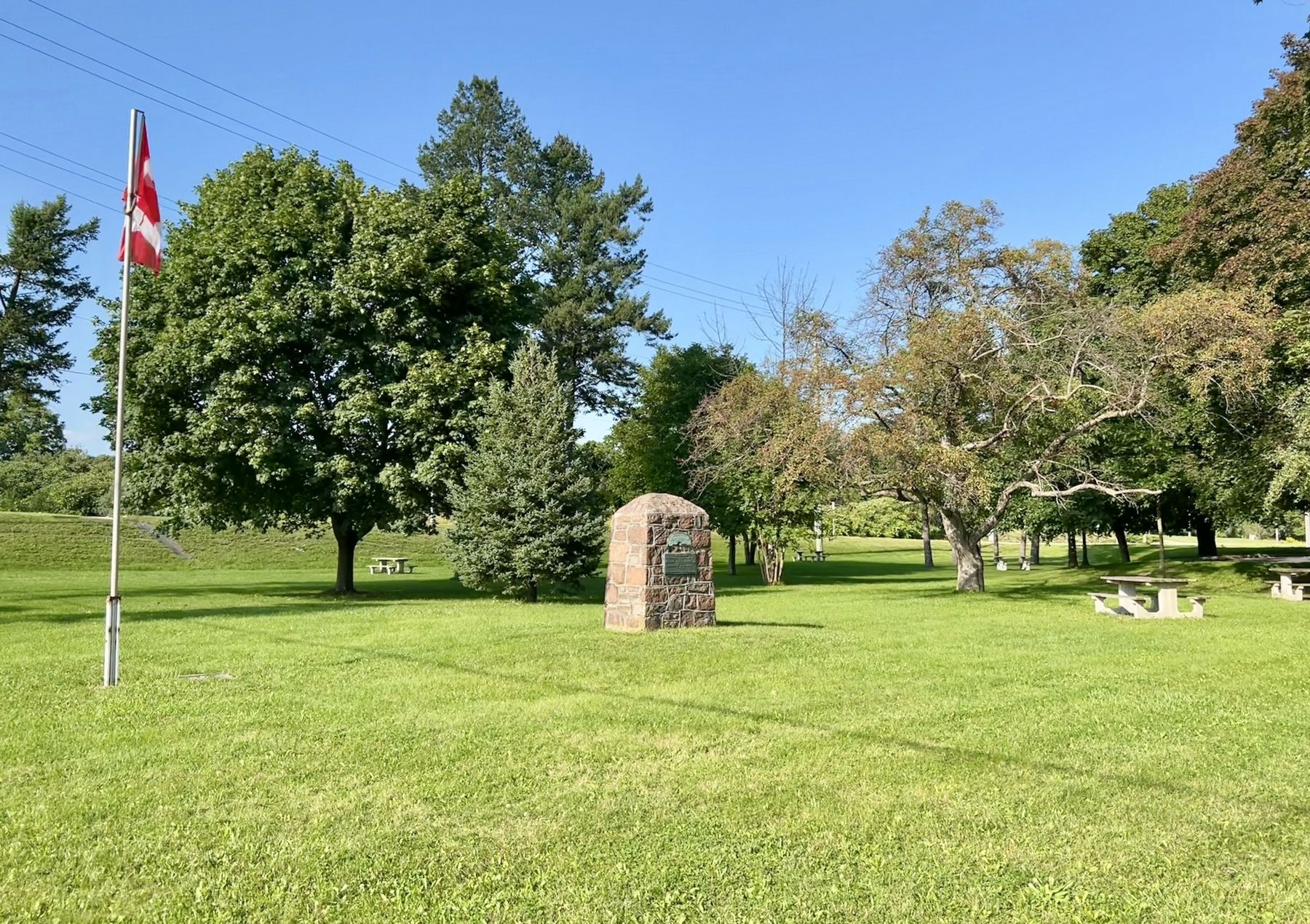
Unveiled by Her Excellency
The Lady Tweedsmuir
October 2, 1937
“For Home and Country"
To commemorate the birth place of
Adelaide Hunter-Hoodless
1858-1910
Who founded the Women's Institute
Feb. 19th 1897
Erected by . . . — — Map (db m232132) HM
Born in Paris, Ontario in 1915, Charles Joseph Sylvanus "Syl" Apps was a professional hockey player, businessman and politician. Throughout his life, Apps displayed remarkable breadth in his abilities and accomplishments. He was a varsity . . . — — Map (db m223241) HM
In 1793 Lieutenant-governor Simcoe granted to Abraham Dayton the entire township of Burford. Dayton was a Native of New Milford, Connecticut, U.S.A. The township was to become the "New Jerusalem" for a religious sect with which he was affiliated. . . . — — Map (db m301949) HM
Ontario's thirteenth prime minister was born on this farm
and in 1913 graduated from Ontario Agricultural College.
A supporter of the United Farmers of Ontario, he was
elected to the provincial legislature in 1919 as member
for Brant North . . . — — Map (db m223085) HM
Canadas first woman graduate in medicine was born in Mount Pleasant. She attended the Toronto School of Medicine, received her degree from Victoria University in 1883, and was licensed to practise. Her mother, Dr. Emily Howard Stowe, had graduated . . . — — Map (db m299631) HM
This house was built in 1831 by Hiram Capron, a
native of Vermont who, in 1822, had emigrated to Norfolk
County where he helped to establish one of Upper Canada's
earliest iron foundries. He settled here at the Forks of the Grand in 1829, . . . — — Map (db m223280) HM
Built by the free labour of its own congregation with
stones gathered from nearby fields, the West Dumfries
Chapel was completed and dedicated in 1845. It is a fine
example of a type of cobblestone construction seldom
found elsewhere in . . . — — Map (db m221681) HM
This house and the adjoining structure were built by Asa
Wolverton, a native of Cayuga County, New York, who had
immigrated to Upper Canada in 1826. About 1832 he settled
in Paris, where he erected sawmills and became a prosperous lumber . . . — — Map (db m223265) HM
The Grand River is aptly named. Flowing 290 kilometres from the Dundalk Highlands to Lake Erie, its watershed is the largest in Southern Ontario. Winding its way through marshes, woods and Carolinian forests, the river provides the common thread . . . — — Map (db m261532) HM
On this site, Alexander Graham Bell, inventor of the telephone,
received from Brantford, Ontario, on August 10, 1876, the world's first successful long distance telephone call.
Erected by the Charles Fleetford Sise Chapter Telephone Pioneers . . . — — Map (db m223183) HM
This Monument the work of Walter S. Allward, R.C.A. Sculptor, was placed here through International subscription by the Bell Telephone Memorial Association to mark the invention of the Telephone at Brantford by Alexander Graham Bell in 1874 — . . . — — Map (db m215700) HM
Architect John Turner and contractor William Sinon built this court house for the Provisional County of Brant in 1852-53. Turner was Brantford's most influential nineteenth-century architect, designing several important public buildings in Brant . . . — — Map (db m198273) HM
In July, 1852, the Six Nations Indians sold to Brant County the land upon which this court-house now stands. Designed by John Turner and William Sinon and erected by the Provisional County of Brant, the stone and brick building was largely . . . — — Map (db m198271) HM
In 1877 this house, then located in downtown Brantford,
became Canada's first telephone business office. It was
the residence of the Reverend Thomas Philip Henderson
(1816-1887), a former Baptist minister and school
inspector in Paris, . . . — — Map (db m230401) HM
Lingering Snow, oil on canvas, n.d. Collection of Glenhyrst Art Gallery of Brant George Thomson was born in Claremont, Ontario in 1868 and, at the age of nine, moved to Rose Hill Farm outside Leith, near Owen Sound. He is the oldest . . . — — Map (db m222039) HM
English: Originally called St. Paul's, this chapel was the first Protestant church in Upper Canada and is now the oldest surviving church in Ontario. Built by the Crown in 1785, it was given to those Mohawk Indians led by Joseph Brant who . . . — — Map (db m83743) HM
A Grand Legacy
In 1994, the Grand River was formally designated a Canadian Heritage River.
This honour recognizes rivers of outstanding significance and their important role in Canadian history. The Grand is unique, as it is the only . . . — — Map (db m240760) HM
Across the Grand River at this point lies "Bow Park", once the farm of George Brown, a leading architect of Confederation, who built up an estate of some 800 acres beginning in 1866. A Scottish immigrant, Brown founded the Toronto "Globe" in 1844, . . . — — Map (db m284027) HM
Log Cabin, oil on canvas, n.d. Collection of the City of Brantford John Claude Whale is the second son of painter Robert R. Whale and was born during his parents' voyage from England to Canada. A self-taught artist like his father, he . . . — — Map (db m243605) HM
Marsh Birds, oil on canvas, 1878 Collection of Glenhyrst Art Gallery of Brant John Hicks Whale was born in Liskeard, England in 1829 and is the nephew of artist Robert R. Whale. He emigrated to Canada in the early 1850s and married . . . — — Map (db m243674) HM
Born into a prominent Brantford family, Lawren Harris began to paint as a child. At the University of Toronto, a professor noticed he sketched during lectures and advised he be sent to Europe to study art. While in Germany (1904-1907), . . . — — Map (db m239617) HM
Three Chords, lithograph print, 1973 Collection of Glenhyrst Art Gallery of Brant Michael Snow is among the world's most celebrated artists and filmmakers. Born in Toronto in 1928, Snow's artwork and films have been exhibited at art . . . — — Map (db m221940) HM
English: Allies of the British during the American War of Independence, the Six Nations Iroquois received extensive lands along the Grand River in 1784. Mohawks, led by Joseph Brant, established a village of some 400 individuals here by . . . — — Map (db m83697) HM
This observation site constructed on the flood control dyke
overlooks the original canoe landing area for the Mohawk
village which was located here at the ox bow in the River Ouse (Grand River). At that time the river flowed past this area. The . . . — — Map (db m262395) HM
Designed by John Turner and built in 1883, Park Baptist Church served as a place of worship for over a century until a dwindling membership led to closure in 1992. The fate of the building remained uncertain until 2000 at which time restoration . . . — — Map (db m215890) HM
[English]To commemorate our heroic Polish and Canadian soldiers under British Command in World War II To honor war veterans who fought for world freedom and all the people that endured suffering and hardship[Polski]Pamieci bohaterów . . . — — Map (db m243591) WM
This house, "Echo Villa", was built by the Reverend Peter
Jones (Kahkewaquonaby) who lived here from 1851 until
his death. Son of the noted surveyor, Augustus Jones, and
Tuhbenahneequay, a Missisauga chief's daughter, Peter was
born at . . . — — Map (db m237708) HM
Royal Victoria Place, originally known as the Commercial Buildings, was designed by John Turner and built in 1881 by Bernhard Heyd. One of the first occupants was the Royal Loan and Savings Company. Following a devastating fire in 1988, . . . — — Map (db m215851) HM
[English] Pioneering journalist in the late 19th century, Sara Jeannette Duncan challenged social and political norms by examining women’s changing roles, the need for a national culture, and the way Canadian politics . . . — — Map (db m215697) HM
[English] An internationally renowned author, Duncan was raised in the adjacent house and educated locally. She taught school briefly, but then determinedly turned to journalism, gaining notice for her distinctive and witty writing . . . — — Map (db m215698) HM
This chapel, the first Protestant church in Ontario, was built by the Crown for the Mohawks of the Six Nations Iroquois who settled here in 1794. It replaced the Queen Anne Chapel (1712) at Fort Hunter, New York, which the Mohawk lost, . . . — — Map (db m284104) HM
This National Monument erected by the Brant Memorial Association, Incorporated 41 Vic. Cap. 62 S.O. to Thayendanegea. Capt. Joseph Brant born 1742 died 1807 interred at Mohawk Church and to The Six Nations Indians for their . . . — — Map (db m215797) HM
The Bell Homestead
Here at his parents' home in July 1874, Alexander Graham
Bell conceived the fundamental idea of the telephone and, in August 1876, carried out the first successful long-distance trials. The Homestead evokes the . . . — — Map (db m230331) HM
Originally dedicated November 11, 1923, and moved from Gore Park to this site on June 2, 1992. The members of the Imperial Order Daughters of the Empire were the sole contributors to this Cenotaph, the only one in Brantford at that time. The . . . — — Map (db m243640) HM WM
In the 1820's significant improvements to the Hamilton and London road attracted settlers to the Indian lands at Brant's Ford where this thoroughfare crossed the Grand River. A thriving village soon developed and in 1830 the Six Nations surrendered . . . — — Map (db m199047) HM
In the early 1820's, the Rev. Alvin Torry was appointed by the American Methodist Society to minister the people of the Grand River Valley. Beginning at Port Maitland he travelled upstream establishing missions on the way and by 1822 arrived in the . . . — — Map (db m299626) HM
Invention of the Telephone
Even here at his father's home where he came for rest
and peace, Alexander Graham Bell continued to ponder
the elusive secret of voice transmission, and it was here,
on 26 July 1874, that insight finally . . . — — Map (db m230396) HM
The Mohawk Institute
The Mohawk Institute was established in 1831 for children of the Six Nations Iroquois living on the Grand River. Pupils from other native communities in Ontario attended the school as well. Like all Canadian . . . — — Map (db m230264) HM
A Brief History…
• 11,000 Years Ago - Nomadic hunter/ gatherer culture in tundra-like environment of the Grand River Valley.
• 9000 Years Ago - Hunter/gatherer culture begins to implement seasonal migratory camps.
The environment has . . . — — Map (db m240764) HM
Tomb Inscription
This tomb is erected to the memory of THAYENDANEGEA , or Captain Joseph Brant, Principal Chief and Warrior of the Six Nations Indians, by his Fellow-Subjects, admirers of his fidelity and attachment to the British . . . — — Map (db m83696) HM
Victoria Park was set aside as a square when Lewis Burwell surveyed the original town plan for Brantford in 1830. The square was first landscaped as a formal park in 1861. The plans were prepared by John Turner, a local architect who designed many . . . — — Map (db m284009) HM
[English] An outstanding sculptor of some of Canada's finest public monuments, Walter Allward is best known for his masterpiece, the Vimy war memorial in France. He emerged as a dominant figure in the transition from . . . — — Map (db m215699) HM
[English] A leading spokesman for Canadian agrarian and co-operative movements, Good was born and raised on Myrtleville farm. He early developed a strong sense of social responsibility and, returning here after attending the . . . — — Map (db m217700) HM
Landscape with Tree, oil on board, n.d. Collection of Glenhyrst Art Gallery of Brant William Henry Clapp was born in Montreal to American parents in 1879. In 1904 he left Canada to study art at l'Academie Julian in Paris, France. By . . . — — Map (db m221779) HM
In 1869, on the recommendation of the Rev. Egerton Ryerson, Superintendent of Education, funds were allocated to establish the first provincial school for blind children. The Ontario Institution for the Education of the Blind, which included the . . . — — Map (db m230229) HM
In October, 1814, an invading American force of about 700 men under Brigadier-General Duncan McArthur advanced rapidly up the Thames Valley. He intended to devastate the Grand River settlements and the region around the head of Lake Ontario which . . . — — Map (db m78341) HM
[English] Completed in 1856, Chiefswood owes its importance to its architecture and the prominence of the people who lived here. Derived from the popular Italianate style of the Picturesque movement, the grandeur of the house . . . — — Map (db m209067) HM
English: An Onondaga from the Six Nations of the Grand River, Tom Longboat was one of the world's great long-distance runners. He ran his first race in Caledonia in 1905 and two years later shot to international attention with a . . . — — Map (db m83700) HM
In this house "Chiefswood", erected about 1853, was born the Mohawk poetess Emily Pauline Johnson (Tekahionwake). Her father, Chief G.H.M. Johnson a greatly respected leader of the Six Nations, built "Chiefswood" as a wedding gift for her English . . . — — Map (db m208900) HM
[English] Born here at Chiefswood, the daughter of a Mohawk chief, E. Pauline Johnson gained international fame for her romantic writings on Indian themes, but she also wrote about nature, religion and Canadian nationalism. . . . — — Map (db m209066) HM
English:
This celebrated Mohawk chief of Canajoharie Castle and Johnson Hall grew up in the Mohawk Valley. He received his baptism of fire at the battle of Lake George in 1755. He served with Sir William Johnson in the Niagara . . . — — Map (db m83714) HM
English:
Commemorating the loyal services and unswerving fidelity of the Six Nations of Iroquois Indians to the British Empire in the Seven Years War, 1755 - 1763, the War of the American Revolution, 1775 - 1783, and in the defence of . . . — — Map (db m83712) HM
Lest We Forget
1914 - 1918
Lt. Brant, Cameron D. • Lt. Moses, James D. • Arron, William • Claus, Issac • Curley, Lloyd • Fish, Reuben • Garlow, James • Goosey, David • Groat, Samuel B. • Hill, Hiram • Hill, Roy • Homer, Harrison • . . . — — Map (db m83744) WM
English
John Brant was born in the Mohawk Village (Brantford), the youngest son of the renowned Joseph Brant. He was educated at Ancaster and Niagara, and fought with distinction during the War of 1812. Brant devoted his life to improving . . . — — Map (db m78340) HM
Dr. Charles Duncombe (1791-1867), prominent physician and politician, was leader of the militant reform movement in the London District at the time of the Rebellion of 1837. He rallied the local "Patriots" at the settlement of Scotland, planning to . . . — — Map (db m189196) HM
In 1914, the Scotland Women’s Institute donated this historic bell to be mounted atop the original Scotland Library, located beside the “Garden Wall” house. The bell was rung three times daily, at 6 a.m., 12 Noon, and 6 p.m. In 1932, the Scotland . . . — — Map (db m221713) HM
Adelaide Hunter was born in this farm house and lived here until she married John Hoodless in 1881. On February 19, 1897, she organized at Stoney Creek the world’s first Women’s Institute. It was her belief that in this organization rural women . . . — — Map (db m208855) HM
[English] Born in Ontario, Adelaide Hoodless sought to release the full potential of women for social action. An outspoken educator and social reformer, she successfully pressed for acceptance of Domestic Economy as a subject for . . . — — Map (db m208860) HM
In recognition of three generations of the Nixon family, who represented the residents of the County of Brant between 1919 and 2004 both Provincially and Federally, this portion of Highway #5 is being designated as the “Nixon Way.” — — Map (db m243520) HM
To our Men & Women who served in World War II & Korea Allen, Edsel ☆22/5/1944 • Allen, Edward • Allen, W. • Alysworth, A. • Anderson, Douglas • Anderson, C. • Andrews, Leslie • Attridge, Donald • Bailey, J. • Barker, Leslie • . . . — — Map (db m243538) WM
This building was presented in memory of Salem Griswold Kitchen by his wife was remodeled by the citizens of the community and is a memorial to the soldiers who fought in the Great War These made the supreme sacrifice Armstrong Walter N . . . — — Map (db m243442) HM WM
'The Dolly' as it was commonly called even in the
1960s, is situated between the Third and Fourth
Concessions at Lot 24 of the former Esquesing
Township, along the Grand Trunk (now Canadian
National) Railway line. The Niagara Escarpment
runs . . . — — Map (db m281060) HM
Shortly after taking ownership of the Acton Quarry in late
2001, Dufferin Aggregates made a number of operational
improvements and accelerated progressive rehabilitation.
Today, rock quarried on the site is crushed and graded to produce high . . . — — Map (db m280996) HM
Methodist preachers Ezra and Zenas Adams and their brother
Rufus settled on the west branch of the Credit River in the
1820s. A community of pioneer families grew around the Adams
family farms. Nicklin's saw and grist mill and Nelles' . . . — — Map (db m280981) HM
Designed by James, Mallory and Mallory and built by Wm. McCulla, this Italianate styled hall was officially opened in 1883. Built to reflect the aspirations of a small community it was preserved through local effort in 1977. — — Map (db m196187) HM
The Dolly Varden operation was known as Canada Lime Works
under the ownership of C.S. Smith. It eventually amalgamated
with the Gowdy operation at Limehouse and became known
as the Toronto Lime Works.
There are two types of lime kilns which . . . — — Map (db m281006) HM
The Dolly Varden site sat idle between 1931 and 1962, until the Acton Limestone Quarries commenced operation shortly there after. This became one of the largest and most modern
aggregate operations in North America. In 1967, Indusmin acquired the . . . — — Map (db m281000) HM
This Edwardian home was constructed for
businessman D.M. Henderson in the early 20th
century, and was later home to J.A. McNiven,
a local doctor who lived and operated his
practice here for 25 years. Acton band master,
musician, and 1973 . . . — — Map (db m281174) HM
This fine brick residence was built in 1891
by Joseph Perkins. The unique layout in
a Gothic Revival style and the fine
condition of many elements in the house
make it an excellent example of late 19th
century homes in Acton. — — Map (db m281064) HM
Five double houses were built
in 1882 by the Acton Building
Association as tenements for
workers
Each is remarkable for
its distinctive brick pattern. — — Map (db m281082) HM
The Victorian-era residence
exhibits many of the features that are
characteristic of this period with Gothic
Revival influences. Alexander Secord,
great-nephew of Laura Secord, commissioned
and named this fine Victorian residence for his
wife . . . — — Map (db m281173) HM
The City of Burlington donated a replica of this 125th anniversary clock to the City of Itabashi, Japan to commemorate the 10th anniversary of the twinning of the two cities. The replica in Itabashi is called the "Friendship Clock." A volunteer . . . — — Map (db m286437) HM
Dividing Burlington Bay from Lake Ontario, the beach strip forms a natural shortcut between Hamilton and Burlington. Beginning with a footpath created by generations of Indigenous peoples, this trail led to the development of roads and railway . . . — — Map (db m263772) HM
Stretching 450 feet into Lake Ontario, the Brant Street Pier is one of Burlington's most iconic landmarks and is a key attraction within Spencer Smith Park.
In the 1800s, that space served a very different purpose. The 1877 Illustrated Atlas . . . — — Map (db m263789) HM
[east side]
In honour
of the men of Burlington
and
Nelson Township
who served in the Great War
1914 - 1919
1939 1945
In memory of the men and women of
Burlington and Nelson Township
who made the supreme sacrifice
in World War II . . . — — Map (db m287388) WM
On Tuesday March 1st 1898, a 4-coach Toronto-bound passenger express train departed Hamilton Stuart Street Station. At Burlington Junction, a 24-car coal train was parked on the siding, north of the double-tracked main line, waiting for the express . . . — — Map (db m243803) HM
Ireland House on Oakridge Farm was built in 1837 by Joseph Ireland, an immigrant from Yorkshire, England.
Constructed of local fieldstone, this house was the home of four generations of the Ireland family. Designated under the Ontario Heritage Act . . . — — Map (db m243813) HM
Before the 1960s, Burlington residents in need of medical treatment had to travel to Hamilton or Toronto or hope that their family doctor could make house calls! Circumstances changed in 1961 when the Joseph Brant Hospital was opened after a long, . . . — — Map (db m263770) HM
Welcome!
The Waterfront Trail stretches 350 km along the shore of Lake Ontario, connecting more than 28 communitites, 177 natural areas, 143 parks, 80 marinas, AND hundreds of historic places and festivals. The goal is a continuous 600 km . . . — — Map (db m273749) HM
Edythe MacKay, following the death in 1929 of her father, the prominent Hamilton industrialist Cyrus Birge, used her inheritance to replace the old Zimmerman farmhouse on her Shore Acres Estate. The design for her mansion, by Hamilton architect . . . — — Map (db m273766) HM
The map below, dated July 16, 1792, shows the Gore District (now Halton) as Mississauga of the Credit land. In 1795, under Treaty 8, the British granted 3,450 acres-later the Brant Tract- to Mohawk Chief Joseph Brant for his Loyalist service in . . . — — Map (db m290614) HM
St Luke's Church was built in 1834 on land originally patented by Chief Joseph Brant. Consecrated in 1838 by the Right Reverend C. J. Mountain, Anglican Bishop of Quebec, the church was a simple two-storey, frame building, with tower plain Gothic . . . — — Map (db m233233) HM
This important botanical garden is distinguished by its first class horticultural collection. Originating in the late 1920s, it developed as a series of discrete gardens and a wildlife conservation area within an urban context. Some of . . . — — Map (db m221298) HM
Erected by the Burlington
Horticultural Society
in honour and memory
of
Spencer Smith
for his outstanding contribution
and leadership in the
beautification of Burlington
25 years on the Executive
during . . . — — Map (db m243617) HM
In 1920, town of Burlington property, from Nelson Avenue to Burlington Avenue, was drained, filled and designated as Lakeside Park. This was the beginning of the area now called Spencer Smith Park. Mr. Spencer Smith, who operated a grocery store on . . . — — Map (db m286415) HM
Kilometre 3582
Burlington July 13, 1980
Terry Fox
Marathon of Hope
"Even if I don't finish, we need others to continue.
It's got to keep going without me"
Burlington may not have been the beginning or the end of the Marathon of Hope, . . . — — Map (db m243612) HM
The original house on this site was built about 1800 by the famous Mohawk chief Joseph Brant (Thayendanegea). Two years previously Captain Brant had been granted some 3500 acres of land in this area for his military services to the Crown during . . . — — Map (db m233215) HM
This is the site of the famous Brant Inn where top North American entertainers and Big Bands from the 1930s to the 1960s performed. Crowds of well over a thousand people would fill the dance floor on a typical night. Music from the Brant Inn was . . . — — Map (db m243616) HM
Whatever the decade, a night at the Brant Inn was something special. Indeed, it was usually a special occasion - a birthday, an engagement, a chance to hear a famous American band - that prompted a visit.
The Brant Inn, most of all, was a . . . — — Map (db m248422) HM
In 1798 Joseph Brant, the celebrated Mohawk War Chief, was given a Crown grant of 3,450 acres in this area. James Gage purchased land from the Brant Tract in 1810, and laid out a town site at the northern end of Burlington Beach from Brant Street . . . — — Map (db m221366) HM
Before cars, buses and the Queen Elizabeth Way, Burlington residents could get around using a futuristic intercity streetcar system! The Hamilton Radial Electric Railway (HRER) started operating in 1896, with service to Burlington beginning in . . . — — Map (db m243609) HM
In 1908 Burlington Council engaged Engineer, W. C. Chipman of Toronto to design a waterworks for the Village. The Water Commission members were: Maxwell Charles Smith (Reeve), J. S. Allen and W. J. Brush.
This Pumpbouse, built by E. Williamson . . . — — Map (db m262530) HM
Sir James Yeo’s Strategic and Defensive Victory over Chauncey
After a United States naval victory on Lake Erie by Commodore Perry on September 10, 1813, a powerful American fleet of ten ships under Commodore Isaac Chauncey appeared off . . . — — Map (db m248427) HM
William Bunton was a prominent businessman in this area, formerly known as Wellington Square. He enjoyed great success as a land developer, grain and lumber merchant, owner of a general store and a ship builder. Schooners, built by Bunton's company . . . — — Map (db m286431) HM
470 entries matched your criteria. The first 100 are listed above. Next 100 ⊳