After filtering for Ontario, 130 entries match your criteria. The first 100 are listed. ⊳
Native Americans Topic
By Kevin Craft, July 4, 2017
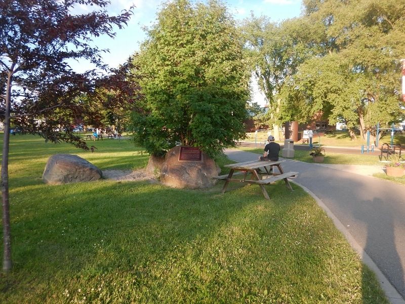
Wideview of Nicolas Perrot Marker
| 1 ► Ontario, Algoma District, Sault Ste. Marie — Nicolas Perrot — ca. 1644-1717 — |
| 2 ► Ontario, Algoma District, Wawa — Louise (Niganigijigok) Towab — |
| 3 ► Ontario, Algoma District, Wawa — Michipicoten Ojibway — |
| 4 ► Ontario, Algoma District, Wawa — Mining Michipicoten — |
| 5 ► Ontario, Algoma District, Wawa — Place of Clear Wawa Water — |
| 6 ► Ontario, Algoma District, Wawa — Reverend Father Dominique Chardon du Ranquet — and the Little Mission Church — |
| 7 ► Ontario, Algoma District, Wawa — Wawa — an unforgettable name — |
| 8 ► Ontario, Algoma District, Wawa — William Teddy — |
| 9 ► Ontario, Algoma District, Wawa, Michipicoten — Michipicoten River Cemetery — A Sign of History — |
| 10 ► Ontario, Algoma District, Wawa, Michipicoten — Michipicoten Scenic Lookout — |
| 11 ► Ontario, Algoma District, Wawa, Michipicoten — Reverend James Evans — |
| 12 ► Ontario, Algoma District, Wawa, Michipicoten — The Fur Trade at Michipicoten — Fur Trading Posts — |
| 13 ► Ontario, Brant County, Brantford — Brant County Court House — |
| 14 ► Ontario, Brant County, Brantford — Her Majesty’s Chapel of the Mohawks — La Chapelle des Agniers de Sa Majesté — Ne Iakataneraientahtsere Ne Iekora Ne Kanienkehaka Rotoreonnaienhs — |
| 15 ► Ontario, Brant County, Brantford — Mohawk Village — Le village des Mohawks — |
| 16 ► Ontario, Brant County, Brantford — Rev. Peter Jones — 1802-1856 — |
| 17 ► Ontario, Brant County, Brantford — St. Paul’s 1785 — H.M. Chapel of the Mohawks — Chapelle Royale des Mohawks — |
| 18 ► Ontario, Brant County, Brantford — Thayendanegea (Joseph Brant) — The Brant Monument — |
| 19 ► Ontario, Brant County, Brantford — The Mohawk Institute — |
| 20 ► Ontario, Brant County, Brantford — The Original Six Nations Land Grant — As surveyed in 1821 — |
| 21 ► Ontario, Brant County, Brantford — Tomb of THAYENDANEGEA — |
| 22 ► Ontario, Brant County, Ohsweken — Chiefswood — |
| 23 ► Ontario, Brant County, Ohsweken — Cogwagee • Tom Longboat — 1886 - 1949 — |
| 24 ► Ontario, Brant County, Ohsweken — E. Pauline Johnson — 1861-1913 — |
| 25 ► Ontario, Brant County, Ohsweken — E. Pauline Johnson — Tekahionwakeh — 1861-1913 — |
| 26 ► Ontario, Brant County, Ohsweken — Thayendanega (Joseph Brant) — 1742-1807 — |
| 27 ► Ontario, Brant County, Ohsweken — The Six Nations — |
| 28 ► Ontario, Brant County, Ossweken — Ahyouwaeghs - John Brant — 1794 - 1832 — |
| 29 ► Ontario, Chatham-Kent, Chatham — British Army River Crossing to Dolsen's Landing — Friday, October 1, 1813 — Tecumseh Parkway — |
| 30 ► Ontario, Chatham-Kent, Chatham — British Encampment: Forks of the Thames — Sunday, October 3, 1813 — Tecumseh Parkway — |
| 31 ► Ontario, Chatham-Kent, Chatham — First Nations Encampment: Thomas McCrae Farm — Friday, October 1, 1813 — Tecumseh Parkway — |
| 32 ► Ontario, Chatham-Kent, Chatham — Skirmish at the Forks — Monday, October 4, 1813 — Tecumseh Parkway — |
| 33 ► Ontario, Chatham-Kent, Chatham — Skirmish at the Forks — Monday, October 4, 1813 — Tecumseh Parkway — |
| 34 ► Ontario, Chatham-Kent, Chatham — Tecumseh — |
| 35 ► Ontario, Chatham-Kent, Thamesville — Assault on Backmetack Marsh — Tuesday, October 5, 1813, 4:00 p.m. — Tecumseh Parkway — |
| 36 ► Ontario, Chatham-Kent, Thamesville — Battle of Moraviantown, 1813 — Bataille de Moraviantown, 1813 — (Battle of the Thames) / (Bataille de la Thames) — |
| 37 ► Ontario, Chatham-Kent, Thamesville — Fairfield — Tecumseh Parkway — |
| 38 ► Ontario, Chatham-Kent, Thamesville — Fairfield on the Thames / The Fairfield Mission — |
| 39 ► Ontario, Chatham-Kent, Thamesville — Participants in the Battle of the Thames — Tuesday, October 5, 1813 — Tecumseh Parkway — |
| 40 ► Ontario, Chatham-Kent, Thamesville — Participants in the Battle of the Thames — Tuesday, October 5, 1813 — Tecumseh Parkway — |
| 41 ► Ontario, Chatham-Kent, Thamesville — Participants in the Battle of the Thames — Tuesday, October 5, 1813 — Tecumseh Parkway — |
| 42 ► Ontario, Chatham-Kent, Thamesville — Prelude to Battle — Tuesday, October 5, 1813 — Tecumseh Parkway — |
| 43 ► Ontario, Chatham-Kent, Thamesville — Tecumseh — 1768-1813 — |
| 44 ► Ontario, Chatham-Kent, Thamesville — The Bugles Sound — Tuesday, October 5, 1813, 4:00 p.m. — Tecumseh Parkway — |
| 45 ► Ontario, Chatham-Kent, Thamesville — The Burning of Fairfield — Tecumseh Parkway — |
| 46 ► Ontario, Chatham-Kent, Thamesville — The Death of Tecumseh — Tuesday, October 5, 1813, Approximately 4:20 p.m. — Tecumseh Parkway — |
| 47 ► Ontario, Cochrane District, Cochrane — The Founding of Cochrane / La fondation de Cochrane — |
| 48 ► Ontario, Durham Region, Whitby — Traditional Territories of the Mississaugas of Scugog Island — |
| 49 ► Ontario, Essex County, Amherstburg — Boblo Island — |
| 50 ► Ontario, Essex County, Amherstburg — Indian Council House — |
| 51 ► Ontario, Essex County, Amherstburg — Simon Girty U.E. — 1741 - 1818 — |
| 52 ► Ontario, Essex County, Amherstburg — The "Tecumseh Stone" — |
| 53 ► Ontario, Essex County, Amherstburg — The Great Sauk Trail — |
| 54 ► Ontario, Essex County, Amherstburg — The Wyandot — Les Hurons de Detroit — |
| 55 ► Ontario, Essex County, Windsor — 1748 — |
| 56 ► Ontario, Essex County, Windsor — Jesuit Mission to the Hurons — |
| 57 ► Ontario, Essex County, Windsor — Montreal Point in 1782 — The Huron First Nation's gift to the Roman Catholic Church — |
| 58 ► Ontario, Essex County, Windsor — The Capture of Detroit — |
| 59 ► Ontario, Essex County, Windsor — The Siege of Detroit 1763 — |
| 60 ► Ontario, Haldimand County, Cayuga — The Haldimand Grant — 1784 — |
| 61 ► Ontario, Haldimand County, York — The Nelles Settlement — |
| 62 ► Ontario, Halton Region, Burlington — The Brant House — |
| 63 ► Ontario, Halton Region, Burlington, Aldershot — La Salle at the Head of the Lake / La Salle à L’amont du Lac — |
| 64 ► Ontario, Halton Region, Oakville — Early Contact Period (1610-1700) — First Nations — Sixteen Mile Creek Trail — |
| 65 ► Ontario, Halton Region, Oakville — Hunter-Gatherer and Fisher People (9,000 BC to AD 500) — First Nations — Sixteen Mile Creek Trail — |
| 66 ► Ontario, Halton Region, Oakville — Oakville and Trafalgar, 1806-1870 — Sixteen Mile Creek Trail — |
| 67 ► Ontario, Halton Region, Oakville — The First Horticultural People (AD 500 to 1610) — First Nations — Sixteen Mile Creek Trail — |
| 68 ► Ontario, Halton Region, Oakville — The Treaty Period (1801-1847) — First Nations — Sixteen Mile Creek Trail — |
| 69 ► Ontario, Hamilton, Albion Falls — Albion Falls — |
| 70 ► Ontario, Hamilton, Albion Falls — Native Trail Networks — Réseaux de Sentiers Auatochtones — |
| 71 ► Ontario, Hamilton, Burlington Heights — Military Occupation of Burlington Heights — |
| 72 ► Ontario, Hamilton, Dundurn B — Treaty Council at Burlington Heights/ Conseil du Traité a Burlington Heights — |
| 73 ► Ontario, Hamilton, Gibson — Woodlands Park — |
| 74 ► Ontario, Hamilton, Mountview — Chedoke, More than a Sanatorium — |
| 75 ► Ontario, Hamilton, Stoney Creek — Augustus Jones (C. 1757-1836) — |
| 76 ► Ontario, Hamilton, Strathcona — Dundurn Castle/Burlington Heights Château Dundurn/Burlington Heights — |
| 77 ► Ontario, Huron County, Clinton — Horatio Emmons Hale (1817-1896) — |
| 78 ► Ontario, Kenora District, Dryden — Beginnings — |
| 79 ► Ontario, Kenora District, Kenora — Governor General's Arrival — |
| 80 ► Ontario, Kenora District, Kenora — Rat Portage — |
| 81 ► Ontario, Kenora District, Kenora — Rev. Albert Lacombe, O.M.I. — 1827-1916 — |
| 82 ► Ontario, Kingston — Indigenous Pasts and Futures at Queen's/Passés et futurs autochtones à l'Université Queens — Nahò:ten ne Iotohétston tánon tsi Nientsá:wen'ne ne Queen's ne Shihatinakereó'nwe Raotirihwà:ke — Anishinaabek miinwaa Haudenosaunee Gaabi-zhi-Zhiwebisiwad miinwaa Geyaabi waa Ni-zhiwebag maanpii Qu — |
| 83 ► Ontario, Kingston — Molly Brant — |
| 84 ► Ontario, Kingston — The Rev. John Stuart — 1740-1811 — |
| 85 ► Ontario, Lanark County, Carleton Place — The Town Hall Square Millennium Project — 15th Day of July 2000 — |
| 86 ► Ontario, Lanark County, Carleton Place — Town Hall Square Historical Murals — |
| 87 ► Ontario, Lanark County, Perth — Thousands of Years of Algonquin Homeland — |
| 88 ► Ontario, Leeds and Grenville United Counties, Prescott — Major James Morrow Walsh 1840-1905 — |
| 89 ► Ontario, Leeds and Grenville United Counties, Roebuck — Roebuck Indian Village Site — |
| 90 ► Ontario, Leeds and Grenville United Counties, Spencerville — Spencerville Riverside Park — Why This Place Matters — |
| 91 ► Ontario, Niagara Region, Chippawa — Battle of Chippawa — |
| 92 ► Ontario, Niagara Region, Chippawa — Chippawa Battlefield Panel 1 — Background to a Battle — |
| 93 ► Ontario, Niagara Region, Chippawa — Chippawa Battlefield Panel 2 — Opening Strikes — July 5, 1814 3:00 p.m. — |
| 94 ► Ontario, Niagara Region, Chippawa — Chippawa Battlefield Panel 5 — Final Stages — July 5, 1814 5:30 p.m. — |
| 95 ► Ontario, Niagara Region, Grimsby — Fisheries in Grimsby — |
| 96 ► Ontario, Niagara Region, Grimsby — Neutral Indian Burial-Ground — |
| 97 ► Ontario, Niagara Region, Niagara Falls — Indian Ossuary — |
| 98 ► Ontario, Niagara Region, Niagara Falls — The Inukshuk — |
| 99 ► Ontario, Niagara Region, Niagara-on-the-Lake — Butler's Rangers — |
| 100 ► Ontario, Niagara Region, Niagara-on-the-Lake — Niagara Land Purchases — |
130 entries matched your criteria. The first 100 are listed above. The final 30 ⊳