via Wikipedia, unknown
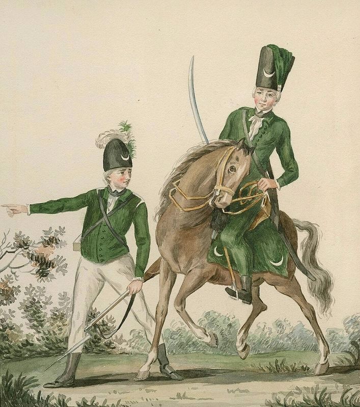
A Light Infantry Man and Huzzar of the Queen's Rangers
GEOGRAPHIC SORT WITH USA FIRST Geographic Sort Title Sort Marker Number Sort Marker Number Sort for Trails Publication Order Sort Publication Order Sort A Erected Year Sort Most Viewed Sort Most Recent-Interest Sort Most Recently Changed Sort SEE FAQ #33 FOR DESCRIPTIONS
On Water Street at Buckner Street, on the left when traveling west on Water Street.
On Donnelly Drive at Burritts Avenue, on the right when traveling west on Donnelly Drive.
On Trans-Canada Highway (Provincial Highway 17) 0.8 kilometers west of Whispering Pines Road, on the right when traveling west.
On Trans-Canada Highway (Provincial Highway 17) at Taylor Street, on the right when traveling east on Trans-Canada Highway.
On Trans-Canada Highway (Provincial Highway 17) 1.5 kilometers west of Kensington Road, on the right when traveling west.
On Provincial Highway 108 at Hillside Drive South, on the left when traveling north on Provincial Highway 108.
On St Mary's River Drive 0.2 kilometers west of Foster Drive, on the right when traveling south.
Near Lake Street 0.6 kilometers south of Queen Street East.
On Queen Street East 0.2 kilometers west of Pim Street, on the right when traveling west.
On Queen Street East 0.2 kilometers west of Riverside Drive, on the right when traveling west.
On Canal Drive 1 kilometer west of Huron Street, on the right when traveling west.
Near Hub Trail 0.1 kilometers east of Canal Drive, on the right when traveling east.
On Lakeside Drive just north of Stanley Street, on the right when traveling north.
Near Trans-Canada Highway (National Highway 17) 1.4 kilometers south of High Falls Road, on the right when traveling south.
On Elm Street at William Street, on the right when traveling south on Elm Street.
Paid Advertisement
On Brant Highway 5 0.5 kilometers west of Sager Road, on the right when traveling west.
On Mount Pleasant Road 0.2 kilometers south of Ellis Avenue, on the right when traveling south.
On Homestead Road at Hiram Road, on the right when traveling east on Homestead Road.
On Paris Plains Church Road 1.1 kilometers east of Pinehurst Road, on the left when traveling east.
On Grand River Street South at Burwell Street, on the right when traveling north on Grand River Street South.
On Wellington Street just west of George Street, on the right when traveling west.
On Wellington Street just east of Market Street, on the left when traveling east. Reported missing.
On Tutela Heights Road 0.8 kilometers east of Mount Pleasant Road, on the left when traveling east.
On Colborne Street East just east of Johnson Road, on the right when traveling east.
Near Ava Road 0.4 kilometers north of Paris Road.
On Mohawk Street close to Morrison Road, on the left when traveling west.
On Colborne Street East 0.3 kilometers east of Wayne Gretzky Boulevard, on the right when traveling east.
On West Street just north of Chatham Street, on the left when traveling north.
Near Mohawk Street close to Morrison Road, on the left when traveling west.
On Wellington Street just east of George Street, on the left when traveling east.
On Mohawk Street, on the right when traveling west.
Paid Advertisement
Near Myrtleville Drive 0.3 kilometers west of Balmoral Drive, on the right when traveling west.
On Saint Paul Avenue at Palmerston Avenue, on the right when traveling south on Saint Paul Avenue.
On Oakland Road (County Route 4) at King Street South (County Route 24), on the right when traveling west on Oakland Road.
On 4th Line close to Chiefswood Road, on the left when traveling west.
Near County Highway 54 just east of Chiefswood Road, on the right when traveling east.
Near Fourth Line Road at Chiefswood Road, on the left when traveling east.
On Simcoe Street at Talbot Street, in the median on Simcoe Street.
On Blue Lake Road (County Road 35) 0.6 kilometers west of Brant Road (Provincial Highway 24), on the right when traveling west.
On Queen Street North (Bruce County Road 3) at Cambridge Street, on the right when traveling south on Queen Street North (Bruce County Road 3).
Near Bruce County Road 20.
On Goldie Street (Provincial Highway 11) at Queen Street South, on the right when traveling west on Goldie Street.
On Clinton Street South at Union Street East, on the right when traveling north on Clinton Street South.
On McNab Street 0.1 kilometers south of Durham Street East, on the right when traveling south.
On Main Street North (Chatham-Kent County Road 22) at Elm Street East on Main Street North (Chatham-Kent County Road 22).
Near William Street North at Murray Street, on the left when traveling north.
On King Street East just east of Prince Street South, on the left when traveling east.
Paid Advertisement
On Stanley Avenue at 7th Street, on the left when traveling east on Stanley Avenue.
On Uncle Tom's Road at Park Street, on the right when traveling west on Uncle Tom's Road.
On Main Street at St. George Street, on the left when traveling east on Main Street.
On Gardiner Avenue at Lakeshore Road, on the left when traveling east on Gardiner Avenue.
On Longwoods Road (County Route 2), on the right when traveling east.
On Dufferin Avenue 0.1 kilometers east of McNaughton Avenue, on the right when traveling east.
On James Street at Fork Street, on the right when traveling east on James Street.
On Saint Clair Parkway at Langstaff Line, on the left when traveling north on Saint Clair Parkway.
On Trans-Canada Highway (Provincial Highway 11) at Beadman Road (Zucks Road), on the right when traveling west on Trans-Canada Highway.
On Railway Street 0.1 kilometers east of 7th Avenue South, on the right when traveling east.
On Frederick House Lake Road 1.6 kilometers east of Connaught Road, on the right when traveling east.
On Cambridge Avenue at Synagogue Avenue, on the left when traveling north on Cambridge Avenue.
On Trans-Canada Highway (Provincial Highway 11) 1 kilometer south of Provincial Highway 67, on the left when traveling south.
Near Fourth Avenue (Provincial Highway 101) just north of 2nd Street, on the left when traveling north.
On King Street (Provincial Highway 101) at Bellemare Street, on the right when traveling west on King Street.
Near Bloor Avenue 0.2 kilometers east of Crawford Street.
Paid Advertisement
On Riverside Drive (Algonquin Boulevard West) (Provincial Highway 101) 0.2 kilometers east of Craig Street, on the left when traveling east.
On Trans-Canada Highway (Provincial Highway 11) at Hanna Road, on the right when traveling north on Trans-Canada Highway.
On Mill Street 0.1 kilometers east of Main Street, on the right when traveling east.
On Zina Street at Louisa Street, on the right when traveling west on Zina Street.
On Victoria Street at Main Street East, on the right when traveling north on Victoria Street.
On Harwood Avenue South, on the right when traveling north.
On Old Kingston Road just west of Church Street North, on the left when traveling west.
Near Peace Street just north of McRae Street, on the right when traveling north.
On King Avenue East 0.1 kilometers Beaver Street North, on the left when traveling east.
On Temperance Street at King Street West, on the right when traveling south on Temperance Street.
On Courtice Road at Bloor Street, on the right when traveling north on Courtice Road.
On Old Kirby School Road at Ganaraska Road, on the left when traveling north on Old Kirby School Road.
On Mill Street South at Edward Street West, on the right when traveling south on Mill Street South.
On Durham Regional Highway 2 0.2 kilometers east of Cobbledick Road, on the right when traveling west.
On King Avenue East at Beaver Street South on King Avenue East.
On Concession Road 7 0.5 kilometers west of Liberty Street North, on the right when traveling west.
Paid Advertisement
On Durham Regional Road 1 just north of Leaskdale Road, on the right when traveling north.
Near Simcoe Street North (Durham Regional Road 2) just south of Parkwood Court, on the right when traveling south.
On Simcoe Street South 0.2 kilometers south of Lakeview Park Avenue, on the right when traveling south.
On Portview Road just east of Island Road (Durham Regional Road 7), on the right when traveling east.
On Reynolds Street at Gilbert Street East, on the left when traveling south on Reynolds Street.
On Talbot Street West at Centre Street, on the left when traveling west on Talbot Street West.
On Erieus Street near Pitt Street, on the right when traveling south.
On Robinson Street just south of Pitt Street, on the right when traveling south.
On Pitt Street at Strachan Street, on the left when traveling east on Pitt Street.
On Colborne Street at Matilda Street, on the left when traveling south on Colborne Street.
On Bridge Street, on the right when traveling west.
On Ron McNeil Line (County Road 52) at Whittaker Road (County Road 49), on the left when traveling west on Ron McNeil Line (County Road 52).
On Talbot Street at Mondamin Street on Talbot Street.
On Wellington Street at Queen Street, on the right when traveling east on Wellington Street.
On Pleasant Street at Talbot Street, on the right when traveling south on Pleasant Street.
On Talbot Street at Mary Street, on the right when traveling east on Talbot Street.
Paid Advertisement
On Sunset Drive (County Road 4) 0.4 kilometers north of John Wise Line, on the right when traveling north.
Near Talbot Street east of Horton Street, on the right when traveling east.
On Walnut Street at Church Street, on the right when traveling east on Walnut Street.
On Fingal Line 1.6 kilometers west of Sunset Drive, on the right when traveling east.
On Sparta Line 1.2 kilometers west of Quaker Road, on the right when traveling west.
︽
790 entries matched your criteria. The first 100 are listed above.
Next 100 ⊳