By Dale K. Benington, June 10, 2012
"The Burlington Races" 1813 Marker
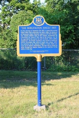
| On York Boulevard north of Dundurn Street North, on the right when traveling north. |
| On York Boulevard just north of Dundurn Street North, on the right when traveling north. |
| Near York Boulevard north of Dundurn Street North. |
| Near York Boulevard just north of Dundurn Street North, on the right when traveling north. |
| On York Boulevard just north of Dundurn Street North, on the right when traveling north. |
| Near York Boulevard north of Dundurn Street North. |
| Near York Boulevard north of Dundurn Street North. |
| Near York Boulevard just north of Dundurn Street North, on the right when traveling north. |
| On York Boulevard north of Dundurn Street North, on the right when traveling north. |
| On York Boulevard just north of Dundurn Street North, on the right when traveling north. |
| On Reid Avenue North at Dunsmure Road, on the right when traveling north on Reid Avenue North. |
| On Stuart Street, 0.1 kilometers east of Bay Street North, on the right when traveling east. |
| On Emerson Street at Royal Avenue, on the right when traveling south on Emerson Street. |
| Near Mountain Brow Boulevard. |
| On Mountain Brow Boulevard, 0.2 kilometers south of Limeridge Road East, on the left when traveling south. |
| On Mountain Brow Boulevard, 0.3 kilometers south of Limeridge Road East, on the right when traveling south. |
| On Wilson Street East, 0.1 kilometers east of Sulphur Springs Road, on the right when traveling west. |
| On Wilson Street East, 0.1 kilometers west of Sulphur Springs Road, on the right when traveling east. |
| Near Sulphur Springs Road. |
| On James Street North, 0.1 kilometers north of Cannon Street East, on the right when traveling north. |
| On Ferguson Avenue South at King Street East, on the left when traveling south on Ferguson Avenue South. |
| On James Street North, 0.3 kilometers north of Cannon Street East, on the right when traveling north. |
| On Main Street East (Highway 8) 0.2 kilometers east of James South and Main East, on the right when traveling east. |
| On James Street North at Murray Street East, on the right when traveling north on James Street North. |
| On James Street North, 0.1 kilometers north of Cannon Street East, on the right when traveling north. |
| On James Street North, 0.1 kilometers north of Cannon Street East, on the right when traveling north. |
| On John Street South at King Street East, on the right when traveling north on John Street South. |
| On John Street North, 0.1 kilometers south of Cannon Street East, on the right when traveling north. |
| On King Street East at John Street South, on the left when traveling west on King Street East. |
| On James Street North, 0.1 kilometers north of Cannon East, on the right when traveling north. |
| On Jame Street North at Robert Street, on the right when traveling north on Jame Street North. |
| On Palmer Road at Reno Avenue, on the left when traveling south on Palmer Road. |
| On Mohawk Road West at West 5th Street, on the right when traveling west on Mohawk Road West. |
| On York Boulevard at Dundurn Street North, on the right when traveling east on York Boulevard. |
| On Bay Street North at Barton Street West, on the left when traveling north on Bay Street North. |
| On Sheaffe Street at Park Street North, on the right when traveling east on Sheaffe Street. |
| On King Street West at James Street North, on the right when traveling west on King Street West. |
| On Concession Street, 0.2 kilometers west of Upper Wellington Street, on the right when traveling west. |
| Near Confederation Drive east of Van Wagners Beach Road. |
| On Van Wagner’s Beach Road, 0.8 kilometers south of Beach Boulevard, on the left when traveling south. |
| On Confederation Drive, 0.7 kilometers south of Van Wagner’s Beach Road, on the left when traveling south. |
| On Confederation Drive, 0.7 kilometers south of Van Wagner’s Beach Road, on the left when traveling south. |
| On Waterfront Trail, on the right when traveling north. |
| On Governors Road, 0.7 kilometers west of Highway 52, on the right when traveling east. |
| On John Street South at St. Joseph’s Drive, on the right when traveling north on John Street South. |
| On Main Street East at James Street South, on the right when traveling east on Main Street East. |
| On James Street at Hunter Street, on the left when traveling south on James Street. |
| On Main Street East at John Street South, on the right when traveling east on Main Street East. |
| On Main Street East at Ottawa Street North, on the left when traveling east on Main Street East. |
| On Governor’s Road at Ogilvie Street when traveling west on Governor’s Road. |
| On Market Street South at King Street West (Highway 8), on the right when traveling south on Market Street South. |
| On King Street West (Highway 8) at Market Street South, on the right when traveling east on King Street West. |
| On Dundas Driving Park Road, on the right. |
| On The Governor’s Road, 0.1 kilometers east of Bridelwood Drive, on the left when traveling west. |
| On Rock Chapel Road, 0.3 kilometers south of Valley Road, on the right when traveling north. |
| On Osler Drive at Ancaster Street East, on the right when traveling west on Osler Drive. |
| On East Street at Cootes Drive, on the right when traveling north on East Street. |
| On King Street East, 0.3 kilometers east of East Street North, on the right when traveling east. |
| On Main Street at Dundas Street (County Road 99), on the left when traveling north on Main Street. |
| On East Street at Cootes Drive, on the right when traveling north on East Street. |
| On Crook’s Hollow Road, 1.5 kilometers west of Brock Road, on the right when traveling west. |
| Near Spring Gardens Road. |
| On Charlton Ave. West at Caroline Street South, on the left when traveling west on Charlton Ave. West. |
| On Hunter Street West at Bay Street South, on the right when traveling west on Hunter Street West. |
| On Bay Street South at Main Street West, on the right when traveling north on Bay Street South. |
| On Hunter Street West at Bay Street South, on the left when traveling west on Hunter Street West. |
| On Bay Street South at Main Street West, on the left when traveling south on Bay Street South. |
| On Hunter Street West at Bay Street South, on the right when traveling west on Hunter Street West. |
| On MacNab Street South at Hurst Place, on the right when traveling north on MacNab Street South. |
| On Bay Street South at Main Street West, on the right when traveling north on Bay Street South. |
| On Duke Street at MacNab Street South, on the left when traveling west on Duke Street. |
| On James Street South at Jackson Street West, on the right when traveling south on James Street South. |
| On James Street South at Jackson Street West, on the right when traveling south on James Street South. |
| On Hunter Street West at Bay Street South, on the right when traveling west on Hunter Street West. |
| Near Jackson Street West, 0.1 kilometers west of Jackson W. and MacNab S., on the left when traveling west. |
| On Jackson Street West at MacNab Street South, on the left when traveling west on Jackson Street West. |
| On Concession Street at Cliff Avenue, on the right when traveling west on Concession Street. |
| On Concession Street, 0.1 kilometers west of Upper Sherman Avenue, on the right when traveling west. |
| On Hamilton Road (Highway 8) at Middletown Road, on the right when traveling east on Hamilton Road (Highway 8). |
| On Barton Street East at Sanford Ave. North, on the right when traveling west on Barton Street East. |
| On Barton Street East at Sandford Avenue North, on the right when traveling west on Barton Street East. |
| On Eastport Drive, 0.5 kilometers north of Beach Boulevard, on the left when traveling north. |
| Near Beach Boulevard, 0.3 kilometers south of Eastport Drive. |
| Near Eastport Drive, 0.4 kilometers north of Beach Boulevard, on the right when traveling north. |
| On Eastport Drive, 0.1 kilometers north of Beach Boulevard, on the right when traveling north. |
| On Beach Boulevard, on the right when traveling north. |
| On Beach Boulevard, 0.2 kilometers south of Eastport Drive, on the right when traveling south. |
| On Beach Boulevard, on the right when traveling north. |
| On Beach Boulevard, 0.2 kilometers Van Wagner’s Beach Road, on the right when traveling south. |
| On Beach Boulevard, 0.4 kilometers north of Van Wagner’s Beach Road, on the right when traveling north. |
| On Mountain Brow Boulevard, 0.3 kilometers north of Mohawk Road East, on the left when traveling south. |
| On Jackson Street West at Locke Street South, on the right when traveling west on Jackson Street West. |
| On Charlton Avenue West at Kent Street, on the right when traveling west on Charlton Avenue West. |
| On King Street East at Wellington Street North, on the right when traveling west on King Street East. |
144 entries matched your criteria. The first 100 are listed above.
The final 44 ⊳