Explorer, interpreter, fur trader and diplomat, French-born Perrot played an important role in the establishment and protection of New France's western frontier during the last four decades of the 17th century. In 1671 he was with Saint-Lusson at . . . — — Map (db m105957) HM
Louise Towab and her husband William Teddy are memorialized in Wawa's history books as discovering gold on Wawa Lake and forever changing the rugged landscape of this corner of Lake Superior country. Born in 1857, Louise represents the virtually . . . — — Map (db m218194) HM
The Michipicoten Ojibway have a long history on the eastern shore of Lake Superior and Wawa area. Michipicoten is an Ojibway word which some say translates to "landing place" or "place of large hills". At the time of first contact with European . . . — — Map (db m218179) HM
Mountains of Minerals The town of Wawa is surrounded by some of the world's oldest rock. These ancient Precambrian mountains were formed some 2.7 billion years ago. Within these mountains is a melting pot of minerals that have . . . — — Map (db m218199) HM
I think you would agree that the Wawa town site is situated in the perfect spot — a level plain on the shores of a picturesque lake of crystal green water surrounded by rolling mountains of natural abundance. Wawa's Ojibway ancestors, early . . . — — Map (db m218362) HM
Born in Chalut, France in 1813, Père Dominic Chardon du Ranquet became an ordained Deacon in 1838. He joined the Jesuit priesthood like his three older brothers before him. Instead of following them on their missionary work to India, he volunteered . . . — — Map (db m218601) HM
Wawa is just one of those place names that stands out. It is one of those names you will never forget. Where did this town get such a unique name and what does it mean? Ojibway Country When the first Europeans traveled to the Wawa . . . — — Map (db m218200) HM
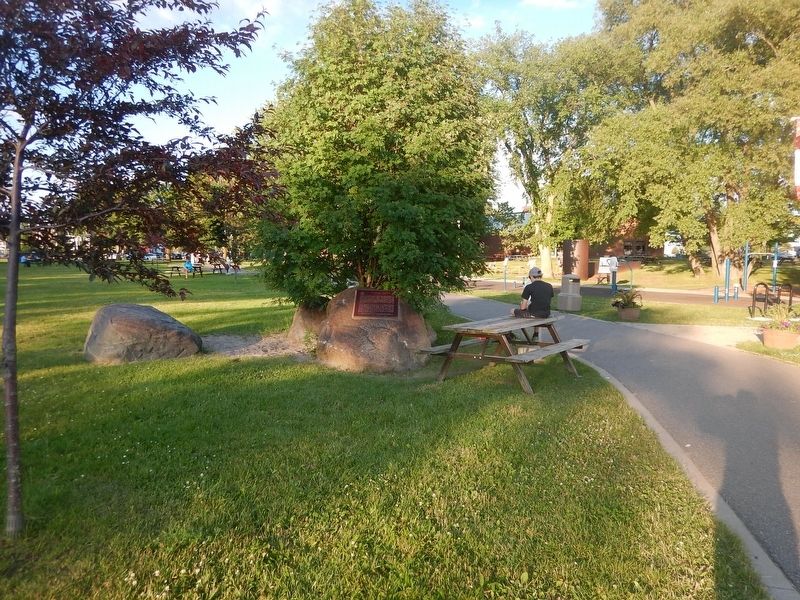
William Teddy was an Ojibway/Cree native Canadian born in 1855 in the Missinabie/Moose River region of Northern Ontario. Records show that William worked as a native guide for tourists, recreational fishermen and prospectors travelling thru the . . . — — Map (db m218189) HM
Once the main cemetery used by residents of Michipicoten River Village. It includes families of both Ojibway and European descent. The earliest headstone dates back to 1901. — — Map (db m218482) HM
From this high bluff, on a clear northern day, you can see the vast expanse of Lake Superior and the dramatic coastline of Michipicoten Bay. This is one of the only accessible lookouts with a fantastic view of pristine Lake Superior, mysterious . . . — — Map (db m218668) HM
Reverend James Evans was a Methodist missionary credited with translating the Cree language and creating the first Ojibway-Cree alphabet. Reverend Evans spent the winter of 1838-1839 at Michipicoten Post. Born in England in 1801, Evans emigrated . . . — — Map (db m218646) HM
Welcome to the centre of Canada's dynamic fur trade history for nearly 200 years. The Michipicoten First Nation's introduced the first European explorers to the rich fur-bearing forests of their home in the 1600's. Michipicoten was the ideal . . . — — Map (db m218187) HM
Architect John Turner and contractor William Sinon built this court house for the Provisional County of Brant in 1852-53. Turner was Brantford's most influential nineteenth-century architect, designing several important public buildings in Brant . . . — — Map (db m198273) HM
English: Originally called St. Paul's, this chapel was the first Protestant church in Upper Canada and is now the oldest surviving church in Ontario. Built by the Crown in 1785, it was given to those Mohawk Indians led by Joseph Brant who . . . — — Map (db m83743) HM
English: Allies of the British during the American War of Independence, the Six Nations Iroquois received extensive lands along the Grand River in 1784. Mohawks, led by Joseph Brant, established a village of some 400 individuals here by . . . — — Map (db m83697) HM
This house, "Echo Villa", was built by the Reverend Peter
Jones (Kahkewaquonaby) who lived here from 1851 until
his death. Son of the noted surveyor, Augustus Jones, and
Tuhbenahneequay, a Missisauga chief's daughter, Peter was
born at . . . — — Map (db m237708) HM
English:
This chapel, the first Protestant church in Ontario, was built by the Crown for the Mohawks of the Six Nations Iroquois who settled here in 1794. It replaced the Queen Anne Chapel (1712) at Fort Hunter, New York, which the Mohawk . . . — — Map (db m83694) HM
This National Monument erected by the Brant Memorial Association, Incorporated 41 Vic. Cap. 62 S.O. to Thayendanegea. Capt. Joseph Brant born 1742 died 1807 interred at Mohawk Church and to The Six Nations Indians for their . . . — — Map (db m215797) HM
The Mohawk Institute
The Mohawk Institute was established in 1831 for children of the Six Nations Iroquois living on the Grand River. Pupils from other native communities in Ontario attended the school as well. Like all Canadian . . . — — Map (db m230264) HM
A Brief History...
• 11,000 Years Ago - Nomadic hunter/ gatherer culture in tundra-like environment of the Grand River Valley.
• 9000 Years Ago - Hunter/gatherer culture begins to implement seasonal migratory camps.
The environment has . . . — — Map (db m240764) HM
Tomb Inscription
This tomb is erected to the memory of THAYENDANEGEA , or Captain Joseph Brant, Principal Chief and Warrior of the Six Nations Indians, by his Fellow-Subjects, admirers of his fidelity and attachment to the British . . . — — Map (db m83696) HM
[English] Completed in 1856, Chiefswood owes its importance to its architecture and the prominence of the people who lived here. Derived from the popular Italianate style of the Picturesque movement, the grandeur of the house . . . — — Map (db m209067) HM
English: An Onondaga from the Six Nations of the Grand River, Tom Longboat was one of the world's great long-distance runners. He ran his first race in Caledonia in 1905 and two years later shot to international attention with a . . . — — Map (db m83700) HM
In this house "Chiefswood", erected about 1853, was born the Mohawk poetess Emily Pauline Johnson (Tekahionwake). Her father, Chief G.H.M. Johnson a greatly respected leader of the Six Nations, built "Chiefswood" as a wedding gift for her English . . . — — Map (db m208900) HM
[English] Born here at Chiefswood, the daughter of a Mohawk chief, E. Pauline Johnson gained international fame for her romantic writings on Indian themes, but she also wrote about nature, religion and Canadian nationalism. . . . — — Map (db m209066) HM
English:
This celebrated Mohawk chief of Canajoharie Castle and Johnson Hall grew up in the Mohawk Valley. He received his baptism of fire at the battle of Lake George in 1755. He served with Sir William Johnson in the Niagara . . . — — Map (db m83714) HM
English:
Commemorating the loyal services and unswerving fidelity of the Six Nations of Iroquois Indians to the British Empire in the Seven Years War, 1755 - 1763, the War of the American Revolution, 1775 - 1783, and in the defence of . . . — — Map (db m83712) HM
English
John Brant was born in the Mohawk Village (Brantford), the youngest son of the renowned Joseph Brant. He was educated at Ancaster and Niagara, and fought with distinction during the War of 1812. Brant devoted his life to improving . . . — — Map (db m78340) HM
Upon sighting American war ships at the mouth of the Thames River on October 1, 1813, the British Army boarded scows and bateaux near this site. One by one, the boats and their cargo were pulled across the river to their next encampment site at . . . — — Map (db m184677) HM
While British Army was encamped at Dolsen's, Procter travelled to Fairfield to investigate the site as a defensive position. At Tecumseh's urging, and learning that the Americans were closing rapidly, Colonel Warburton, Procter's second-in-command, . . . — — Map (db m71360) HM
Thomas McCrae was an early settler, innkeeper, and political figure in Raleigh Township along the Thames River. He served as a captain and company commander in the Kent Militia and was present at the capture of Fort Detroit. Family tradition relates . . . — — Map (db m71308) HM
On October 2, 1813, Tecumseh moved his warriors up-river to the Forks where he had been led to believe that fortifications would be prepared for a full-scale confrontation with harrison's army. When Tecumseh arrived, he was enraged to find no . . . — — Map (db m71335) HM
Robert McAfee, a member of Colonel Johnson's Kentucky Mounted Regiment, described the skirmish in his journal. He wrote:
Oct 4: …a woman … informed us that about six miles above the River forked, that there was a large bridge across the mouth . . . — — Map (db m71378) HM
On this site, Tecumseh, a Shawnee Chief, who was an ally of the British during the War of 1812, fought against American forces on October 4, 1813. Tecumseh was born in 1768 and became an important organizer of native resistance to the spread of . . . — — Map (db m71322) HM
As Lieutenant Colonel James Johnson's horsemen were charging the British front line, his brother, Colonel Richard Johnson led an attack against the First Nations warriors in Backmetack Marsh. The mounted infantry charged the Native left flank led by . . . — — Map (db m233828) HM
In September 1813, during the second year of the War of 1812, the United States won control of Lake Erie, cutting British supply lines with the east and forcing the British to withdraw from the Detroit River region. Then, on October 5, . . . — — Map (db m78367) HM
The Moravians or "Bohemian Brethren" were a protestant sect that originated in the 1400s in Moravia and Bohemia, the present day Czech Republic. They faced persecution in their homeland and in 1722 many moved to Saxony (now part of Germany) where . . . — — Map (db m72448) HM
(Front of monument)
Fairfield on the Thames / Fairfield sur la Thames
Here stood the village of Fairfield, destroyed by invading American forces following the Battle of the Thames. , 5th October, 1813.
Its inhabitants, Delaware . . . — — Map (db m116758) HM
Makataimeshekiakiak, Black Hawk, 1767-1838: A Sauk war leader and experienced warrior, Blackhawk was a veteran of the Battles of Fort Meigs and Fort Stephenson. Although he left the war for a period of time, he rejoined the British, and scholars . . . — — Map (db m71418) HM
Shabbona 1775-1859: A Potawatomi chief, grand nephew of Pontiac, and veteran of Tippecanoe, Shabbona was an accomplished warrior and strong supporter of Tecumseh. He persuaded many natives to join the confederacy.
Sou-veh-hoo-wah, Split Log, . . . — — Map (db m71419) HM
Isaac Shelby 1750-1826: Shelby was the 1st and 5th governor of Kentucky and a veteran of the American Revolution. As governor and at 63years of age, Shelby personally led the Kentucky Militia at the Battle of the Thames.
Tarhe 1742-1816: A . . . — — Map (db m72388) HM
By the early morning of October 5, 1813, the American Army had forded the Thames River and was advancing quickly. The British rearguard was able to destroy Cornwall's mill, west of Sherman's farm (present-day Thamesville, Ontario) but not the mill . . . — — Map (db m71413) HM
Born in a Shawnee village in what is now Ohio, Tecumseh became in the 1770s co-leader with his brother, the Prophet, of a movement to restore and preserve traditional Indian values. He believed a union of all the western tribes to drive back white . . . — — Map (db m71410) HM
Many of the men of the 41st Regiment had been stationed in Canada for 13 years. By October 5, 1813, they had not been paid for 6 to 9 months; they lacked tents and blankets; their uniforms were in rags; they were plagued by a variety of diseases; . . . — — Map (db m72393) HM
Robert McAfee, a soldier in Colonel Johnson's Mounted Regiment, kept a journal of his experiences, and wrote on October 7, 1813:
Spent the day in collecting in plunder ... Colonel Owings Regiment of Regulars came up and took charge of the . . . — — Map (db m72414) HM
At some point during the attack on Backmetack Marsh, Tecumseh was fatally shot. As word spread of their leader's death, one American account tells of the warriors giving, "the loudest yells I ever heard from human beings and that ended the fight." . . . — — Map (db m72405) HM
[English] For centuries the site of Cochrane was used by indigenous peoples as a summer camping ground. Later it became a stopping place for fur traders en route to Moose Factory. In 1907 the Temiskaming and Northern Ontario Railway . . . — — Map (db m217898) HM
This church acknowledges being on the traditional territories of the Mississaugas of Scugog Island, the Iroquoian speaking Wendat and the 1923 Williams Treaties First Nations — — Map (db m236759) HM
Boblo Island
For many centuries the island you see in front of you was used for hunting and fishing by First Nations people. Called Île aux Bois Blancs by the French, Boblo Island's key location made it a site for . . . — — Map (db m71185) HM
Indian Council House
Two hundred years ago a small building stood about 100 metres north of here, close to the water's edge. This was where meetings took place between the representatives of the British government and those of . . . — — Map (db m71170) HM
Girty's life crossed cultural boundaries between native and white societies on the frontier of American settlement. In 1756 his family was captured by a French-led native war party in Pennsylvania. Simon was adopted by the Seneca, then repatriated . . . — — Map (db m34688) HM
Tradition has it that the Indian leader Tecumseh stood upon this stone to deliver a final address to the British at Amherstburg after the Battle of Lake Erie. Donated in 1939, it originally stood near the corner of Dalhousie and Gore Streets. In his . . . — — Map (db m34412) HM
Part of an ancient network of Indian paths, the Great Sauk Trail, as it came to be known, extended from Rock Island in present-day Illinois to the Detroit River. It played a significant role in the communications between the native peoples in the . . . — — Map (db m36976) HM
This area was once the home of the Wyandot, remnants of the Huron, Neutrals, and Petuns who were dispersed by the Iroquois in the 1640's. Some eventually reunited and settled along the Detroit River, where they became known as the Hurons of Detroit, . . . — — Map (db m37340) HM
In 1728 a mission to the Huron Indians was established near Fort Pontchartrain (Detroit) by Father Armand de la Richardie, S.J. The mission was moved to Bois Blane Island and the adjacent mainland in 1742. In 1747 it was destroyed by disaffected . . . — — Map (db m37386) HM
In the year 1782 the Huron First Nation gave Montreal Point to the Diocese. The Jesuit Fathers constructed the Assumption Parish in 1787, the first Roman Catholic Parish west of Montreal, Quebec. Today the park, named Assumption, is owned and . . . — — Map (db m37389) HM
Confident of victory, General Hull had invaded Canada in July 1812, but failed to take advantage of his early success and the demoralization of the defenders. Fear of the Indians then rallying to the British cause and an inability to maintain supply . . . — — Map (db m34321) HM
Shortly after the founding of Detroit in 1701 a village of Ottawa Indians was established on the south shore of the river in this vicinity and its inhabitants lived on friendly terms with the French garrison and settlers. However after the British . . . — — Map (db m36944) HM
Following the American Revolution Sir Frederick Haldimand,
Governor-in-Chief of Canada, granted to the Six Nations of
the Iroquois a tract of land extending for six miles on both sides of the Grand River from its source to Lake Erie. This grant . . . — — Map (db m234947) HM
After receiving lands on the Grand River in 1784, the Six
Nations Indians invited Captain Hendrick Nelles, a Loyalist from the Mohawk Valley, to settle there with five of his sons. He and Robert, the eldest, established farms in what is new . . . — — Map (db m234914) HM
The original house on this site was built about 1800 by the famous Mohawk chief Joseph Brant (Thayendanegea). Two years previously Captain Brant had been granted some 3500 acres of land in this area for his military services to the Crown during . . . — — Map (db m233215) HM
LA SALLE AT THE HEAD OF THE LAKE
In 1669 René-Robert Cavelier de La Salle, intent on reaching the Ohio River in order "not to leave to another the honour of finding the way to the Southern Sea, and thereby the route to China”, set out on . . . — — Map (db m221304) HM
Europeans first arrived in what is now southern
Ontario during the second decade of the 17th century. At the time, the area was populated by three major groups of Iroquoian-speaking people: Huron, Petun and Neutral.
By 1650 these aboriginal . . . — — Map (db m241925) HM
After the ice melted away from southern Ontario, Paleo-Indians moved into the
region. Southern Ontario was a treeless tundra then, like today's Arctic.
The Paleo-Indians travelled widely, hunting caribou with spear points made of chert, a type . . . — — Map (db m241978) HM
The area that is present day Oakville was first settled by Europeans in 1806, after the land was purchased from the Mississauga tribe and Trafalgar Township was surveyed.
Twenty-one years later, in 1827, William Chisholm bought 960 acres at . . . — — Map (db m238670) HM
In the Late Woodland period (AD 500-1000) people of the Princess Point Complex introduced corn into southern Ontario. Evidence of their culture has been found at Cootes Paradise in Hamilton and along the Credit River.
The Princess Point . . . — — Map (db m242013) HM
Under the Royal Proclamation of 1763, European settlement could not proceed without a formal treaty with the aboriginal proprietors of the land. In 1806 the Mississauga signed the treaty surrendering all the lands from Etobicoke River to Burlington . . . — — Map (db m241812) HM
European settlement began here
in 1792 with William Davis (1741-1834),
a United Empire Loyalist
who left North Carolina to fight
alongside the British in the
American Revolution. Davis was
granted 2300 acres in Barton and
Saltfleet . . . — — Map (db m228834) HM
Native Trail Networks
According to Six Nations oral tradition, many major roads in southern Ontario are built upon ancient paths created by Native hunters, traders and diplomats. These pathways connected the Native settlements to . . . — — Map (db m228894) HM
[text on left side]
BLOODY ASSIZE
In the spring of 1814, a court of assize (travelling circuit court) in Ancaster convicted fifteen men of high treason for aiding American forces during the War of 1812. In June 1814, the harshest of sentences . . . — — Map (db m222062) HM
"This Belt which I now hand to you I ask in compliance with your
Customs be sent by you with these my words in his behalf to all the
Nations in friendship with your Great Father the King of England."
Col. William Claus, April 1815 . . . — — Map (db m227174) HM
This land was occupied by various indigenous groups, including the Chonnonton Nation, meaning people who tend deer'. They were known by their neighbours as the 'Attiuoindaron' and by the French as the Neutrals.
United Empire Loyalist Colonel . . . — — Map (db m220755) HM
The year 2006 marks the centennial of the Hamilton Health Association's opening of the city's tuberculosis hospital on the west mountain known as the Sanatorium. At the turn of the twentieth century tuberculosis was a disease of
pandemic . . . — — Map (db m232317) HM
Augustus Jones (C. 1757-1836)
Augustus Jones was born of Welsh ancestry in the Hudson River valley circa 1757. He received survey training in New York City in 1786 and he moved to Niagara in 1787. From then until 1789, to meet the needs of . . . — — Map (db m232645) HM
One of North America's pioneer ethnologists and linguists,
Hale practised law in Clinton 1856-1896. Born in New
Hampshire he graduated from Harvard in 1837, and
accompanied the Wilkes Expedition to the Pacific, 1838-1842. His contribution to . . . — — Map (db m233539) HM
The west shore of the river is about where nature made it. There was a waterfall where the dam and Duke Street Bridge are now, and an island at the east end of the present bridge. A second channel, also with a waterfall about where you are . . . — — Map (db m242997) HM
Reception of the Marquis of Lorne, August 5, 1881 at the Lake of the Woods, Rat Portage Most of the 500-plus inhabitants of Rat Portage, including older Indians and French-Canadian voyageurs, waited along the waterfront behind today's Library, . . . — — Map (db m245165) HM
This was early frontier Kenora/Keewatin, and was named by the Ojibway people for the many muskrats inhabiting these waters. Venturing into this area were a number of fur traders employed by the Northwest Company and the Hudson’s Bay Company. They . . . — — Map (db m244996) HM
Born at St. Sulpice, Quebec, and ordained in 1849, Father Lacombe took up mission work at Fort Edmonton in 1852. The following year he founded Ste. Anne, first of several Oblate missions he established in what is now Alberta. He won the confidence . . . — — Map (db m106498) HM
Four Directions Aboriginal Student Centre
Historically, an Indigenous person pursuing higher education could lose their status under the Indian Act, or
might feel forced to deny their heritage. Today, Queen's is becoming a more welcoming . . . — — Map (db m243774) HM
Born about 1736, Molly Brant (Degonwadonti) was a member of a prominent Mohawk family. About 1759 she became the wife of Sir William Johnson, Superintendent of Indian Affairs in the Province of New York and a powerful figure in that colony. . . . — — Map (db m141525) HM
Born in Pennsylvania, Stuart was ordained in 1770 and sent to Fort Hunter, N.Y., as missionary to the Mohawks. An ardent Loyalist, he came to Canada in 1781 where he was appointed chaplain to the 2nd Battalion King’s Royal Regiment of New York. In . . . — — Map (db m144202) HM
The Town Hall Square forms the nucleus of the pioneer development along the Mississippi River and rapids. This environmentally important area, near the unique and significant stand of Hackberry Trees, has become the central part of the Town of . . . — — Map (db m234372) HM
The Ripple [Steamboat on Mississippi River] 1885
First Nations Harvesting of wild rice
Logging on the Mississippi
Men's War Canoe Team 1905
The Ballygiblin Riots 1824 — — Map (db m234374) HM
Algonquin/Omàmìwinini People have lived on this river and in this territory for thousands of years. These waterways were elemental to people's seasonal lives, moving into the family's territories in the upper watersheds for the winter and . . . — — Map (db m207879) HM
Born and educated in Prescott, Walsh was trained at military schools at Kingston and by 1873 had attained the rank of Major in the militia. In that year he was commissioned in the newly formed North-West Mounted Police. While in charge at Fort . . . — — Map (db m86953) HM
Approximately 500 years ago an Iroquoian agricultural community of about 1600 persons occupied this site. Archaeological excavations suggested approximately 40 communal longhouses, averaging nearly 100 feet in length, stood in this village, . . . — — Map (db m89977) HM
Downstream from present day Spencerville, the Roebuck area was once home to 1,600 Indigenous people. Based upon research done by Augusta Township we understand that this park is on aboriginal land that was inhabited by Indigenous peoples for . . . — — Map (db m193865) HM
[Text on the West Side]:
Battle of Chippawa
5 July 1814
In memory of all those who fought on this ground, many of whom are buried nearby,
and to commemorate the peace that has prevailed between Canada and the . . . — — Map (db m49393) HM
On these fields and the surrounding woods 4,000 American, British, Canadian and Native forces fought the first major battle of the Niagara campaign of 1814. When the last shots died away on Samuel Street's farm, more than 800 lay dead and wounded. . . . — — Map (db m49398) HM
At dawn 5 July 1814, parties of Canadian-Militia and British allied Native Warriors scouted the American camp. They began sniping from the bushes on the north side of Street's Creek and this continued throughout the morning. Around noon, General . . . — — Map (db m49399) HM
As the battle raged, more American artillery deployed to the middle of the plain between the 11th U.S. and the lone 25th U.S. company, less than 100 meters (109 yards) from the British line. General Brown then led Ripley's brigade across Street's . . . — — Map (db m49403) HM
Grimsby Nature
Fisheries in Grimsby
The fish once caught in Lake Ontario help tell the story of settlement and growth around Forty Mile Creek. The Neutral Confederacy, Niagara's first inhabitants, were well established in the area, . . . — — Map (db m234100) HM
This nearby burial-ground, one of few representative sites
known to have survived relatively intact in Ontario, was used by the Neutral Indians, a confederacy of Iroquoian tribes which occupied the area around western Lake Ontario before 1655. . . . — — Map (db m233650) HM
200 yards north west of the highest point was situated the largest Indian Ossuary yet discovered in the Province. First discovered in 1828. Bones and sand removed in 1908. — — Map (db m75853) HM
The inukshuk (pronounced IN-OOK-SHOOK) means “in the image of man.” These magnificent lifelike figures of stone erected by the Inuit people are unique to the Canadian Arctic. The traditional purpose of an Inukshuk was . . . — — Map (db m79021) HM
In 1777 John Butler of New York raised a force of Rangers who, with their Iroquois allies, raided the frontiers of New York, Pennsylvania and New Jersey throughout the American Revolutionary War. From their base at Fort Niagara they successfully . . . — — Map (db m75857) HM
To obtain land on which to settle Loyalists and dispossessed members of the Six Nations of the Iroquois, Guy Johnson in May 1781 and John Butler in May 1784 negotiated treaties with representatives of the Mississauga and Chippewa of this region. The . . . — — Map (db m75863) HM
Warriors of the Six Nations of Iroquois (Mohawks, Oniedas Onondagos, Cayugas, Senecas, Tuscaroras), mainly from the Grand River, fought as allies of the British in this historic battle with the Americans. Speaking distinctive dialects and with . . . — — Map (db m49168) HM
129 entries matched your criteria. The first 100 are listed above. The final 29 ⊳