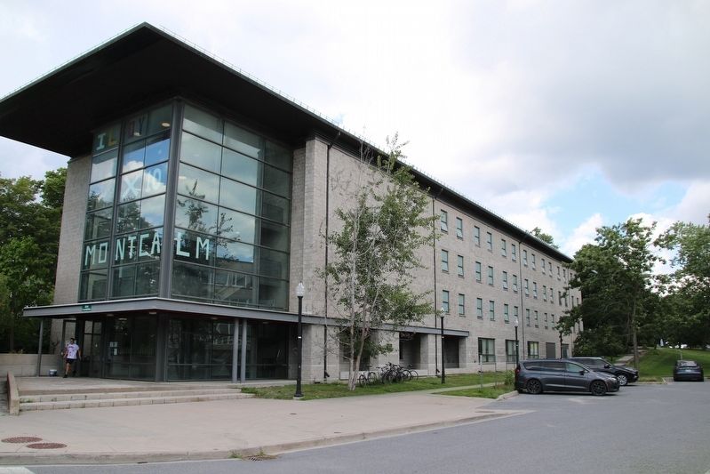
This building is named in honour of Mary (Molly) Brant (c.1736-1796),
matriarch and influential leader of the Mohawk Nation and her
younger brother, Joseph Brant (c. 1742-1807), Mohawk war leader.
Both were instrumental in maintaining the . . . — — Map (db m309157) HM
[English] In 1925, Dr. Perry Doolittle was the first Canadian to cross Canada by car. He drove 800 km (500 miles) of his journey using railway wheels fitted to his car where there was no road. He was a life-long . . . — — Map (db m272300) HM
This plaque stands at approximately at the halfway point of the Trans-Canada Highway, which runs from St. John's, Newfoundland to Victoria, British Columbia. The highway's construction, in conjunction with the provinces, was authorized by the . . . — — Map (db m195918) HM
The Mississagi Natives named this river Penewobecong referring to the narrow rock outcropping at the East outlet. The Voyageurs named it Blind River as they could not see the East outlet from the North Channel. In 1853 this was the site of the . . . — — Map (db m271599) HM
[English] Like the attic for a community, this museum is a storehouse for Bruce Mines' past, its people, its lifestyle, its events. Within are nuggets of life on the North Shore of Algoma Country where copper lay in . . . — — Map (db m271868) HM
The original claim to the Bruce Mine location was filed in September, 1846 by James Cuthbertson. It was acquired the following year by the Montreal Mining Company, and production commenced in 1847-48 at what became the first commercially successful . . . — — Map (db m105635) HM
The ripple marks on the adjacent rock face were made some two billion years ago by waves in a shallow body of water. Buried by later deposition of silt and then subjected to great pressure, the rippled sand became sandstone. The formation was . . . — — Map (db m105638) HM
[English] In 2012, Canada's most striking coin had its 25th birthday. More than 1.5 billion have been produced and "the loonie", as it is affectionately called, has become a symbol of Canada. It even played a "good . . . — — Map (db m271999) HM
The area encompassed by the Township of Macdonald, Meredith and Aberdeen Additional was originally inhabited by the Ojibway. After the Canadian government and the Ojibway signed the Huron-Robinson Treaty of 1850, surveyors were sent into this area . . . — — Map (db m271998) HM
[English] Evidence of radioactive ore prompted Aimé Breton and Karl Gunterman to stake claims south of here near Lauzon Lake in Long Township in 1948. Geologist Franc R. Joubin became interested and persuaded mining . . . — — Map (db m255198) HM
[English] Black Hole or Flogging? One of Lieutenant Landmann's first priorities was to build a guardhouse for the fort's sentries. It also included a jail for disobedient soldiers. Some are born leaders, others . . . — — Map (db m309499) HM
[English] Build it Better The fort's first powder magazine, where they kept the gun powder and ammunition, was a makeshift pile of logs and earth. It was beside the bake house, not the wisest location. In January . . . — — Map (db m309494) HM
This mountain community was named after the Carter Family who settled on Lot 11. Conc. O in 1879. The First Post Office was opened on June 1, 1883 with Dan McPhail as Postmaster and operated out of various homes in the area until closing on August . . . — — Map (db m272087) HM
[English] Welcome to Fort St. Joseph National Historic Site in the traditional territory of the Ojibwa (Chippewa). This was once part of the British colony known as Upper Canada. The British fort was built in . . . — — Map (db m309422) HM
[English] When the British withdrew from Michilimackinac in 1796 they moved to this island, where they built the most westerly of the British military posts. The troops were accompanied by officers of the Indian . . . — — Map (db m261900) HM
[English] Inside the Walls You are standing at the back gate to the fort. Picture a palisade made of 4-metre (13-foot) tall cedar posts forming a wall around the fort. They say the palisade served two purposes — . . . — — Map (db m309493) HM
[English] Land of Little Comfort It's been a long, cold day. You just want to relax, have something to eat and visit with companions. Trudge through the snow to the bake house kitchen. Open the door and the warmth . . . — — Map (db m309696) HM
[English] Major Intersection You have Just walked up the path that connected the canoe docks to the fort. Many a soldier marched up this road to face the gates of what would be their home for the next few years. . . . — — Map (db m309492) HM
[English] Making Do Even though the fort was small, enlisted men and officers did not mix. Each had their own kitchen. Food was prepared in the kitchens and then taken to the blockhouse to eat. The men's rations . . . — — Map (db m309497) HM
Homesteaders began settling along the 5th Side Road from the shore to the P Line at the "foot" of the island in 1878. The area soon became known as Tenby Bay. Mail delivery began in 1881 with the establishment of a Tenby Bay Post Office, and . . . — — Map (db m272082) HM
[English] The Importance of Friends The fort's British Indian Department handled all communications with the First Nations, not just the Ojibwa (Chippewa) and Odawa (Ottawa), but all nations to the south and . . . — — Map (db m309622) HM
[English] Want to be a Soldier? The blockhouse was the barracks for the soldiers and Commanding Officer. Made from fresh cut trees, the green logs shrank, allowing wind and mosquitoes inside. One officer . . . — — Map (db m309495) HM
[English] What's the Story? This chimney is the most recognized ruin on the site, yet its story is least known. It might have been part of the officers' kitchen; it's certainly grand enough. Yet archaeologists . . . — — Map (db m309498) HM
Long before the development of St. Joseph Island, both shores of this area were known as Sailor's Encampment. Winter ice forced ships and travelers to stop and wait until the spring thaw before moving on. By the 1850's fuel docks were established . . . — — Map (db m271984) HM
John Richards, born in Wales, came to the Island with his family in 1876 from Sault Ste. Marie, where he had been employed as Clerk. He immediately built a wharf to accommodate the many settlers arriving by way of the North Channel of the St. . . . — — Map (db m271899) HM
Erected and dedicated by the people of St. Joseph to the memory of her soldiers who fought and died in two World Wars. 1914 — 1918John I. Macnab • Oren W. Crowder • C.A. Russell Cheer • A. Gordon Cheer • Albert E. Powe • John J. Harron • William . . . — — Map (db m271897) WM
[English] This spring garden celebrates the gift of 100,000 tulip bulbs sent to Canadians by the Dutch royal family in 1945. The gift of tulips is a symbol of appreciation for Canada's hospitality to the members of . . . — — Map (db m272473) HM
[English] The Sault Ste. Marie Canal is of national historic significance because: • when opened in 1895, it was one of eight main line canals along the Great Lakes — St. Lawrence system and formed the final link . . . — — Map (db m272596) HM
This building, built in 1912, was the terminal station and head office of the Algoma Central & Hudson Bay Railway Company. The A.C.R. was founded in 1899 by Francis Hector Clergue.
Re-dedicated on August 11, 1999 on the occasion of the company's . . . — — Map (db m198348) HM
[English] Included in the design of the Sault Canal was planning for emergency conditions should something cause the failure of the lock gates, unleashing a torrent of water from Lake Superior through the lock. The . . . — — Map (db m272599) HM
Born in Dublin, Ireland, and raised in London, this famous 19th century author, illustrator and social reformer joined her husband, Robert Jameson, Attorney General of Upper Canada, at Toronto in 1836. The following June, unescorted, Mrs. Jameson . . . — — Map (db m105960) HM
[English] This land has been an important place for the Anishinaabe for millennia. A natural meeting point, people came from all over North and South America to trade and discuss governance issues here. By the late . . . — — Map (db m272591) HM
The word "rose" is usually associated with flowers, but in fact, both apples and raspberries are also members of the rose family. The history of apples is an ancient one. Carbonized remains of apples have been found at a Stone Age village in . . . — — Map (db m272393) HM
[English] They will never know the beauty of this place, see the seasons change, enjoy nature’s chorus. All we enjoy we owe to them, men and women who lie buried in the earth of foreign lands and in the seven seas. . . . — — Map (db m272694) WM
Sault Ste Marie Canal and Vicinity August 1894 [English] This view of the canal shows a very different picture than today. The Powerhouse is the most recognizable building still in place. Batchewana First . . . — — Map (db m272598) HM
[English] Summer solstice, the day when sunlight dominates, remains a strong symbol in many Indigenous cultures across Canada. For the past 25 years, on June 21, First Nations, Inuit and Métis peoples in Canada have . . . — — Map (db m272693) HM
Sault Ste. Marie Ontario, Canada Celebrate 100! ☆ 1912 — 2012 ☆ On April 16, 1912 and Act to incorporate the City of Sault Ste. Marie was passed by the Provincial Legislature. A century later the city remains an important commercial . . . — — Map (db m272098) HM
In 1819, fur traders from the North West Company built a magazine for gunpowder storage at their post near the rapids of the St. Marys River. Later, the magazine became part of a Hudson's Bay Company post. In 1894, Francis Hector Clergue built a . . . — — Map (db m272299) HM
Here, on a portion of his former estate, is buried Col. Prince who emigrated from England in 1833 and settled at Sandwich, Upper Canada. As commanding officer of the Essex Militia, he stirred up a violent controversy by ordering the summary . . . — — Map (db m105739) HM
[English] Passenger ships like Canadian Pacific Railway's SS Keewatin and Assiniboia frequently locked through at the Sault Canal. They were a highlight for locals. Resident Mr. Wilfred Fountain recalls they . . . — — Map (db m272697) HM
[English] D-Day and the Battle of Normandy 6 June-21 August 1944 After months of elaborate planning, the largest seaborne invasion in modern history commenced on 6 June 1944 (D-Day) to liberate northwestern . . . — — Map (db m272509) HM
Erected to commemorate discovery of Steelton Wells March 6th 1914 by Augusto Biagini born at Montesa Province of Modena Italy July 5th 1867 — — Map (db m272218) HM
Dedicated at the official opening of Roberta Bondar Park In honour of our hero, Dr. Roberta Lynn Bondar, O.C., O.ONT., M.D., PH.D., F.R.C.P.(C), neurologist, biologist, pilot and researcher. Canada's first female astronaut was a crew member on the . . . — — Map (db m106415) HM
In 1887, Edison Sault Light and Power Company developed the first hydroelectric generation in the American waters of the St. Marys River. In 1891, Edison Sault Electric Company bought out Edison Sault Light and Power and started the utility that . . . — — Map (db m272222) HM
The common elderberry (Sambucus canadensis) is a shrub which grows wild in much of eastern North America. In the spring this bush produces an abundance of white flowers which later ripen into a flavourful purple, black fruit. The Ojibway . . . — — Map (db m272356) HM
[English] The Emergency Swing Bridge Dam was built by the Dominion Bridge company of Montreal in 1896. The dam was modeled on the American Sault Canal dam, but the Canadian design was modified and the structure built entirely of steel. . . . — — Map (db m198477) HM
[English] Taking a stand On November 8, 1946, Viola Desmond was travelling on business and decided to see a movie at the Roseland Theatre in New Glasgow, Nova Scotia. She bought a balcony ticket, then challenged . . . — — Map (db m272699) HM
This house, built between 1814 and 1823 by Charles Ermatinger of the North West Company, is the oldest surviving house in northwestern Ontario. Constructed when Sault Ste. Marie was still a small fur trading post on the Upper Lakes, this fine house . . . — — Map (db m105955) HM
Charles Oakes Ermatinger, fur trader, merchant, farmer, militia officer and Justice of the Peace, was born in Montreal in 1776. Entering the fur trade as a clerk for the North West Company, he became a partner in the firm. In 1808 he settled in . . . — — Map (db m272297) HM
A Maine-born promoter, Clergue transformed Sault Ste. Marie into a major industrial centre. He purchased an unfinished hydroelectric station and canal at the Sault in 1894; then, lacking markets for his electric power, he created his own . . . — — Map (db m106374) HM
Bawaating — which translates to ‘Gathering at the Rapids’; is known as Sault Ste. Marie where historically Anishinaabe/Ojibway clans gathered for ceremonies, marriages, adoptions, trading, fishing and learning. Viewers are invited to witness the . . . — — Map (db m272097) HM
Herbs were used to flavour food, heal illness, repel insects and dye cloth. Herb gardens were foremost utilitarian and found at the home of everyone who had a garden, whether rich or poor. These herbs were essential to everyday life. The settlers . . . — — Map (db m272388) HM
John Rowswell served as Mayor of the City of Sault Ste. Marie from December 2000 until his death on August 31, 2010. He was one of the longest serving mayors in the city’s history. John Rowswell Park was designed to reflect the city’s natural . . . — — Map (db m272099) HM
Explorer, interpreter, fur trader and diplomat, French-born Perrot played an important role in the establishment and protection of New France's western frontier during the last four decades of the 17th century. In 1671 he was with Saint-Lusson at . . . — — Map (db m105957) HM
[English] The largest lock in the world also had the largest gates. The gates were 13 metres (42.7 feet) high, 11.3 metres (37 feet) wide, and 0.6 metres (2 feet) thick. At first, solid gates that size were . . . — — Map (db m272696) HM
[English] The Bushplane Museum is part of Sault Ste. Marie's rich story as a gateway to the north. Here, the earsplitting roar of engines and the race of pontoons across the water have been common place since 1924 when this site . . . — — Map (db m253913) HM
Until the mid-20th century, passenger and packet freighters were the most efficient means for transporting goods and people to and from isolated communities of the Upper Great Lakes. Essential to early regional development and instrumental in the . . . — — Map (db m105959) HM
The paving brick incorporated in the crosswalks at Bruce & Queen and Bruce & Bay Streets, and on the eastern boulevard was obtained between 1914 and 1916 from the Metropolitan Paving Brick Company of Ohio. Until 2007 this paving brick formed the . . . — — Map (db m253801) HM
[English] Powerhouse, 1900 This view of the past reveals a dramatic change in the lock design mid-construction. In the original design, hydraulic power was to be used to operate the lock. But hydraulic power was . . . — — Map (db m272399) HM
This church was constructed in 1875 and dedicated in 1876 as the Parish Church of The Sacred Heart by Bishop Jean-Francois Jamot. It replaced a wooden building constructed in 1846 which had served as a Jesuit missionary post for this region. Built . . . — — Map (db m105953) HM
On January 22, 1992, Doctor Roberta Lynn Bondar became Canada’s first female astronaut aboard the Space Shuttle “Discovery”. We, the citizens of her birthplace, take great pride in her achievements, her commitment and her inspiration to others. . . . — — Map (db m272100) HM
In memory of the military contribution of the Métis and Indian allies at Sault Ste. Marie in the defence of Canada during the War of 1812 — — Map (db m272398) HM
[English] Built in 1895, the Sault Ste. Marie Canal completed an all-Canadian waterway linking the Atlantic Ocean to the interior of the continent. When it opened, the Canadian lock was the longest lock in the world . . . — — Map (db m272401) HM
Welcome to the Sault Ste. Marie Memorial Tower Historic Site. It is not just a structure of concrete and glass, but a symbol of the sacrifices made by local men and women in the service of their country and to the world. Memorial Tower as a . . . — — Map (db m272083) HM
Completed in 1895, this canal formed the last link in an all-Canadian navigation system stretching from the St. Lawrence River to Lake Superior. Designed and built by Canadians, the canal incorporated several engineering innovations. It . . . — — Map (db m106185) HM
This plaque is erected in memory of the men of Abitibi Power & Paper Company Limited and subsidiary companies who gave their lives in the Second World War1939 – 1945 G.H. Anderson • R.H. Betts • J. Boyd • B.E. Columbus • J.F. Cooper • G.S. Cybolsky . . . — — Map (db m253902) WM
Shingwauk Hall was erected in 1935 to house a residential training school established in 1873 by the Reverend Edward F. Wilson. Under this Anglican missionary's tutelage the institution, named after the well-known Ojibway Chief Augustin Shingwauk . . . — — Map (db m105738) HM
Historically, Sault Ste. Marie was the centre of early trade and the crossroads of North America. Over the years people from many nations settled here blending together to form the unique culture of our City with Algoma Steel, the lifeblood of the . . . — — Map (db m272096) HM
In May, 1870, Col. Garnet Wolseley arrived here with an expeditionary force of British regulars and Canadian militia aboard the steamer "Chicora". They were travelling to Fort Garry on the Red River to put down an uprising led by Louis Riel. The . . . — — Map (db m106362) HM
[English] Completion of the Sault Canal opened up an all Canadian waterway from Lake Superior to the Atlantic Ocean. The waterway was formed by a series of eight canals which provided uninterrupted passage for . . . — — Map (db m272597) HM
[English] The Canal at war, 1914 During the World Wars the canal was heavily guarded, to make sure the vital transportation link was secure. Local resident Mrs. Joyce Curry recalled her mother, who lived on the . . . — — Map (db m272580) HM
[English] The Emergency Swing Dam rests and pivots on a large turntable. Historically, four men turned a T-shaped handle to swing it across the canal. Once across the canal, each of the dam's 23 wickets (metal . . . — — Map (db m272698) HM
The French explorers who first reached this favoured Ojibway hunting and fishing ground were soon followed by fur traders and missionaries who built a post and mission. By 1762 the region had come under British control and the trade eventually fell . . . — — Map (db m106412) HM
[English] You are standing beside the world's last Emergency Swing Dam. Only nine of these structures were ever built. Only this one was put to the ultimate test under emergency conditions.
In a 1909 emergency, this dam was swung across . . . — — Map (db m198462) HM
[English] In the 1600s, fur traders arrived from New France. Many of the traders partnered with First Nations women, developing a distinct group of people who formed their own culture and way of life. They became the . . . — — Map (db m272587) HM
Travellers on the canoe route to the West had to make a portage around the St. Mary's rapids. The North West Company established a fur-trading post south of the river by 1791. After the British abandoned their occupation of the American midwest, . . . — — Map (db m106373) HM
[English] A Vital Link in the All Canadian Waterway The St. Marys Rapids, with its abundant supply of fish, attracted First Nations to the region some 2,000 years ago. The rapids however were an obstacle to fur . . . — — Map (db m272600) HM
[English] Construction of the Canal ushered in a golden age of industrial development at the Sault. Cheap power, easy transportation, abundant raw materials and a growing workforce combined with bold vision by . . . — — Map (db m272595) HM
[English]The St. Marys RiverConnecting three of North America’s Great Lakes – Superior, Huron and Michigan – the St. Marys River is the key hydrological, ecological and transportation link in the Great . . . — — Map (db m272201) HM
In late spring, Aboriginal people would companion plant corn, beans and squash. This trio was known as the "Three Sisters." These crops played an essential role in the nutrition of Aboriginal people throughout the Americas and were celebrated with . . . — — Map (db m272294) HM
Coureurs de bois and other gallant sons of Old France who since 1622 have passed this way and made the Sault known to the world. — — Map (db m253923) HM
[English] Sault Ste. Marie's changing waterfront over the past century, reflects the growth and development that has transformed the community from a small rural settlement to a dynamic modern city. . . . — — Map (db m272594) HM
[English] On June 9th, 1909, the Emergency Swing Dam was called into action! On this day, the freighter Perry G. Walker crashed into the lock gates causing a rush of water from Lake Superior to flood into the canal. The force of the water was . . . — — Map (db m198469) HM
[English] This steel structure looks like a bridge, but it is actually a dam. It is called the Emergency Swing Dam, since it was designed to swing out over the canal in an emergency and greatly slow the flow of water.
Only nine emergency . . . — — Map (db m198472) HM
Billy “O” was a well known citizen, musher and legend in this area. Over the years he entered many dog sled races, including the 1992 Alaskan Iditarod, not to win, but to compete for himself and his dogs. Born in Sault Ste. Marie, Ontario, October . . . — — Map (db m272091) HM
Some 25 miles southwest of here lies the Detour Passage between Drummond Island and Michigan's upper peninsula. In August, 1814, it was occupied by the armed U.S. schooners "Tigress" and "Scorpion", whose intention it was to prevent supplies . . . — — Map (db m86040) HM
In recognition And In Tribute To The Men and Women Of The Mining Industry Who Developed The Gold Mines, And Our Community To What It Is Today. — — Map (db m218198) HM
Wawa's first town historian was Mrs. Agnes Turcott. Born Agnes Lindgren in Goren, Missouri in 1909, she spent her youth on the family homestead at Biggar, Saskatchewan. At the age of 18 she was a pioneer teacher earning $400 a year. Her marriage . . . — — Map (db m218197) HM
Born in Sault Ste. Marie, Ontario in August, 1907, Joseph Ernest Aime Breton was raised in a large family whose parents were involved in the hotel industry. Aime loved the wilderness and people. He could run a hotel just as easily as he could trap, . . . — — Map (db m218502) HM
Born in Cape Breton, Nova Scotia, Alex Ross was attracted to the Michipicoten area with hundreds of other fortune seekers after the cry of gold echoed through the hills in 1897. Alex first worked as a cook at the Minto Mine in 1898. Never one to . . . — — Map (db m218193) HM
Born in Sault Ste. Marie in 1929, Atillio (Tillio) was the oldest of 8 children of Reno and Pauline Berdusco. The family first settled at the Parkhill Mine where Reno worked as a gold miner and Pauline operated a dry goods store. When the gold . . . — — Map (db m218298) HM
Born in 1907, Al Turcott came to Wawa in 1939 with the idea that he would be employed for 6 months assisting with the construction of the crushing plant at the New Helen Mine. Deeply attracted to the area, Al soon sent for his wife Agnes and two . . . — — Map (db m218196) HM
It was erected to commemorate the completion of the last link of the Trans-Canada Highway. A Wawa Goose Statue has stood at the intersection of Highways 17 and 101 since September 1960.
The Idea
An innovation of long tíme Wawa resident B.A. . . . — — Map (db m195914) HM
[English] This highway's construction from St. John's to Victoria between 1949 and 1970 was a great feat of engineering, linking the provinces of this vast country. Here, in 1960, near the halfway point of the 7,821 kilometre-long . . . — — Map (db m199454) HM
4997 entries matched your criteria. The first 100 are listed above. Next 100 ⊳