By cmh2315fl via Flickr (CC BY-NC 2.0), August 4, 2011
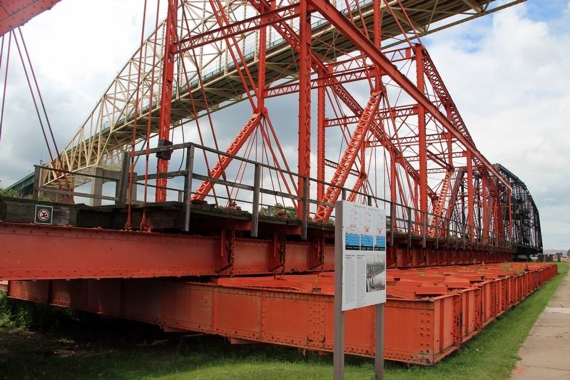
Emergency Swing Bridge Dam / Barrage tournant de secours Marker
GEOGRAPHIC SORT Title Sort Marker Number Sort Marker Number Sort N Marker Number Sort T Publication Order Sort Publication Order Sort A Erected Year Sort Most Viewed Sort Most Recent-Interest Sort Most Recently Changed Sort SEE FAQ #33 FOR DESCRIPTIONS
On Canal Drive, 1.2 kilometers west of Huron Street, on the left when traveling west.
On Hub Trail at Canal Drive, on the right when traveling north on Hub Trail.
Near Bay Street at East Street.
On Foster Drive, 0.4 kilometers east of St Mary's River Drive, on the right when traveling east.
Near Canal Drive, 0.7 kilometers south of Huron Street, on the right when traveling east.
On Canal Drive, 1 kilometer west of Huron Street, on the right when traveling west.
On Huron Street, 0.1 kilometers south of Canal Drive, on the right when traveling south.
On Canal Drive, 1.1 kilometers west of Huron Street, on the left when traveling west.
Near Hub Trail, 0.1 kilometers east of Canal Drive, on the right when traveling east.
On Canal Drive, 1.1 kilometers west of Huron Street, on the left when traveling west.
On Canal Drive, 1.1 kilometers west of Huron Street, on the left when traveling west.
On Broadway Avenue just north of Mackey Street, on the left when traveling north.
Near Scenic High Falls Road (Pinewood Drive), 3.6 kilometers west of Trans-Canada Highway (Provincial Highway 17).
On Broadway Avenue just north of Laurier Street, on the right when traveling north.
Near Scenic High Falls Road (Pinewood Drive), 3.6 kilometers west of Trans-Canada Highway (Provincial Highway 17).
Paid Advertisement
Near Mission Road (Provincial Highway 101) just east of Trans-Canada Highway (Provincial Highway 17), on the left when traveling north.
Near Trans-Canada Highway (National Highway 17) 1.4 kilometers south of High Falls Road, on the right when traveling south.
On Broadway Avenue just south of Algoma Street, on the right when traveling north.
Near Scenic High Falls Road (Pinewood Drive), 3.6 kilometers west of Trans-Canada Highway (Provincial Highway 17).
On Government Dock Road, 1 kilometer west of Michipicoten Harbour Road.
On Government Dock Road, 1 kilometer west of Michipicoten Harbour Road.
On Michipicoten Harbour Road, 1.5 kilometers west of Queen Street, on the left when traveling west.
Near Superior Avenue, 0.6 kilometers west of Michipicoten River Village Road.
On Michipicoten Harbour Road, 1.5 kilometers west of Queen Street, on the left when traveling west.
On Michipicoten Harbour Road, 0.8 kilometers west of Queen Street, on the left when traveling west.
On Fordview Court, on the right.
On Fordview Court, on the right.
On Cedar Trail at Lighthouse Road, on the right when traveling south on Cedar Trail.
On River Line (County Route 39) just east of Communication Road (Ontario Highway 40), on the left when traveling east.
Near William Street North just west of Murray Street, on the left when traveling north.
On Park Street just west of Cambridge Avenue, on the left when traveling west.
Paid Advertisement
Near Railway Street just west of 4th Avenue (Provincial Highway 101), on the left when traveling west.
On Simcoe Street South, 0.2 kilometers Lakeview Park Avenue, on the right when traveling south.
On King Street East at Ontario Street, on the left when traveling east on King Street East.
On Robinson Street just south of Pitt Street, on the right when traveling south.
Near Laird Avenue South just south of Elm Avenue, on the right when traveling south.
Near Laird Avenue South just south of Elm Avenue, on the right when traveling south.
Near Laird Avenue South just south of Elm Avenue, on the right when traveling south.
Near Dalhousie Street west of Rankin Avenue.
Near Lower Thames Lane just north of Harbour Drive when traveling north.
On Riverside Drive East at Riverside Avenue, on the right when traveling west on Riverside Drive East.
Near Riverside Drive West north of Ferry Street.
On 1st Avenue West at 8th Street West, on the left when traveling north on 1st Avenue West.
On Port Maitland Road, 0.1 kilometers south of Dover Street, on the left when traveling south.
On Walker Street, 0.1 kilometers east of Chisholm Street, on the right when traveling east.
On Walker Street, 0.2 kilometers east of Chisholm Street, on the right when traveling east.
Paid Advertisement
On Bronte Road, 0.1 kilometers north of Ontario Street, on the right when traveling south.
On Bronte Road, 0.1 kilometers north of Ontario Street, on the right when traveling east.
On Bronte Road, 0.1 kilometers north of Ontario Street, on the right when traveling east.
Near Confederation Drive east of Van Wagners Beach Road.
On Confederation Drive, 0.7 kilometers south of Van Wagner’s Beach Road, on the left when traveling south.
On Confederation Drive, 0.7 kilometers south of Van Wagner’s Beach Road, on the left when traveling south.
On Waterfront Trail, on the right when traveling north.
On East Street at Cootes Drive, on the right when traveling north on East Street.
On King Street East, 0.3 kilometers east of East Street North, on the right when traveling east.
On Eastport Drive, 0.5 kilometers north of Beach Boulevard, on the left when traveling north.
Near Eastport Drive, 0.4 kilometers north of Beach Boulevard, on the right when traveling north.
On Waterfront Trail/ E. Guise Street just north of Catherine Street, N. - Dock Service Road, on the right when traveling north.
On Bay Street North at MacNab Street North, on the left when traveling east on Bay Street North.
On Cobourg Street just south of Lighthouse Street, on the right when traveling south.
On Cobourg Street just west of Lighthouse Street, on the right when traveling west.
On Cobourg Street just east of Lighthouse Street, on the left when traveling east.
Paid Advertisement
On West River Road (Duke Street) (Provincial Highway 594) at Earl Avenue, on the right when traveling east on West River Road (Duke Street).
On West River Road (Duke Street) (Provincial Highway 594) at Earl Avenue, on the right when traveling east on West River Road (Duke Street).
Near Provincial Highway 17 at Florence Street, on the right when traveling south.
On West River Road (Duke Street) (Provincial Highway 594) at Earl Avenue, on the right when traveling east on West River Road (Duke Street).
On West River Road (Duke Street) (Provincial Highway 594) at Earl Avenue, on the right when traveling east on West River Road (Duke Street).
On West River Road (Duke Street) (Provincial Highway 594) at Earl Avenue, on the right when traveling east on West River Road (Duke Street).
On West River Road (Duke Street) (Provincial Highway 594) at Earl Avenue, on the right when traveling east on West River Road (Duke Street).
Near Bernier Drive just south of Main Street South (Trans-Canada Highway) (Provincial Highway 17), on the right when traveling south.
On Main Street South (Trans-Canada Highway) (Provincial Highway 17) just north of McClellan Avenue, on the left when traveling north.
Near Bernier Drive just south of Main Street South (Trans-Canada Highway) (Provincial Highway 17), on the right when traveling south.
On Trans-Canada Highway (Provincial Highway 17) 0.4 kilometers east of Nethercutt Drive, on the right when traveling west.
On Main Street South (Trans-Canada Highway) (Provincial Highway 17) just north of McClellan Avenue, on the left when traveling north.
Near Bernier Drive just south of Main Street South (Trans-Canada Highway) (Provincial Highway 17), on the right when traveling south.
Near Lakeview Drive (Trans-Canada Highway) (Provincial Highway 17) 0.6 kilometers west of Bernier Drive (Veterans Drive), on the right when traveling west.
On Main Street South (Trans-Canada Highway) (Provincial Highway 17) just south of McClellan Avenue, on the right when traveling south.
Near Bernier Drive just south of Main Street South (Trans-Canada Highway) (Provincial Highway 17), on the right when traveling south.
Paid Advertisement
Near Provincial Highway 2.
On King St W, on the left when traveling west.
On Fort Henry Drive close to Kingston Highway (Provincial Highway 2), on the left when traveling south.
On Valour Drive at Point Frederick Drive, on the right when traveling east on Valour Drive.
On Alexandria Avenue at Michigan Avenue, on the left when traveling north on Alexandria Avenue.
On Mill Street, 0.1 kilometers west of Little Bridge Street, on the right when traveling west.
On Mill Street just east of Bridge Street, on the left when traveling east.
On Mill Street just east of Bridge Street, on the left when traveling east.
On Basin Street at Tay Street, on the right when traveling north on Basin Street.
On Basin Street at Tay Street, on the right when traveling north on Basin Street.
On Basin Street at Tay Street, on the right when traveling north on Basin Street.
On Basin Street at Tay Street, on the right when traveling north on Basin Street.
On Basin Street at Tay Street, on the right when traveling north on Basin Street.
On Basin Street at Tay Street, on the right when traveling north on Basin Street.
Paid Advertisement
On Basin Street at Tay Street, on the right when traveling north on Basin Street.
On Mill Street just south of Market Street, on the right when traveling south.
On Basin Street at Tay Street, on the right when traveling north on Basin Street.
On Basin Street at Gore Street East (County Highway 43), on the right when traveling north on Basin Street.
276 entries matched your criteria. The first 100 are listed above.
Next 100 ⊳