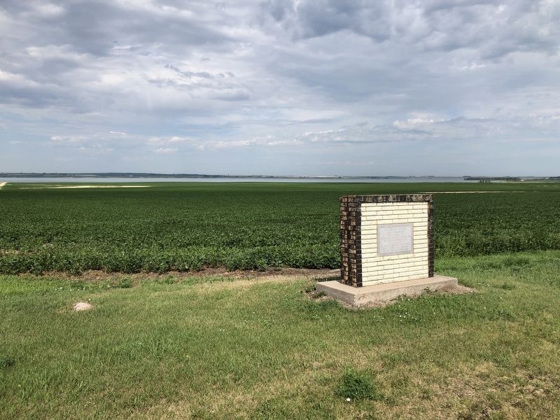
Born in Norway 1851
Homesteaded and buried one mile west
Froze to death February 6, 1887 in Logan County
He was the first white man married.
Father of first white child born
And the first white man buried. — — Map (db m168907) HM
Thomas Jefferson imagined the land explored by the Corps of Discovery as a blank canvas which would take many generations to fill. When Fort Stevenson was established in 1867 less than three generations had passed and Jefferson's blank canvas was . . . — — Map (db m283551) HM
When Fort Stevenson was being built in 1867, 30 million or more buffalo roamed the Great Plains. By the time the fort was decommissioned sixteen years later, it is estimated that only 2,000 were left.
The Native American Indians used . . . — — Map (db m283116) HM
Evidence of Euro-American occupation began to appear near the "big bend" of the Missouri River not long after the Corps of Discovery passed through. Competing trading posts to serve the Mandan, Hidatsa, and Arikara, as well as other tribal groups . . . — — Map (db m284826) HM
Custer Mine, owned and operated by the Truax Traer Coal Company, was a
working surface mine from 1947-1964. The surface or strip mining method of coal
mining is used when the coal seam is near the surface of the ground. The
lignite coal was mined . . . — — Map (db m164410) HM
In August of 1867 General Philippe Regis Denis de Keredern de Trobriand took command of Fort Stevenson, headquarters for the Middle District of Dakota Territory. He served at the fort through April of 1869 and is the best known commander of Fort . . . — — Map (db m286143) HM
The Mandan, Hidatsa, and Arikara used various kinds of dwelling before and after coming together as a single group in the Nineteenth Century. Earthlodges were the largest of the dwellings. These were round structures based upon four large posts 12 . . . — — Map (db m284820) HM
Wednesday, August 13, 1806
With "the assistance of the wind, the current and our oars," the expedition covered 86 miles of its homeward journey on the cool and blustery day. At the mouth of the Little Missouri, the party stopped to . . . — — Map (db m283566) HM
In 1928 the Fort Berthold Reservation Civic Organization (FBRCO) was organized to promote the building of a Missouri River bridge at Elbowoods. The river split the reservation into two parts that could only be crossed by ferry boats. Work began in . . . — — Map (db m284818) HM
Dam Type ... Belled Earth
Height ... 202 feet
Length ... 11,3000 feet
Width At Top Of Dam ,,, 60 feet
Width At Bottom of Dam ... 3,400 feet
Volume of Earth Fill ... 66,500,000 cubic yard
Volume Of Concrete ... 1,500,000 cubic . . . — — Map (db m283554) HM
The Missouri River winds through the fertile and alluvial floodplains within the river trench.
Overlooking the valley is the drift prairie, covered by glacial till, which is equally fertile. Within the river are found bars of sand , silt, and . . . — — Map (db m284979) HM
In March 1805, Lewis and Clark hired a French-Canadian fur trader living with the Hidastsa Indians. This man, Toussaint Charbonneau, along with his wife, a teenage Indian girl named Sakakawea, would serve as interpreters.
Sakakawea proved her . . . — — Map (db m283555) HM
With the flooding of the reservoir, the Three Affiliated Tribes of Fort Berthold sought to have a Native American honored in naming the lake, particularly after having given up much of their prime agricultural land to the reservoir. Finally, on July . . . — — Map (db m284838) HM
People have lived in the area now called North Dakota for over 12,000 years. The people of prehistoric
times were nomadic hunters and gatherers. More recent Native American tribes of this area include the Mandan, Arikara and Hidatsa. These . . . — — Map (db m164407) HM
The Corps of Discovery, led by Meriwether Lewis and William Clark, passed through the part of the Missouri River Valley, now encompassed by Lake Sakakawea, in April 1805. The camp for the latter day being approximately at the south end of the Lewis . . . — — Map (db m284833) HM
Uncovering the Past
Nightwalker's Village was extensively excavated by archaeologists from the Smithsonian Institute in the 1950s, as part of the Missouri River Basin Surveys. Low circular mounds and depressions in the grass hinted at . . . — — Map (db m284977) HM
On the flat-topped butte across the valley, once stood and Hidatsa village of 28 small earthlodges, enclosed within a high, defensive fence, or palisade of posts that followed the bluff edge. The village was named after Nightwalker, a Hidatsa leader . . . — — Map (db m284978) HM
Sakakawea was probably born among the Shoshone Indians around 1787 in the Three-Forks-Shoshone Cove region of what is now southwestern Montana. She was captured at about age eleven by Hidatsa raiders from the Knife River villages in present-day . . . — — Map (db m283108) HM
The transition from a working coal mine to today's
Custer Mine Wildlife Management Area took place over
many years. While the coal mine was still in operation,
local residents started planting trees on the mine spoil
banks. The trees were . . . — — Map (db m164412) HM
Mandan, Hidatsa, and Arikara Territory
The Mandan, Hidatsa, and Arikara (MHA) tribal lands historically encompassed much of the west and central North Dakota, Before 1851, the US government did not delimit MHA territory, but this changed . . . — — Map (db m283984) HM
Riverdale, Pick City, Dakota City, American City, Sitka, Silver City, and Big Bend are towns a dam built.
Boom towns and the Government town of Riverdale sprang up rapidly between the years of 1945 and 1946 as the Garrison Dam . . . — — Map (db m284059) HM
The Garrison Dam Project required a significant workforce, and they lived in local company towns built and managed by the government. Blending permanent dam administration buildings with temporary homes for the surge of workers, towns like . . . — — Map (db m284084) HM
Two Engineers, General Lewis Pick and William Sloan, were tasked to develop a plan to stop flooding and drought cycles plaguing the region between 1935 and 1944. The Garrison Dam being part of their plan was authorized by congress in the Flood . . . — — Map (db m284057) HM
MHA Nation
The Mandan, Hidatsa, and Arikara, today allied as the HMA Natio, haven deep historical and cultural connections to the Missouri River. The Mandan and Hidatsa, both Siouan speaking peoples. have oral histories that tie their . . . — — Map (db m283980) HM
But it's only a small part, used to manage water levels above and below the dam.
(photo upper left:) The Emergency Spillway, as it was once called, is believed to only be used in the event of and emergency, but this is not the case. The . . . — — Map (db m284062) HM
"the root wen pounded in either green or dryed state makes an excellent poltice for swelling or soar throat..." Meriwether Lewis, Winter 1804
Captain Meriwether Lewis, a fervent student of plants since childhood and the naturalist of . . . — — Map (db m253187) HM
"... all our provisions goods and equipage on Board of a Boat of 22 oars, a large Perogue of 7 oars and a second Perogue of 6 oars, complete with sails" -Captain William Clark, May 13, 1804
The Corps of Discovery traveled nearly eight . . . — — Map (db m253141) HM
In December of 1804 the temperature dipped and snow began to fall. Despite waking to an unrelenting cold the Corps of Discovery continued to work on the finishing touches of Fort Mandan, went hunting and preformed the never-ending job of gathering . . . — — Map (db m162597) HM
From this site, North Dakota Wagon Train, that took our message to Valley Forge, left on September 26, 1975.
Outriders presented scrolls from their various bicentennial communities to Wagon Master Jerry Nelson and Governor Arthur Link. These . . . — — Map (db m162594) HM
"We are situated in a point of the Missouri North side in a Cotton wood Timbery this Timber is tall and heavy" William Clark, November 9, 1804
Cottonwood trees played a vital role in the success of the Lewis & Clark Expedition. Like . . . — — Map (db m253184) HM
"This River is a turbilant + muddy stream..." -William Clark, undated, winter 1804-05
The Missouri River was part of the Lewis & Clark Expedition from Camp Debois to near the crest of the Rocky Mountains. Even though the men contended . . . — — Map (db m253173) HM
One of the earliest forms of Missouri River transportation was the bull boat. Used primarily by the Mandan, Hidatsa, and Arikara tribes, bull boats served as the main watercraft for natives living along the river banks. These boats were both built . . . — — Map (db m235041) HM
To attract shoppers to Washburn from west of the Missouri River, the Washburn Road installed a cable ferry in May 1902, known unofficially as the General Washburn. Cable ferries were small, unpowered boats attached to steel cables stretched between . . . — — Map (db m235089) HM
"We had several presents from the women of corn boiled homney. soft corn &c.&c." -William Clark, October 28, 1805
Long before the migration of settlers and establishment of farms in present day North Dakota, Mandan and Hidatsa women . . . — — Map (db m253144) HM
Winter 1804-1805
Named for the nearby Indians, Fort Mandan was winter quarters for the Lewis and Clark Expedition. Sited by Captain Clark on November 2, 1804, the fort was built in a triangular shape from cottonwood logs cut in . . . — — Map (db m162536) HM
Fort Mandan, 1804-05 Winter Quarters of the Lewis and Clark Expedition, also was the birthplace of the son born to Sakakawea and her French husband Charbonneau, interpreter for the explorers. The "Bird Woman" helped guide Lewis and Clark to their . . . — — Map (db m162595) HM
Approximately two miles south of this point, on low ground, on the east bank of the Missouri River the Lewis and Clark Expedition built Fort Mandan. This fort, the first military post in the State, was a substantial log structure which served as . . . — — Map (db m252802) HM
camped in this vicinity from October 27 1804 to April 7 1805. Captain Meriwether Lewis, a member of St. Louis Lodge No. 111 A.F.&A.M., was possibly the first mason to tread upon what is now North Dakota soil. Captain William Clark was made a mason . . . — — Map (db m252808) HM
The Mandan Winter
"If we eat you Shall eat, if we Starve, you must Starve also."
Mandan Chief Sheheka-shote, to Captains Lewis and Clark, November 1, 1804
With those words, Chief Sheheke-shote (White Coyote), . . . — — Map (db m162953) HM
Privates John Shields, William Bratton and Alexander Willard manned the blacksmith shop at Fort Mandan. These men provided repair work to native tools, such as sharpening iron hoes and knives and fixing trade kettles.
The Mandan and Hidatsa who . . . — — Map (db m162950) HM
Nettle Creek School was the first school in McLean County, opening on November 6, 1883. Originally located seven miles east of Washburn, the one-room country school was first constructed as a log cabin, with clapboard siding added to it later. In . . . — — Map (db m235060) HM
"At half past 2 another gun was fired, as a notice to assemble at the dance, which was continued in a jovial manner until 8 at night…" Patrick Gass, Dec. 25, 1804
The Corps of Discovery found many ways to . . . — — Map (db m253183) HM
The first steamboat to reach the upper Missouri was the American Fur Company's Yellow Stone, which arrived at Fort Union in 1832. Nearly 30 years later, steamers began reaching Fort Benton, Montana, the head of navigation on the Missouri. From then . . . — — Map (db m235097) HM
While preparing for the expedition to the Pacific, Meriwether Lewis visited Philadelphia for instructions in natural sciences, astronomical navigation and field medicine. It is believed that it was during this period that Lewis purchased Seaman, . . . — — Map (db m36352) HM
The last stern wheel ferry on the Missouri. Built by Oscar Anderson in 1951 and operated by him on the Missouri River at Washburn from 1952 to 1962. Restored by the Washburn Bi-centennial Committee in 1976. American Revolution Bicentennial . . . — — Map (db m235096) HM
In 1898, William Drew Washburn, a wealthy Minneapolis flour miller, railroad man, and U.S. Senator from Minnesota, purchased 115,000 acres of land along the line between McLean and Burleigh counties. He formed the Bismarck, Washburn & Great Falls . . . — — Map (db m235098) HM
Pioneer home of Joseph Henry Taylor, soldier, trapper, hunter, author and printer by trade. Born in 1843 of Quaker parents in Chester County, PA., he drifted west, locating in the Painted Woods area, twelve miles south of here in 1869, where he led . . . — — Map (db m235199) HM
In 1950 Oscar Anderson, a native of Washburn who had traveled the world since 1917 as an officer in the merchant marine, returned home to spend his retirement years. He found a community that missed its ferryboat connection with the west bank of . . . — — Map (db m235095) HM
In the early 1920s, most North Dakota towns were served by small local power plants producing direct current (DC) electric power. In 1926, Otter Tail Power Company of Fergus Falls, Minnesota, was one of several companies building a series of power . . . — — Map (db m235057) HM
The bridging of the Missouri River at Washburn had been a longtime goal for residents of the community. As early as 1908, a party of local residents traveled to Washington, D.C., unsuccessfully, in the interests of such a project. During the 1920s . . . — — Map (db m235047) HM
On this site are the remains of a large earthlodge village originally settled by the Mandan Indians (ca.1822) and the trading forts Clark and Primeau. Previous to the establishment of Fort Clark, an unnamed post was built in the area by James . . . — — Map (db m33313) HM
Construction of the dam began in 1947
and was completed in 1954 at a cost of
$300 million dollars. Garrison Dam is
one of the largest earthen dam structures
in the world with a volume of 66.5 million
cubic yards of rolled earth fill. The . . . — — Map (db m178019) HM
Construction of the Intake
Structure took 5 years and
cost $21 million dollars
back in 1954. Enough
concrete to pave a road
115 miles long was used
in construction of the
structure. The Intake Structure is 249 feet
tall, 540 feet long and . . . — — Map (db m177992) HM
Hydroelectric power is produced
through generating units in the
Powerhouse. The generators
produce electricity at 13,800 volts
which is stepped up to 115,000 and
230,000 volts for transmission. The
rotors on units 1, 2, and 3 are 35 feet
in . . . — — Map (db m178018) HM
The river that nurtured Awatixa Village is erasing evidence of its existence. In 1798, explorer-trader David Thompson estimated fifty-two earthlodges here. As of 1990, only thirty-one earthlodge depressions remained. Cutbank erosion and channel . . . — — Map (db m162270) HM
Circles in the Earth
You are at the edge of a large village of earthlodges. When the dwellings collapsed, they left circular mounds of earth around hardened saucer-like floors. From that pattern you can picture the extent of this village . . . — — Map (db m162212) HM
In front of you are situated what archaeologist believe may have been corrals constructed by the Arikaras. Because views of the fort painted by George Catlin and Karl Bodmer between 1832 and 1834 do not show the corrals, they were likely built after . . . — — Map (db m162381) HM
Anatomy of a Village
Viewed at prairie level, the village site shows few details of the Hidatsa people's lives. Most evidence lies below the surface. Here along the bank, repeated floods have exposed a slice of village life and given it . . . — — Map (db m162272) HM
The earthlodge was a type of home used by many tribes on the Great Plains. Around you are the remains of earthlodges found in the village of Mih-tutta-hang-kush. There were more than eighty of these homes found on this site. Today, circular . . . — — Map (db m162528) HM
From archeological evidence, we know how the Hidatsa fished. The villagers used bone fishhooks at first, but metal hooks began to appear after the 1790s - a result of trade with Europeans. From catfish spines and fish scales found in middens, we . . . — — Map (db m162273) HM
This location contains the remains of Fort Clark, named in honor of former explorer William Clark, who was Superintendent of Indian Affairs at the time. It was built by James Kipp for trade with the Mitutanka Mandan Indians living in the earthlodge . . . — — Map (db m162387) HM
Fort Clark was a small but important post in the American Fur Co. (AMF) empire but only a minute element within an immense international fur and hide trade. Its cycle of trade incorporated Native Americans of the northern plains, American traders . . . — — Map (db m162379) HM
Eighteen years before the establishment of the Mandan Village of Mih-tutta-hang-kush, a settlement of a different kind was being built a few miles northwest of this point. In November 1804, the Lewis and Clark Expedition began construction of their . . . — — Map (db m162530) HM
Geophysics is the application of the methods of physics to the study of object or materials beneath the surface of the earth. Archeo-geophysics applies geophysical principles to the study of near-surface archaeological deposits. The goal is to . . . — — Map (db m162461) HM
With simple tools, Hidatsa women grew corn, beans, squash, and sunflowers in the fertile soil along the Missouri and Knife Rivers.
Buffalo Bird Woman, known in Hidatsa as Maxidiwiac, was born born about 1839, in an earth lodge along the . . . — — Map (db m162210) HM
Fortified Ground
A thriving earthlodge village stood here. Though surface clues appear minimal, there is a pattern to the ground's subtle dips and wrinkles, a way to reconstruct the life and death of the village. Read the terrain like . . . — — Map (db m162274) HM
With 168 days and 1,600 miles behind them, the Lewis and Clark Expedition arrived near the Knife River Villages. Captain William Clark wrote:
October 27, 1804
"came too at the Village on the L.S. this village is situated on an . . . — — Map (db m33610) HM
Mato-Tope (the Four Bears)
The second chief of the Mandans, Mato-Tope, was respected and revered for his leadership, honor, and bravery. George Catlin referred to his in an 1832 letter:
This extraordinary man, though second in . . . — — Map (db m162529) HM
"a fine worm Day we met with a french man by the name of Jassame which we employ as an interpreter This man has a wife & Chindren in the Village - Great numbers of both Sides flocked down to the bank to views us as wee passed." Captain Clark's . . . — — Map (db m253622) HM
To imagine these people's daily lives, consider their trash. Molehill-like mounds two to four feet high near the village edge are middens or garbage heaps packed with broken pottery, bone tools, and flaked stone. Shattered buffalo bones are the most . . . — — Map (db m162214) HM
You are approaching the site of a former Mandan Indian village called Mih-tutta-hang-kush. This name means "east village" or "first village." Mih-tutta-hanf-kush was established in 1822 and was occupied by the Mandans until 1837 when the smallpox . . . — — Map (db m162276) HM
Fort Clark and its opposition post Primeau's Post, as well as that of the nearby Mandan and later Arikara village, were for defense and also served to tap the bountiful natural resources of this stretch of the Missouri River valley. Between 1832 and . . . — — Map (db m162383) HM
You are now looking at a portion of the former palisade wall and the ditch that surrounded the Mandan village of Mih-tutta-hang-kush. A palisade is a row of closely spaced vertical posts set together to form a protective wall. Archaeologists belief . . . — — Map (db m162534) HM
This earthlodge was the home of Pierre Garreau. Garreau, the son of a French father and an Arikara mother, was employed by the American Fur Company as an interpreter. He was well known for his strength and bravery. Interpreters, such as Garreau, . . . — — Map (db m162391) HM
Built so close to the river, Awatixa Village and other nearby sites suggest a pattern - a vital link between Hidatsa culture and the riverine environment. The Missouri River and its tributaries provided fish, fertile soil for crops, and a green . . . — — Map (db m162271) HM
This is the site of the Mandan village Mitutanka, the home of Sheheke Shote (White Coyote* in English). Sheheke was born on On-a-Slant village (now part of Fort Lincoln State Park in 1766, a Golden Age of the Mandan culture. Due to his storied acts . . . — — Map (db m253620) HM
In the summer of 1837, the steamboat St. Peters arrived at the Mandan village and Fort Clark, carrying passengers, supplies, and trade goods. Tragically, some of the people on the St. Peters were also infected with smallpox. In a . . . — — Map (db m162532) HM
The stone shelter you are standing in was constructed in the 1930s as one of the many projects completed throughout the state by the Civilian Conservation Corps (CCC) and the Works Progress Administration (WPA). The CCC and the WPA were programs . . . — — Map (db m162476) HM
Fort Clark's most prominent structural features, the enclosure or "palisade" and projecting blockhouses, were built to defend its occupants from attack and the Company's trade goods from theft. Curiously, historic documents and archaeological . . . — — Map (db m162471) HM
Fort Clark's citizens were small in number but extremely diverse in cultural origin. This ethnic diversity is reflected in one Company trader's remarks that trading posts were a "Babylonian confusion of languages...Assiniboin, Crow, Herantsa, . . . — — Map (db m162389) HM
"Tobacco was cultivated in my tribe only by old men." - Buffalo Bird Woman's Garden
"Our young men did not smoke much; a few did, but most of them used little tobacco, or almost none. They were taught that smoking would injure their . . . — — Map (db m178101) HM
Shortly after Fort Clark's construction (circa 1830), Prince Maximilian of Wied (Germany) described the post in his journal as "built on the same plan as the other trading posts of the Company. The front and back of the square are forty-four paces . . . — — Map (db m162459) HM
James Kipp
In the twilight of his years, a "Canadian of German descent," James Kipp, (1788-1880_ was to be remembered for both his AMF fort-building experiences and his vast knowledge of the Upper Missouri country and its . . . — — Map (db m162456) HM
Winter villages of the Mandans and the neighboring Hidatsas were located in the forested river bottoms of the Missouri River and Knife River valleys. These temporary village locations were chosen based on availability, suitable protection form harsh . . . — — Map (db m162473) HM
The Yellowstone Expedition of 1876, organized to quell the hostile Sioux, marched from Fort Abraham Lincoln May 17, 1876, and camped a short distance in a southerly direction of this marker on May 19, 1876. The trail extends to the banks of the . . . — — Map (db m234874) HM
The World’s Largest Holstein Cow is 38 feet high, 50 feet long, and weighs 12,000 pounds.
Salem Sue was erected in 1974 at a cost of nearly $40,000.00 contributed by dairymen, farmers, businessmen, the dairy industry, and area residents. The . . . — — Map (db m161849) HM
[east side]In honor and memory of all Men and Women who served in the Armed Forces of the United States of America to preserve our freedom[west side]American Legion and Auxiliary Miller-Linn Post 90 Oliver County Center, N.D. In God . . . — — Map (db m231513) WM
Once the Missouri River flowed wild and untamed for 360 miles through North Dakota. With the construction of upstream dams, and urban development, little of the river's natural cottonwood environment now remains . Thanks to public and private . . . — — Map (db m285134) HM
Wednesday, October 24, 1804
Near this point, Lewis and Clark made their fist substantial contact with Mandan Indians (missing)
passed an oxbow island (present-day Painted Woods Lake). "One of the Grand Chiefs of the Mandan (missing) . . . — — Map (db m285120) HM
Wednesday, October 24, 1804
Near this point Lewis and Clark made their first substantial contact with the Mandan Indians. As the expedition passed an oxbow island (present-day Painted Woods Lake). "One of the Grand Chiefs of the . . . — — Map (db m284340) HM
Look up and down the Missouri River and hear the echo of Meriwether Lewis' words; "I found this land fertile in the extreme...well-watered...(and) game is very abundant." The words still ring true but the fundamental character of the valley has been . . . — — Map (db m285162) HM
Long before white men learned of the Missouri, the Mandan and Hidatsa, semi-sedentary earthlodge villagers living along it, had developed the bullbat for traveling on the river. Made and navigated by women, bullboats were circular craft constructed . . . — — Map (db m285141) HM
It begins a mile and a half above the sea in the mountains of southwestern Montana and touches on seven states in its 2,714 mile journey to its junction with the Mississippi River near St. Louis. Its sediment-laden waters gathered from a half . . . — — Map (db m285135) HM
It is said that this territory was claimed by the Mandan Indians and by their enemy the Yanktonai Sioux. To meet here was to fight here. A day came when all grew tired of the fighting and the Mandan hosted a peace council during the autumn harvest. . . . — — Map (db m284338) HM
You are about to enter South Dakota Created with its twin, North Dakota, 2 November 1889, its 77,047 square miles ranks 15th in size. Those square miles include: exceptional corn land in the SE, grass land in the W, wheat land in the N. and . . . — — Map (db m44710) HM
Side A The Flint store and post office was built on this site in 1895. It was named after Moses E. Flint, and early homesteader. Mr. Flint served as a teamster with General Custer on the 1876 campaign against the Sioux which ended with the . . . — — Map (db m112082) HM
Lewis and Clark
The Lewis and Clark Expedition, officially the Corps of Discovery, was in what is now South Dakota from August 21 to October 14, 1804 and from August 21 to September 4, 1806.
While here they would make numerous . . . — — Map (db m187079) HM
128 entries matched your criteria. The first 100 are listed above. The final 28 ⊳